- Williamstown, New Jersey
Infobox Settlement
official_name = Williamstown, New Jersey
settlement_type = CDP
nickname =
motto =
imagesize =
image_caption =
image_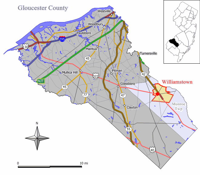
mapsize = 250x200px
map_caption = Map of Williamstown CDP in Gloucester County
mapsize1 =
map_caption1 =subdivision_type = Country
subdivision_name =United States
subdivision_type1 = State
subdivision_name1 =New Jersey
subdivision_type2 = County
subdivision_name2 = Gloucester
government_footnotes =
government_type =
leader_title =
leader_name =
leader_title1 =
leader_name1 =
established_title =
established_date =area_footnotes =
area_magnitude =
area_total_km2 = 16.0
area_land_km2 = 16.0
area_water_km2 = 0.0
area_total_sq_mi = 6.2
area_land_sq_mi = 6.2
area_water_sq_mi = 0.0population_as_of = 2000
population_footnotes =
population_total = 11812
population_density_km2 = 740.1
population_density_sq_mi = 1916.7timezone = Eastern (EST)
utc_offset = -5
timezone_DST = EDT
utc_offset_DST = -4
elevation_footnotes =
elevation_m = 44
elevation_ft = 144
latd = 39 |latm = 41 |lats = 11 |latNS = N
longd = 74 |longm = 59 |longs = 29 |longEW = Wpostal_code_type =
ZIP code
postal_code = 08094
area_code = 856
blank_name = FIPS code
blank_info = 34-81380GR|2
blank1_name = GNIS feature ID
blank1_info = 0881844GR|3
website =
footnotes =Williamstown is a
census-designated place and unincorporated area located within Monroe Township, in Gloucester County,New Jersey . As of theUnited States 2000 Census , the CDP population was 11,812.Geography
Williamstown is located at coor dms|39|41|11|N|74|59|29|W|city (39.686424, -74.991465)GR|1.
According to the
United States Census Bureau , the CDP has a total area of 16.0km² (6.2 mi²), all land.Demographics
USCensusPop
1990=10891
2000=11812
footnote=source: [cite web
url=http://factfinder.census.gov/servlet/SAFFPopulation?_event=Search&geo_id=16000US3480855&_geoContext=01000US%7C04000US34%7C16000US3480855&_street=&_county=Williamstown&_cityTown=Williamstown&_state=04000US34&_zip=&_lang=en&_sse=on&ActiveGeoDiv=geoSelect&_useEV=&pctxt=fph&pgsl=160&_submenuId=population_0&ds_name=null&_ci_nbr=null&qr_name=null®=null%3Anull&_keyword=&_industry=
title=Population Finder: Williamstown CDP, New Jersey
publisher=U.S. Census Bureau
accessdate=2007-03-19] As of thecensus GR|2 of 2000, there were 11,812 people, 4,484 households, and 3,223 families residing in the CDP. Thepopulation density was 740.4/km² (1,916.7/mi²). There were 4,764 housing units at an average density of 298.6/km² (773.1/mi²). The racial makeup of the CDP was 85.68% White, 10.35% African American, 0.30% Native American, 0.96% Asian, 0.06% Pacific Islander, 0.99% from other races, and 1.67% from two or more races. Hispanic or Latino of any race were 2.87% of the population.There were 4,484 households out of which 32.6% had children under the age of 18 living with them, 55.6% were married couples living together, 12.2% had a female householder with no husband present, and 28.1% were non-families. 23.8% of all households were made up of individuals and 11.6% had someone living alone who was 65 years of age or older. The average household size was 2.63 and the average family size was 3.13.
In the CDP the population was spread out with 25.2% under the age of 18, 8.0% from 18 to 24, 29.0% from 25 to 44, 23.0% from 45 to 64, and 14.9% who were 65 years of age or older. The median age was 37 years. For every 100 females there were 90.5 males. For every 100 females age 18 and over, there were 85.4 males.
The median income for a household in the CDP was $44,200, and the median income for a family was $51,552. Males had a median income of $40,411 versus $29,112 for females. The
per capita income for the CDP was $19,112. About 5.5% of families and 7.5% of the population were below thepoverty line , including 10.8% of those under age 18 and 4.7% of those age 65 or over.History
Before settlement in 1737, Williamstown was inhabited by the Lenni-
Lenape tribe of Native Americans, from whom the town derived its original name, "Squankum." The name (Lenape for 'place where evil spirits dwell') was changed to Williamstown when the town's first post office was established, due to postal regulations that prohibited two towns from having the same name (a Squankum roughly sixty miles northeast pre-dated its southwesterly namesake). It is generally thought that 'evil spirits' referred to the abundance of mosquitoes in the area, a by-product of the low-lying swamps that characterized the area during that time period. In the early eighteenth century, Richard Penn sold what eventually became Williamstown to his grandson, John Williams, who divided and resold the land in lots to settlers and for whom the town was eventually renamed. ["A History of Monroe Township" published by the Historic Society of Monroe Township.] The town was officially incorporated as Monroe Township in March of 1859, with Williamstown as meeting place to vote and have town discussions. A municipal court was established in the Township of Monroe, in accordance with the provisions of Chapter 264 of the Laws of 1948. [N.J.S.A.2B:12-1, New Jersey Office of Legislative Services.] The first school was built in 1750 and stood where the Washington Hotel now stands. The local schools operated on a pay-as-you-go basis until the 1850s and were predominantly church-run. The area built its first high school in 1958.The Population of the town remained small until the early 1830s when the glass industry sprung up (Glassboro, a neighboring town, still bears the name borne of that commercial boom). The first company to form was called Free Will Glass Manufacturing and caused a population surge. The industry thrived until the early 1900s when agricultural businesses began to flourish in the face of the waning glass industry. One notable company, The John Sharp Canning Co., still operates today as Blue Ribbon. The Monroe Township Historical Society was formed as a volunteer organization on
October 16 ,1974 , by Mayor John W. Sharp (of the Canning Company Sharps), to be composed of volunteer citizens concerned with preserving items that reflect the past history of Monroe Township.Transportation
Crosskeys Airport is a public-usegeneral aviation airport located convert|2.5|mi|km southwest of thecentral business district .Education
The
Monroe Township Public Schools is a comprehensive district serving the educational needs of resident students from grades kindergarten through twelve.References
External links
Wikimedia Foundation. 2010.