- Holland Township, New Jersey
Infobox Settlement
official_name = Holland Township, New Jersey
settlement_type = Township
nickname =
motto =
imagesize =
image_caption =
image_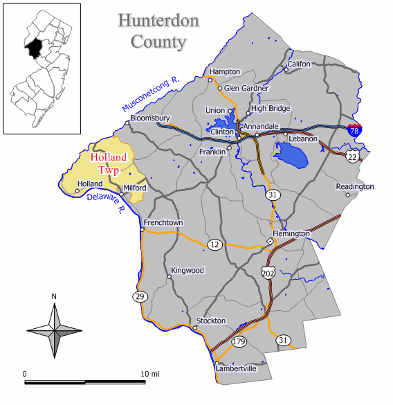
mapsize = 250x200px
map_caption = Map of Holland Township in Hunterdon County. Inset: Location of Hunterdon County highlighted in the State of New Jersey.
mapsize1 = 250x200px
map_caption1 = Census Bureau map of Holland Township, New Jerseysubdivision_type = Country
subdivision_name =United States
subdivision_type1 = State
subdivision_name1 =New Jersey
subdivision_type2 = County
subdivision_name2 = Hunterdon
government_footnotes =
government_type =Township (New Jersey)
leader_title =Mayor
leader_name = Bernard O’Brien (2009)
leader_title1 =
leader_name1 =
established_title = Incorporated
established_date =April 13 ,1874 unit_pref = Imperial
area_footnotes =
area_magnitude =
area_total_km2 = 62.4
area_land_km2 = 61.4
area_water_km2 = 1.0
area_total_sq_mi = 24.1
area_land_sq_mi = 23.7
area_water_sq_mi = 0.4population_as_of = 2006
population_footnotes =
population_total = 5310
population_density_km2 = 83.5
population_density_sq_mi = 216.2timezone = Eastern (EST)
utc_offset = -5
timezone_DST = EDT
utc_offset_DST = -4
elevation_footnotes = [Gnis|882185|Township of Holland,Geographic Names Information System . AccessedJanuary 4 ,2008 .]
elevation_m = 122
elevation_ft = 400
latd = 40 |latm = 35 |lats = 44 |latNS = N
longd = 75 |longm = 7 |longs = 30 |longEW = Wpostal_code_type =
ZIP code
postal_code = 08848 - Milford
area_code = 908
blank_name = FIPS code
blank_info = 34-32460GR|2 [ [http://mcdc2.missouri.edu/webrepts/commoncodes/ccc_nj.html A Cure for the Common Codes: New Jersey] , Missouri Census Data Center. AccessedJuly 14 ,2008 .]
blank1_name = GNIS feature ID
blank1_info = 0882185GR|3
website = http://www.hollandtownship.org
footnotes =Holland Township is a Township in Hunterdon County,
New Jersey ,United States . As of theUnited States 2000 Census , the township population was 5,124.Holland Township is located in the northwestern part of Hunterdon County. The
Delaware River forms its boundary withPennsylvania and theMusconetcong River its boundary with Warren County. It was initially created from Alexandria Township onApril 13 ,1874 , returning and remerged with Alexandria Township onMarch 4 ,1878 . The township was reformed and separated as a municipality of its own again onMarch 11 ,1879 . Milford was created onApril 15 ,1911 from portions of Holland Township, based on the results of a referendum held onMay 8 ,1911 ."The Story of New Jersey's Civil Boundaries: 1606-1968", John P. Snyder, Bureau of Geology and Topography; Trenton, New Jersey; 1969. p. 155-156.]The Volendam Windmill Museum is a working mill driven by wind, used for grinding raw grain into flour. The sixty-foot structure is seven stories high with sail arms sixty-eight feet from tip to tip. [http://www.co.hunterdon.nj.us/mun/holland.htm Hunterdon County web page for Holland Township] , accessed
March 20 ,2007 ]The 379-acre Musconetcong Gorge Nature Preserve is an undeveloped park managed by the Hunterdon County Parks and Recreational System, with steeply wooded terrain overlooking the
Musconetcong River . The gorge includes many spring-fed streams, a variety of plant species and wildlife. While much of the area offers challenging hikes, a variety of trails are being developed to offer access to less-seasoned hikers.Geography
According to the
United States Census Bureau , the township has a total area of 24.1square mile s (62.4km² ), of which, 23.7 square miles (61.4 km²) of it is land and 0.4 square miles (1.0 km²) of it (1.62%) is water.Holland Township borders Alexandria Township, Bethlehem Township, and Milford Borough. Holland Township also borders Warren County and the Commonwealth of Pennsylvania.
Demographics
USCensusPop
1930= 994
1940= 1150
1950= 1341
1960= 2495
1970= 3587
1980= 4593
1990= 4892
2000= 5124
estimate= 5310
estyear=2006
estref= [http://factfinder.census.gov/servlet/SAFFPopulation?_event=Search&geo_id=16000US3431320&_geoContext=01000US%7C04000US34%7C16000US3431320&_street=&_county=holland&_cityTown=holland&_state=04000US34&_zip=&_lang=en&_sse=on&ActiveGeoDiv=geoSelect&_useEV=&pctxt=fph&pgsl=160&_submenuId=population_0&ds_name=null&_ci_nbr=null&qr_name=null®=null%3Anull&_keyword=&_industry= Census data for Holland township] ,United States Census Bureau . AccessedAugust 12 ,2007 .]
footnote=Population 1930 - 1990. [ [http://www.wnjpin.net/OneStopCareerCenter/LaborMarketInformation/lmi01/poptrd6.htm New Jersey Resident Population by Municipality: 1930 - 1990] , Workforce New Jersey Public Information Network. AccessedMarch 1 ,2007 .] As of thecensus GR|2 of 2000, there were 5,124 people, 1,881 households, and 1,523 families residing in the township. Thepopulation density was 216.2 people per square mile (83.5/km²). There were 1,942 housing units at an average density of 81.9/sq mi (31.6/km²). The racial makeup of the township was 98.09% White, 0.43% African American, 0.04% Native American, 0.43% Asian, 0.39% from other races, and 0.62% from two or more races. Hispanic or Latino of any race were 1.70% of the population.There were 1,881 households out of which 33.3% had children under the age of 18 living with them, 73.2% were married couples living together, 5.2% had a female householder with no husband present, and 19.0% were non-families. 15.5% of all households were made up of individuals and 7.7% had someone living alone who was 65 years of age or older. The average household size was 2.72 and the average family size was 3.06.
In the township the population was spread out with 24.7% under the age of 18, 5.6% from 18 to 24, 26.8% from 25 to 44, 28.4% from 45 to 64, and 14.5% who were 65 years of age or older. The median age was 41 years. For every 100 females there were 97.7 males. For every 100 females age 18 and over, there were 95.1 males.
The median income for a household in the township was $68,083, and the median income for a family was $71,925. Males had a median income of $50,737 versus $35,615 for females. The
per capita income for the township was $28,581. About 1.6% of families and 2.2% of the population were below thepoverty line , including 2.9% of those under age 18 and 3.3% of those age 65 or over.Government
Local government
Holland Township is governed under the Township form of government with a five-member Township Committee. The Township Committee is elected directly by the voters in partisan elections to serve three-year terms of office on a staggered basis, with one or two seats coming up for election each year. ["2005 New Jersey Legislative District Data Book",
Rutgers University Edward J. Bloustein School of Planning and Public Policy , April 2005, p. 103.] At an annual reorganization meeting, the Township Committee selects one of its members to serve as Mayor.Members of the Holland Township Committee are
Mayor Bernard O'Brien (R, 2009),Deputy Mayor Edward Burdzy (R, 2010), John B. DiSarro (R, 2008), Robert Peabody (R, 2008) and Kenneth Vogel (I, 2010). [ [http://www.hollandtownship.org/townshipcommittee.htmlTownship Committee] , Holland Township. AccessedJune 2 ,2008 .]Federal, state and county representation
Holland Township is in the Seventh Congressional District and is part of New Jersey's 23rd Legislative District. [ [http://www.lwvnj.org/pubs/CG06.pdf 2006 New Jersey Citizen's Guide to Government] , New Jersey
League of Women Voters , p. 58. AccessedAugust 30 ,2006 .]Education
The
Holland Township School District serves public school students in grades K through 8. Schools in the district (with 2005-06 enrollment data from theNational Center for Education Statistics [ [http://nces.ed.gov/ccd/schoolsearch/school_list.asp?Search=1&DistrictID=3407380 Data for the Holland Township School District] ,National Center for Education Statistics . AccessedJune 2 ,2008 .] ) are Holland Township Elementary School serving grades K - 4 (378 students) and Holland Township Middle School serving grades 5 - 8 (343 students). Both schools operate within the same facility.Public school students in grade 9 - 12 attend the
Delaware Valley Regional High School in Frenchtown, which serves almost 1,000 students in western Hunterdon County. Students from Alexandria, Holland and Kingwood Townships along with the boroughs of Frenchtown and Milford attend the high school. The school is part of the Delaware Valley Regional High School District. [ [http://www.dvrhs.org/ Home] , Delaware Valley Regional High School. AccessedJune 2 ,2008 . "Delaware Valley Regional High School serves over 1000 students in western Hunterdon County, New Jersey. Students from Alexandria, Holland, & Kingwood Townships along with the boroughs of Frenchtown and Milford attend Del Val."]References in fiction
In the cult science fiction film "
The Adventures of Buckaroo Banzai Across the 8th Dimension ", Holland Township is depicted as the location of the Banzai Insitute for Biomedical Research and Strategic Information.References
External links
* [http://hollandtownship.org/ Holland Township website]
* [http://www.co.hunterdon.nj.us/mun/holland.htm Hunterdon County web page for Holland Township]
* [http://hts.k12.nj.us/ Holland Township School District]
*NJReportCard|19|2220|0|Holland Township School District
* [http://nces.ed.gov/ccd/schoolsearch/school_list.asp?Search=1&DistrictID=3407380 Data for the Holland Township School District] ,National Center for Education Statistics
* [http://www.dvrhs.k12.nj.us/ Delaware Valley Regional High School District]
* [http://www.hlta.org Hunterdon Land Trust Alliance]
Wikimedia Foundation. 2010.