- Ewing Township, New Jersey
Infobox Settlement
official_name = Ewing Township, New Jersey
settlement_type = Township
nickname =
motto =
imagesize =
image_caption =
image_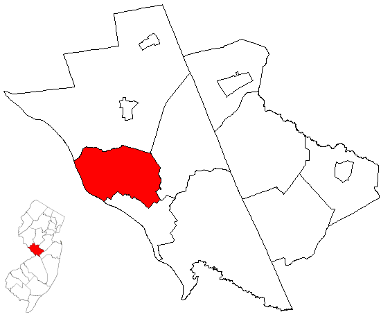
mapsize = 250x200px
map_caption = Ewing Township highlighted in Mercer County. Inset
mapsize1 = 250x200px
map_caption1 = Census Bureau map of Ewing Township, New Jerseysubdivision_type = Country
subdivision_name =United States
subdivision_type1 = State
subdivision_name1 =New Jersey
subdivision_type2 = County
subdivision_name2 = Mercer
government_footnotes =
government_type =Faulkner Act (Mayor-Council)
leader_title =Mayor
leader_name = Jack Ball
leader_title1 = Administrator
leader_name1 = David W. Thompson [ [http://www.ewingtwp.net/directory/index.php Telephone & Email Directory] , Ewing Township. AccessedJune 29 ,2008 .]
established_title = Incorporated
established_date =February 22 ,1834 unit_pref = Imperial
area_footnotes =
area_magnitude =
area_total_km2 = 40.4
area_land_km2 = 39.7
area_water_km2 = 0.7
area_total_sq_mi = 15.6
area_land_sq_mi = 15.3
area_water_sq_mi = 0.3population_as_of = 2006
population_footnotes =
population_total = 36916
population_density_km2 = 899.1
population_density_sq_mi = 2328.6timezone = Eastern (EST)
utc_offset = -5
timezone_DST = EDT
utc_offset_DST = -4
elevation_footnotes = [Gnis|882128|Township of Ewing,Geographic Names Information System . AccessedJune 13 ,2008 .]
elevation_m = 38
elevation_ft = 125
latd = 40 |latm = 15 |lats = 36 |latNS = N
longd = 74 |longm = 47 |longs = 20 |longEW = Wpostal_code_type =
ZIP code s
postal_code = 08618, 08628, 08638
area_code = 609
blank_name = FIPS code
blank_info = 34-22185GR|2 [ [http://mcdc2.missouri.edu/webrepts/commoncodes/ccc_nj.html A Cure for the Common Codes: New Jersey] , Missouri Census Data Center. AccessedJuly 14 ,2008 .]
blank1_name = GNIS feature ID
blank1_info = 0882128GR|3
website = http://www.ewingtwp.net
footnotes =Ewing Township is a Township in Mercer County,
New Jersey ,United States . As of theUnited States 2000 Census , the township population was 35,707. The Census Bureau's 2006 population estimate for Ewing Township is 36,916.Ewing Township was incorporated as a township by an Act of the
New Jersey Legislature onFebruary 22 ,1834 , from portions of Trenton Township, while the area was still part of Hunterdon County. It became part of the newly-created Mercer County onFebruary 22 ,1838 ."The Story of New Jersey's Civil Boundaries: 1606-1968", John P. Snyder, Bureau of Geology and Topography; Trenton, New Jersey; 1969. p. 161.]Although Ewing Township was officially established in 1834, the history of the region ranges back thousands of years. The earliest inhabitants of the land area today known as Ewing Township were the
Lenni Lenape Native Americans. These migratory people ranged throughout New Jersey along the banks of theDelaware River , and the Township's many creeks provided rich natural resources for hunting, fishing, pottery-making, and simple farming.When the region was first settled by European colonists around 1699, it was part of Hopewell Township, and continued under that name until the City of Trenton was established in 1719. From 1719 until 1834, the area was named Trenton Township. On
February 22 ,1834 , the name was changed from Trenton Township to Ewing Township in honor of Charles Ewing, who was posthumously honored for his work as Chief Justice of theNew Jersey Supreme Court from 1824-1832.Geography
Ewing is located at coor dms|40|15|36|N|74|47|20|W|city (40.259958, -74.788842)GR|1.
According to the
United States Census Bureau , the township has a total area of 15.6 square miles (40.4 km²), of which, 15.3 square miles (39.7 km²) of it is land and 0.3 square miles (0.7 km²) of it is water, mostly consisting of theDelaware River . The total area is 1.73% water.The highest elevation in Ewing Township is convert|225|ft|m
AMSL just east of I-95 and just west ofTrenton-Mercer Airport [ [http://www.topozone.com/map.asp?lat=40.27686&lon=-74.82581&size=l&datum=nad83&layer=DRG25] USGS Topographic map of the highest point in Ewing] , while the lowest point is just below convert|20|ft|m AMSL near theDelaware River [ [http://www.topozone.com/map.asp?lat=40.24087&lon=-74.81766&size=l&datum=nad83&layer=DRG25] USGS Topographic map of the lowest point in Ewing] .Ewing Township shares land borders with Hopewell Township, Lawrence Township, and the City of Trenton, all in
New Jersey ; theDelaware River separates Ewing from Lower Makefield Township and Yardley Borough, both inPennsylvania .Demographics
USCensusPop
1910= 1889
1920= 3475
1930= 6942
1940= 10146
1950= 16840
1960= 26628
1970= 32831
1980= 34842
1990= 34185
2000= 35707
estimate= 36916
estyear=2006
estref= [http://factfinder.census.gov/servlet/SAFFPopulation?_event=ChangeGeoContext&geo_id=06000US3402122185&_geoContext=01000US%7C04000US34%7C05000US34021%7C06000US3402119780&_street=&_county=ewing&_cityTown=ewing&_state=04000US34&_zip=&_lang=en&_sse=on&ActiveGeoDiv=geoSelect&_useEV=&pctxt=fph&pgsl=010&_submenuId=population_0&ds_name=null&_ci_nbr=null&qr_name=null®=null%3Anull&_keyword=&_industry= Census data for Ewing township] ,United States Census Bureau . AccessedSeptember 22 ,2007 .]
footnote=Population 1930 - 1990. [ [http://www.wnjpin.net/OneStopCareerCenter/LaborMarketInformation/lmi01/poptrd6.htm New Jersey Resident Population by Municipality: 1930 - 1990] , Workforce New Jersey Public Information Network. AccessedMarch 1 ,2007 .] As of thecensus GR|2 of 2000, there were 35,707 people, 12,551 households, and 8,208 families residing in the township. Thepopulation density was 2,328.6 people per square mile (899.3/km²). There were 12,924 housing units at an average density of 842.8/sq mi (325.5/km²). The racial makeup of the township was 69.02% White, 24.82% African American, 0.15% Native American, 2.27% Asian, 0.06% Pacific Islander, 1.83% from other races, and 1.84% from two or more races. Hispanic or Latino of any race were 4.44% of the population.There were 12,551 households out of which 25.3% had children under the age of 18 living with them, 49.7% were married couples living together, 12.2% had a female householder with no husband present, and 34.6% were non-families. 27.7% of all households were made up of individuals and 12.1% had someone living alone who was 65 years of age or older. The average household size was 2.45 and the average family size was 3.00.
In the township the population was spread out with 18.0% under the age of 18, 17.3% from 18 to 24, 26.8% from 25 to 44, 22.1% from 45 to 64, and 15.8% who were 65 years of age or older. The median age was 37 years. For every 100 females there were 93.0 males. For every 100 females age 18 and over, there were 90.0 males.
The median income for a household in the township was $57,274, and the median income for a family was $67,618. Males had a median income of $44,531 versus $35,844 for females. The
per capita income for the township was $24,268. About 3.3% of families and 6.4% of the population were below thepoverty line , including 5.4% of those under age 18 and 7.1% of those age 65 or over.Township layout
Ewing Township was originally farmland punctuated by hamlets, including Ewingville, West Trenton, and Wilburtha. Since the beginning of the 20th Century, the township has developed as a suburb of Trenton. The sections near the city border are distinctly urban, but most of the township is suburban residential development. The main commercial district extends along North Olden Avenue Extension (County Route 622), originally constructed to connect north Trenton residences with the now-closed General Motors plant. Ewing Township is also the location of the
The College of New Jersey ,New Jersey State Police headquarters, the Jones Farm State Correction Institute, theNew Jersey Department of Transportation headquarters, [http://www.mksd.org/ Katzenbach School for the Deaf] , andTrenton-Mercer Airport (KTTN), the location of Trenton, New Jersey's weather observations.Government
Local government
Ewing Township is governed under a Mayor-Council form of New jersey municipal government, under the Faulkner Act."2005 New Jersey Legislative District Data Book",
Rutgers University Edward J. Bloustein School of Planning and Public Policy , April 2005, p. 73.] The Governing Body of the township consists of five Council members and a Mayor, all of whom are elected by the residents of the community. The Mayor is elected to a four-year term. Members of the Council are elected to staggered four-year terms. [ [http://www.ewingtwp.net/demographics.htm Ewing Township Demographics] , Ewing Township. AccessedOctober 20 ,2006 .]The
Mayor of Ewing Township is Jack Ball (term endsDecember 31 ,2010 ). Members of the Ewing Township Council are Council President Les Summiel (2008), Council Vice President Bert Steinmann (2008), Kathy Wollert (2010), Joe Murphy (2008), and Don Cox (2010). [ [http://ewingobserver.com/default.php?article=1071 Candidates Wanted] "Ewing Observer", February 2006] [ [http://www.ewingtwp.net/governmentreps.htm Government Representatives] , accessedJanuary 5 ,2007 contains incorrect data that has not been updated to reflect the current composition of the Council.]Federal, state and county representation
Ewing Township is in the Twelfth Congressional District and is part of New Jersey's 15th Legislative District. [ [http://www.lwvnj.org/pubs/CG06.pdf 2006 New Jersey Citizen's Guide to Government] , New Jersey
League of Women Voters , p. 57. AccessedAugust 30 ,2006 .]Education
The Ewing Township
Board of Education oversees theEwing Public Schools . Schools in the district (with 2005-06 enrollment data from theNational Center for Education Statistics [ [http://nces.ed.gov/ccd/schoolsearch/school_list.asp?Search=1&DistrictID=3404920 Data for the Ewing Public Schools] ,National Center for Education Statistics . AccessedJune 29 ,2008 .] ) are three K-5 elementary schools — [http://www.ewing.k12.nj.us/EwingWeb/Schools/Antheil/AntheilHomePage/AntheilHome.html Antheil] (724 students), [http://www.ewing.k12.nj.us/ewingweb/Schools/Lore/lore/lorehome.html Lore] (609) and [http://www.ewing.k12.nj.us/ewingweb/Schools/Parkway/pkyhomepage.html Parkway] (494) — [http://www.ewing.k12.nj.us/ewingweb/Schools/Fisher/fmshome.html Fisher] (949) for grades 6-8 and
Ewing High School (1,178) for grades 9-12. An adult school is also administered.Independent from the School District, but a major proponent of programs, the Ewing Public Education Foundation [Ewing Public Education Foundation http://epef.org] , established in 1995, is an independent, not-for-profit citizen’s organization whose mission is to mobilize community support, concern, commitment and resources to help improve the quality of education in Ewing Township. EPEF provides grants to Ewing Township Schools for innovative educational programs through fund-raising activities, and corporate and institutional sponsorship. The Foundation also seeks to match corporate and organizational donors with teachers to fund additional projects of mutual interest. These programs enhance the educational experience without the use of additional taxpayer dollars.
The College of New Jersey (formerly Trenton State College) is located within the Ewingville section of the township.Thomas J. Rubino Academy (formerly Mercer County Alternative High School) is one of Mercer County's only alternative schools, offering an alternative educational program for students who have struggled in the traditional school environment, featuring smaller classes, mentoring and counseling. [ [http://www.mctec.net/rubino/index.htm Thomas J. Rubino Academy] , Mercer County Technical Schools. Accessed
August 25 ,2008 .]Transportation
Ewing Township is traversed by multiple main roadways, as well as by a passenger rail line and is the location of an airport.
Route 29 (Daniel Bray Highway and River Road) extends north-south along the western edge of the township, along the
Delaware River . The southern section, Daniel Bray Highway, is a 55 mph (90 km/h), divided 4-lane facility with at-grade intersections and traffic lights, and was constructed in the 1950s. The northern section, River Road, is a 45 mph (70 km/h), undivided 2-lane facility whose construction as a state highway dates from the 1930s. NJ 29 connects southwards to Trenton, and northwards to Lambertville and Frenchtown.Route 31 (Pennington Road) extends north-south towards the eastern side of the township. It is a 35-45 mph (60-70 km/h), undivided 4-lane facility whose construction as a state highway also dates to the 1930s. It once also carried a trolley line, but it has long since been removed. It was once proposed to be bypassed by a
freeway , but this plan has since been cancelled. NJ 31 also connects south to Trenton, and connects north to Pennington, Flemington, and Clinton.U.S. Route 206 (Princeton Avenue) skirts the southeastern section of the township. It is a 25 mph (40 km/h), undivided 4-lane [ [http://maps.google.com/maps?f=q&hl=en&q=ewing,+nj&ie=UTF8&z=19&ll=40.241152,-74.751416&spn=0.00145,0.00339&t=h&om=1 Google Map of Route 206 in Ewing] , accessedNovember 1 ,2006 .] facility. Although part of US 206, it was not constructed and is not maintained by the state. US 206 also connects south to Trenton, and connects north to Princeton and Somerville.Interstate 95 (the Scudder Falls Freeway and Bridge) crosses the northwestern section of the township. It is a 55-65 mph (90-100 km/h), 4-6 lane divided
freeway facility. It was constructed as a 4-lane facility in the 1960s, and widened to 6 lanes in the 1990s, with the exception of theScudder Falls Bridge over theDelaware River . It connects south withPhiladelphia, Pennsylvania and connects north to U.S. 1, where this branch of Interstate 95 ends. It becomes Interstate 295. From there, travelers use U.S. 1 or Interstate 195 and theNew Jersey Turnpike to reach the next major destination northwards,New York City . The Ewing portion of Interstate 95 will eventually be redesignated as "Interstate 195 Extension" when a direct interchange between Interstate 95 inPennsylvania and thePennsylvania Turnpike is completed, re-routing Interstate 95 onto the New Jersey Turnpike at Exit 6 (in Mansfield Township).Ewing Township also boasts a commuter rail facility, West Trenton Station, at the terminus of SEPTA's R3 Regional Rail line. This facility mainly serves commuter traffic to and from
Philadelphia, Pennsylvania .Ewing Township is also the site of the
Trenton-Mercer Airport (TTN). This facility is the site of limited commercial flights to various east coast locations, as well as a substantial public recreational airport.Ewing Township is also traversed by the
Delaware and Raritan Canal near theDelaware River . Originally important to commerce and trade, the advent ofrailroad s caused the canal's commercial demise. The strip of land along the canal is currently part of theDelaware and Raritan Canal State Park , which comprises a section of theEast Coast Greenway , an "urban" Appalachian Trail, aiming to connect all the major cities of the East Coast along a convert|3000|mi|km|sing=on continuous off-road path fromCalais, Maine toKey West, Florida .Points of Interest
*
Delaware and Raritan Canal - Runs along the eastern bank of theDelaware River in western Ewing Township.
* [http://www.barracks.org/thingsdo/images/Washington%27s%20Victory%20Trail.pdf Washington Victory Trail] - Documents the trail taken by George Washington's army during theAmerican Revolution onChristmas Day , 1776. This led to a successful surprise attack on the Hessian troops occupyingHarrisburg, New Jersey . Victory trail begins in nearbyWashington Crossing State Park , enters Ewing Township at Jacobs Creek Road and continues along Bear Tavern Road. General Sullivan's route follows Grand Avenue and Sullivan Way to Trenton. General Greene's route follows Parkway Avenue to Trenton. [ [http://www.barracks.org/index.html Old Barracks Museum] ] [ [http://www.tencrucialdays.com/ Ten Crucial Days] ]Notable residents
Notable current and former residents of Hamilton Township include:
*Hollis Copeland former basketball player with theNew York Knicks . [Emanski, Joe. [http://www.ewingobserver.com/default.php?article=403 "Catching up with the Copelands"] , "Ewing Observer", March 2004. AccessedJune 20 ,2007 . "One moment, Ewing High grad Hollis Copeland was negotiating a new contract as a member of the New York Knicks of the National Basketball Association.... After his career ended, they moved to Yonkers, where they lived for 13 years. They’ve lived back in Ewing since 1994."]
*Glenn K. Rieth ,Adjutant General ofNew Jersey since 2002. [ [http://www.state.nj.us/governor/news/news/approved/20060103a.html Corzine Names Secretary of State and Military and Veterans Affairs Adjutant General] , press release datedJanuary 3 ,2006 .]
*Michael Schur , writer for the American TV series,The Office . In several episodes, he portays a beet farmer, Mose Schrute.Fact|date=July 2008References
External links
* [http://www.ewingtwp.net/ Township of Ewing official website]
* [http://www.ewing.k12.nj.us/ Ewing Township Public Schools]
*NJReportCard|21|1430|0|Ewing Public Schools
* [http://nces.ed.gov/ccd/schoolsearch/school_list.asp?Search=1&DistrictID=3404920 Data for the Ewing Public Schools] ,National Center for Education Statistics
* [http://ewingobserver.com/ Ewing Observer (Twice-monthly community newspaper)]
* [http://www.state.nj.us/transportation/traffic/cameras/rt95/rt95_2.8.shtm Route 95 & Scotch Road Traffic Camera]
* [http://www.nj.com/forums/ewing Popular Local Forum (Run by Star-Ledger)]
* [http://www.erh.noaa.gov/forecast/MapClick.php?CityName=Ewing&state=NJ&site=PHI Local Weather Forecast (NOAA)]
* [http://www.dvrpc.org/ Delaware Valley Regional Planning Commission]

Wikimedia Foundation. 2010.