- Jamesburg, New Jersey
Infobox Settlement
official_name = Jamesburg, New Jersey
settlement_type = Borough
nickname =
motto =
imagesize =
image_caption =
image_
imagesize =
image_caption =
image_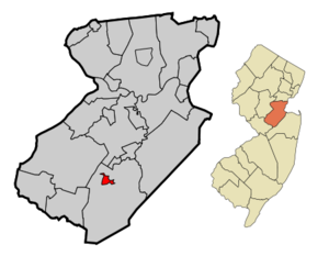
mapsize = 250x200px
map_caption = Jamesburg highlighted in Middlesex County
mapsize1 =
map_caption1 =subdivision_type = Country
subdivision_name =United States
subdivision_type1 = State
subdivision_name1 =New Jersey
subdivision_type2 = County
subdivision_name2 = Middlesex
government_footnotes =
government_type =
leader_title =
leader_name =
leader_title1 =
leader_name1 =
established_title =
established_date =unit_pref = Imperial
area_footnotes =
area_magnitude =
area_total_km2 = 2.2
area_land_km2 = 2.2
area_water_km2 = 0.0
area_total_sq_mi = 0.8
area_land_sq_mi = 0.8
area_water_sq_mi = 0.0population_as_of = 2000
population_footnotes =
population_total = 6025
population_density_km2 = 2760.0
population_density_sq_mi = 7148.2timezone = Eastern (EST)
utc_offset = -5
timezone_DST = EDT
utc_offset_DST = -4
elevation_footnotes =
elevation_m = 22
elevation_ft = 72
latd = 40 |latm = 21 |lats = 0 |latNS = N
longd = 74 |longm = 26 |longs = 21 |longEW = Wpostal_code_type =
ZIP code
postal_code = 08831
area_code = 732
blank_name = FIPS code
blank_info = 34-34890GR|2 [ [http://mcdc2.missouri.edu/webrepts/commoncodes/ccc_nj.html A Cure for the Common Codes: New Jersey] , Missouri Census Data Center. AccessedJuly 14 ,2008 .]
blank1_name = GNIS feature ID
blank1_info = 0877409GR|3
website =
footnotes =Jamesburg is a Borough in Middlesex County,
New Jersey ,United States . As of theUnited States 2000 Census , the borough population was 6,025.Jamesburg was formed as a borough by an Act of the
New Jersey Legislature onMarch 19 ,1887 , when it was created from portions of Monroe Township, based on the results of a referendum held onMarch 15 ,1887 . Jamesburg's incorporation was confirmedApril 15 ,1915 ."The Story of New Jersey's Civil Boundaries: 1606-1968", John P. Snyder, Bureau of Geology and Topography; Trenton, New Jersey; 1969. p. 170.]Geography
Jamesburg is located at coor dms|40|21|0|N|74|26|21|W|city (40.350107, -74.439095)GR|1.
According to the
United States Census Bureau , the borough has a total area of 0.9square mile s (2.2km² ), all of it land.Jamesburg is a borough that is entirely surrounded by Monroe Township. Jamesburg is the older and more urban area located in the center of Monroe Township.
Demographics
USCensusPop
1930= 2048
1940= 2128
1950= 2307
1960= 2853
1970= 4584
1980= 4114
1990= 5294
2000= 6025
estimate= 6429
estyear=2006
estref= [http://factfinder.census.gov/servlet/SAFFPopulation?_event=Search&geo_id=16000US3431470&_geoContext=01000US%7C04000US34%7C16000US3431470&_street=&_county=jamesburg&_cityTown=jamesburg&_state=04000US34&_zip=&_lang=en&_sse=on&ActiveGeoDiv=geoSelect&_useEV=&pctxt=fph&pgsl=160&_submenuId=population_0&ds_name=null&_ci_nbr=null&qr_name=null®=null%3Anull&_keyword=&_industry= Census data for Jamesburg borough] ,United States Census Bureau . AccessedSeptember 20 ,2007 .]
footnote=Population 1930 - 1990. [ [http://www.wnjpin.net/OneStopCareerCenter/LaborMarketInformation/lmi01/poptrd6.htm Jersey Resident Population by Municipality: 1930 - 1990] , Workforce New Jersey Public Information Network. AccessedMarch 1 ,2007 .] As of thecensus GR|2 of 2000, there were 6,025 people, 2,176 households, and 1,551 families residing in the borough. Thepopulation density was 7,148.2 people per square mile (2,769.4/km²). There were 2,240 housing units at an average density of 2,657.6/sq mi (1,029.6/km²). The racial makeup of the borough was 82.82% White, 8.83% African American, 0.20% Native American, 2.22% Asian, 3.80% from other races, and 2.12% from two or more races. Hispanic or Latino of any race were 10.06% of the population.There were 2,176 households out of which 35.4% had children under the age of 18 living with them, 54.7% were married couples living together, 12.1% had a female householder with no husband present, and 28.7% were non-families. 22.4% of all households were made up of individuals and 6.9% had someone living alone who was 65 years of age or older. The average household size was 2.70 and the average family size was 3.18.
In the borough the population was spread out with 24.6% under the age of 18, 7.5% from 18 to 24, 35.6% from 25 to 44, 21.5% from 45 to 64, and 10.7% who were 65 years of age or older. The median age was 35 years. For every 100 females there were 95.0 males. For every 100 females age 18 and over, there were 92.7 males.
The median income for a household in the borough was $59,461, and the median income for a family was $67,887. Males had a median income of $45,019 versus $33,333 for females. The
per capita income for the borough was $23,325. About 3.0% of families and 3.5% of the population were below thepoverty line , including 5.1% of those under age 18 and 3.9% of those age 65 or over.Government
Local government
Jamesburg is governed under the Borough form of New Jersey Government. The mayor is directly elected by the voters to a four-year term of office. The Borough council consists of six members elected on a partisan basis to three-year terms of office on a staggered basis, with two seats coming up for election each year.
The
Mayor of the Borough of Jamesburg is Anthony LaMantia, whose term of office ends onDecember 31 ,2007 . Members of the Jamesburg Borough Council are Council President John Longo Jr. (term ends 2007), Barbara Carpenter (2007), Otto Kostbar (2008), Joseph Jennings (2009), Brian Grimes (2009) and Carlos Morales (2008). [ [http://www.jamesburgborough.org/new_page_13.htm Borough of Jamesburg Mayor & Borough Council] , Borough of Jamesburg. AccessedFebruary 13 ,2007 .]Federal, state and county representation
Jamesburg is in the Twelfth Congressional District and is part of New Jersey's 14th Legislative District. [ [http://www.lwvnj.org/pubs/CG06.pdf 2006 New Jersey Citizen's Guide to Government] , New Jersey
League of Women Voters , p. 59. AccessedAugust 30 ,2006 .]Education
The
Jamesburg Public Schools serve students in kindergarten through eighth grade. Schools in the district are [http://www.jamesburg.org/jfk/index.html John F. Kennedy School] for grades K-5 and [http://www.jamesburg.org/gmb/index.html Grace M. Breckwedel Middle School] , which serves students in grades 6-8.Jamesburg High School, founded in 1905, graduated its last class in June 1979. Jamesburg's high school students now attend
Monroe Township High School in Monroe Township, as part of asending/receiving relationship with theMonroe Township School District . [Cheslow, Jerry. [http://www.nytimes.com/2007/10/14/realestate/14livi.html?fta=y&pagewanted=all "A Townful of Empty Nesters"] , "The New York Times ",October 14 ,2007 . AccessedAugust 8 ,2008 . "In addition to the four elementary schools, the Applegarth Middle School teaches Grades 7 and 8, and the 1,400-student Monroe Township High School covers Grades 9 through 12. It is shared with the borough of Jamesburg, the “hole in the doughnut” municipality in the center of the township."]Transportation
Jamesburg hosts CR 522, which then passes through Monroe at both ends. Jamesburg's busiest roads are Pergola Avenue (County Route 612), Buckelew Avenue (CR 522), Perrineville Road (County Route 625), Half Acre Road (County Route 615), and Forsgate Drive (County Route 612). Motorists can use 612 as a route to connect to Route 32 or the
New Jersey Turnpike to CR 520.Jamesburg is accessible from Turnpike Exit 8A via Forsgate Drive (County Route 612).
Notable residents
*
Frankie Hayes (1914-1955),catcher inMajor League Baseball from 1933 to 1947. He batted and threw right-handed, and played for the Philadelphia Athletics for most of his career. [ [http://www.baseball-almanac.com/players/playerpost.php?p=hayesfr01&ps=asg Frankie Hayes All-Star Stats] , Baseball Almanac. AccessedJune 8 ,2007 .]
*Harrison Woodhull Crosby , in 1847 became the first to can tomatoes. [ [http://www.jamesburg.net/walkingtour.html A Walking Tour of Jamesburg] . AccessedApril 8 ,2007 . "In 1847, tomatoes were first canned in tin cans by Harrison Woodhull Crosby, a Lafayette Professor, in the Buckelew Cannery."]Parks and Recreation
Thompson Park is located on the south western edge of Jamesburg. The park is also partially in the neighboring town of Monroe. Thompson Park takes up at total of 675 acres. The beautiful thirty acre Manalapan Lake is located on the eastern edge of the park. The park in total has 4 tennis courts, 4 basketball courts, 2 handball courts, 3 baseball fields, 1 softball field, 1 soccer field, multiple picnic groves equipped with grills, 3 hiking/biking trails, fishing, animal haven, and a lovely gazebo. [ [http://co.middlesex.nj.us/parksrecreation/thompson.asp Middlesex County, NJ - Parks and Recreation] Accessed
July 28 ,2008 . ]The park has three entrances. Two are located on Perrineville Road, and one is located on Forsgate Drive.
References
External links
* [http://www.jamesburgborough.org/ Jamesburg Borough website]
* [http://co.middlesex.nj.us/economicdevelopment/jam.asp Middlesex County web page for Jamesburg]
* [http://www.jamesburg.org/ Jamesburg Public Schools]
*NJReportCard|23|2370|0|Jamesburg Public Schools
* [http://nces.ed.gov/ccd/schoolsearch/school_list.asp?Search=1&DistrictID=3407770 Data for the Jamesburg Public Schools] ,National Center for Education Statistics
* [http://www.jamesburgnj.org/ Historic Jamesburg]
Wikimedia Foundation. 2010.