- Kingston, New Jersey
:"not to be confused with
Barclay-Kingston, New Jersey "Infobox Settlement
official_name = Kingston, New Jersey
settlement_type = CDP
Unincorporated area
nickname =
motto =
imagesize =
image_caption =
image_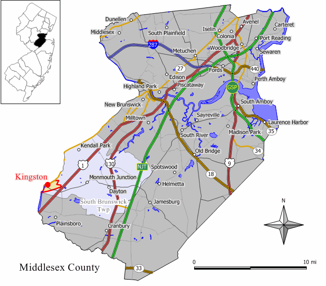
mapsize = 250px
map_caption = Map of Kingston showing section in Middlesex County
mapsize1 =
map_caption1 =subdivision_type = Country
subdivision_name =United States
subdivision_type1 = State
subdivision_name1 =New Jersey
subdivision_type2 = County
subdivision_name2 = Middlesex
Mercer
Somerset
government_footnotes =
government_type =
leader_title =
leader_name =
leader_title1 =
leader_name1 =
established_title =
established_date = circa 1700area_footnotes =
area_magnitude =
area_total_km2 = 2.4
area_land_km2 = 2.3
area_water_km2 = 0.0
area_total_sq_mi = 0.9
area_land_sq_mi = 0.9
area_water_sq_mi = 0.0population_as_of = 2000
population_footnotes =
population_total = 1292
population_density_km2 = 556.3
population_density_sq_mi = 1440.9timezone = Eastern (EST)
utc_offset = -5
timezone_DST = EDT
utc_offset_DST = -4
elevation_footnotes =
elevation_m = 37
elevation_ft = 121
latd = 40 |latm = 22 |lats = 22 |latNS = N
longd = 74 |longm = 36 |longs = 46 |longEW = Wpostal_code_type = ZIP codes
postal_code = 08528
area_code = 732
blank_name = FIPS code
blank_info = 34-36930GR|2
blank1_name = GNIS feature ID
blank1_info = 0877579GR|3
website =
footnotes = USCensusPop
1990=1047
2000=1292
footnote=source: [cite web
url=http://factfinder.census.gov/servlet/SAFFPopulation?_event=ChangeGeoContext&geo_id=16000US3436930&_geoContext=01000US%7C04000US34%7C16000US3436660&_street=&_county=kingston&_cityTown=kingston&_state=04000US34&_zip=&_lang=en&_sse=on&ActiveGeoDiv=geoSelect&_useEV=&pctxt=fph&pgsl=010&_submenuId=population_0&ds_name=null&_ci_nbr=null&qr_name=null®=null%3Anull&_keyword=&_industry=
title=Population Finder: Kingston CDP, New Jersey
publisher=U.S. Census Bureau
accessdate=2007-03-18]Kingston is a
census-designated place (CDP) and unincorporated area in theU.S. state ofNew Jersey , which has been officially designated as aVillage Center by theNew Jersey State Planning Commission . The CDP portion, is the area that lies in Middlesex County. The Village of Kingston exists in three different municipalities: South Brunswick Township in Middlesex County, Franklin Township in Somerset County andPrinceton Township in Mercer County. [cite web |url=http://www.villageofkingston.com/Website/location.html |title=Village of Kingston |accessdate=2008-07-17 |quote=The Village of Kingston exists in three different municipalities consisting of South Brunswick Township in Middlesex County, Franklin Township in Somerset County, and Princeton Township in Mercer County.|publisher=Village of Kingston |accessdate=2008-07-17 |] It is the only tri-county community in New Jersey. [cite news | first=Jeanette K. |last=Muser |url=http://www.kingstongreenways.org/history.html |title=Kingston: Crossroads To History |accessdate=2008-07-17 |quote=Although the community remains unincorporated today, residents share a common heritage that goes back to the 17th century. What makes Kingston so unique, however, is that it is the only tri-county community in New Jersey. |publisher=Kingstongreenways ] The population was 1,292 at the 2000 census.The
Kingston Village Advisory Committee , appointed by the Councils of both South Brunswick and Franklin Townships, holds an annual Village Meeting and advises the Councils on citizen issues in this unique split jurisdiction.Kingston is located in five historic districts and is part of the
Millstone River Valley Scenic Byway. TheDelaware and Raritan Canal and Rockingham State Historic Site are a short distance away.History
Jediah Higgins purchased 1,000 acres from the Native Americans in the early 1700s and the town of Kingston was established.cite web |url=http://www.kingstonpresbyterian.org/index.asp?Type=B_BASIC&SEC={2C83D948-9A35-4C1E-BCB6-E090D3780F0F} |title=Kingston Presbyterian Church |accessdate=2008-07-18 |quote= |publisher=Kingston Presbyterian ]
Geography
Kingston is located at coor dms|40|22|22|N|74|36|46|W|city (40.372656, -74.612865)GR|1.
According to the
United States Census Bureau , the CDP has a total area of 2.4km² (0.9 mi²). 2.3 km² (0.9 mi²) of it is land and 0.1 km² (0.04 mi²) of it (2.20%) is water.Demographics
As of the
census GR|2 of 2000, there were 1,292 people, 561 households, and 315 families residing in the CDP. Thepopulation density was 554.3/km² (1,440.9/mi²). There were 576 housing units at an average density of 247.1/km² (642.4/mi²). The racial makeup of the CDP was 74.07% White, 8.05% African American, 0.62% Native American, 10.06% Asian, 4.33% from other races, and 2.86% from two or more races. Hispanic or Latino of any race were 11.69% of the population.There were 561 households out of which 24.4% had children under the age of 18 living with them, 44.7% were married couples living together, 8.4% had a female householder with no husband present, and 43.7% were non-families. 36.4% of all households were made up of individuals and 8.0% had someone living alone who was 65 years of age or older. The average household size was 2.30 and the average family size was 3.08.
In the CDP the population was spread out with 20.3% under the age of 18, 6.7% from 18 to 24, 36.4% from 25 to 44, 23.1% from 45 to 64, and 13.5% who were 65 years of age or older. The median age was 38 years. For every 100 females there were 93.4 males. For every 100 females age 18 and over, there were 90.7 males.
The median income for a household in the CDP was $65,962, and the median income for a family was $80,242. Males had a median income of $56,371 versus $46,250 for females. The
per capita income for Kingston was $34,457. None of the families and 1.0% of the population were living below thepoverty line , including no under eighteens and none of those over 64.Kingston Presbyterian Church
The Kingston Presbyterian Church was organized in 1723 and was initially located in a log building adjacent to the
Millstone River . The old tombstones surround the site where the church once stood in the Kingston Cemetery. The ReverendEleazer Wales was the first recorded minister of the church. The original church building in the cemetery burned down in 1791, and new building was erected in 1792 on the original foundation. The congregation used this building until 1852, when the larger building on Main Street in Kingston was constructed on land purchased from Elijah Stout. In 1853, the church building in the cemetery was sold and was later dismantled.National Register of Historic Places
The following sites and districts in Kingston are listed on the
National Register of Historic Places :
*Rockingham Historic Site, George Washington's last war-time headquarters in 1783, added in 1970 it is #70000394
*Delaware and Raritan Canal Historic District was added in 1973, it is district #73001105
*Kingston Mill Historic District was added in 1986, it is district #86000707.
*Kingston Village Historic District was added in 1990, it is district #89002163.
*King’s Highway Historic District was added in 2000, it is district #00001493References
External links
* [http://www.twp.south-brunswick.nj.us/ South Brunswick Township]
* [http://www.villageofkingston.com/ villageofkingston.com]
* [http://www.rockingham.net/index.htm Rockingham State Historic Site]
* [http://www.no92.com No 92]
* [http://www.preservationnj.org/ten_most/ten_most_property_detail.asp?COUNTY=Statewide&PropID=72 Preservation New Jersey: Vanishing Villages]
*cite book |last=Brahms |first=William |authorlink=William B. Brahms |coauthors= |title=Images of America: Franklin Township |year= 1997|publisher=Arcadia Publishing |location=Dover, New Hampshire |isbn=0-7524-0938-7
*cite book |last=Brahms |first=William |authorlink=William B. Brahms |coauthors= |title=Franklin Township, Somerset County, NJ: A History |year= 1998|publisher=FTPL |location=Franklin Township, New Jersey |isbn=0-9668586-0-3
*Geolinks-US-cityscale|40.372656|-74.612865
Wikimedia Foundation. 2010.