- South Brunswick Township, New Jersey
Infobox Settlement
official_name = South Brunswick Township, New Jersey
settlement_type = Township
nickname =
motto =
imagesize =
image_caption =
image_|pushpin_
pushpin_label_position =
pushpin_map_caption =
pushpin_mapsize =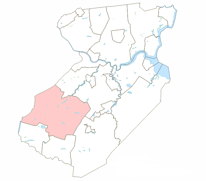
mapsize = 200px
map_caption = Location within Middlesex County.
mapsize1 =
map_caption1 =subdivision_type = Country
subdivision_name =United States
subdivision_type1 = State
subdivision_name1 =New Jersey
subdivision_type2 = County
subdivision_name2 = Middlesex
government_footnotes =
government_type =Faulkner Act (Council-Manager)
leader_title =
leader_name =
leader_title1 =
leader_name1 =
established_title =
established_date =unit_pref = Imperial
area_footnotes =
area_magnitude =
area_total_km2 = 106.4
area_land_km2 = 105.8
area_water_km2 = 0.6
area_total_sq_mi = 41.1
area_land_sq_mi = 40.9
area_water_sq_mi = 0.2population_as_of = 2000
population_footnotes =
population_total = 37734
population_density_km2 = 356.6
population_density_sq_mi = 923.5timezone = Eastern (EST)
utc_offset = -5
timezone_DST = EDT
utc_offset_DST = -4
elevation_footnotes =
elevation_m = 43
elevation_ft = 141
latd = 40 |latm = 23 |lats = 30 |latNS = N
longd = 74 |longm = 32 |longs = 45 |longEW = Wpostal_code_type =
ZIP code
postal_code = 08810, 08824, 08852, 08540
area_code = 732
blank_name = FIPS code
blank_info = 34-68790GR|2 [ [http://mcdc2.missouri.edu/webrepts/commoncodes/ccc_nj.html A Cure for the Common Codes: New Jersey] , Missouri Census Data Center. AccessedJuly 14 ,2008 .]
blank1_name = GNIS feature ID
blank1_info = 0882162GR|3
website =
footnotes =South Brunswick Township is a Township in Middlesex County,
New Jersey ,United States . As of theUnited States 2000 Census , the township population was 37,734.South Brunswick was first mentioned on
February 28 ,1779 in Freeholder minutes as being formed from New Brunswick Township. It was formally incorporated as one of New Jersey's initial group of 104 townships onFebruary 21 ,1798 . Portions of the township have been taken to form Cranbury Township (March 7 ,1872 ) and Plainsboro Township (April 1 ,1919 )."The Story of New Jersey's Civil Boundaries: 1606-1968", John P. Snyder, Bureau of Geology and Topography; Trenton, New Jersey; 1969. p. 174.]Geography
According to the
United States Census Bureau , the township has a total area of 41.1square mile s (106.4km² ), of which, 40.9 square miles (105.8 km²) of it is land and 0.2 square miles (0.6 km²) of it (0.58%) is water.The township encompasses the
census-designated place s and unincorporated areas of Dayton (2000 Census population of 6,235), Heathcote (4,755), Kendall Park (9,006), Kingston (1,292) and Monmouth Junction (2,721). Deans is an unincorporated area within the Township. Among these, Kingston is (so far) unique as the onlyVillage Center that has been officially designated by theNew Jersey State Planning Commission in the township.The
Lawrence Brook , a tributary of theRaritan River , flows through the township.Kingston's location on the
Lenape Assunpink Trail where it crossed theMillstone River was the prime factor in its early prominence. Kingston was by far the most active and important village, being situated on both the heavily traveled King's Road and Millstone River, combining commercial activities of both mills and taverns. TheKingston Village Advisory Committee , jointly appointed by the South Brunswick and Franklin Township Councils, reports to the Township Council on matters of concern to residents of Kingston. [ [http://www.villageofkingston.com/Website/advisory.html Kingston Village Advisory Committee] , Village of Kingston. AccessedSeptember 6 ,2007 .]Dayton was first known simply as The Cross Roads, where James Whitlock built a tavern on Georges Road around 1750. Early enterprises included a brick manufacturer and large nursery. In 1866, the name was changed from Cross Roads to Dayton, in honor of
William L. Dayton , an attorney for the Freehold and Jamesburg Agricultural Railroad. Dayton had helped settle disputes arising from the location of a railroad right-of-way. He was later a United States Senator, was the first Republican nominee for Vice President (in 1856), and Minister toFrance . The nature of its business establishments — farm implements, tow hay dealers, a general store, a nursery and a harness maker — attests to its agricultural identity.Deans originated from its location on both Crosswicknung Trail (Georges Road) and Lawrence Brook. Dams were built on the brook, creating Deans Pond.
Monmouth Junction was created as the junction of three rail branches, the New York division of the
Pennsylvania Railroad , the Rocky Hill and the Jamesburg and Freehold.With increased mobility and a growing population, the suburban style residential development was born after the
World War II and Kendall Park was begun in the 1950s. Kendall Park is located right off Route 27, the old Indian trail and major thoroughfare of earlier centuries.South Brunswick borders Cranbury Township, East Brunswick Township, Monroe Township, North Brunswick Township and Plainsboro Township in Middlesex County, Franklin Township in Somerset County, and Princeton Township in Mercer County.
Pigeon Swamp State Park is a New Jersey state park located on Deans Rhode Hall Road (Middlesex CR-610). The park has 1,078 acres of undeveloped land.Demographics
USCensusPop
1930=2758
1940=3129
1950=4001
1960=10278
1970=14058
1980=17127
1990=25792
2000=37734
estimate= 40570
estyear=2006
estref= [http://factfinder.census.gov/servlet/SAFFPopulation?_event=Search&geo_id=16000US3468550&_geoContext=01000US%7C04000US34%7C16000US3468550&_street=&_county=south+brunswick&_cityTown=south+brunswick&_state=04000US34&_zip=&_lang=en&_sse=on&ActiveGeoDiv=geoSelect&_useEV=&pctxt=fph&pgsl=160&_submenuId=population_0&ds_name=null&_ci_nbr=null&qr_name=null®=null%3Anull&_keyword=&_industry= Census data for South Brunswick city] ,United States Census Bureau . AccessedAugust 18 ,2007 .]
footnote=Population 1930 - 1990. [ [http://www.wnjpin.net/OneStopCareerCenter/LaborMarketInformation/lmi01/poptrd6.htm New Jersey Resident Population by Municipality: 1930 - 1990] , Workforce New Jersey Public Information Network. AccessedMarch 1 ,2007 .] As of thecensus GR|2 of 2000, there were 37,734 people, 13,428 households, and 10,084 families residing in the township. Thepopulation density was 923.5 people per square mile (356.6/km²). There were 13,862 housing units at an average density of 339.3/sq mi (131.0/km²). The racial makeup of the township was 70.49% White, 7.88% African American, 0.13% Native American, 18.04% Asian, 0.04% Pacific Islander, 1.37% from other races, and 2.04% from two or more races. Hispanic or Latino of any race were 5.08% of the population.As of the 2000 census, 10.48% of South Brunswick's residents identified themselves as being of
Indian American ancestry, which was the seventh highest of any municipality in the United States and the fourth highest in New Jersey — behind Edison (17.75%), Plainsboro Township (16.97%) and Piscataway Township (12.49%) — of all places with 1,000 or more residents identifying their ancestry. [ [http://www.epodunk.com/ancestry/Asian-Indian.html Asian-Indian Communities] ,Epodunk . AccessedFebruary 18 ,2007 .]There were 13,428 households out of which 43.0% had children under the age of 18 living with them, 63.8% were married couples living together, 8.6% had a female householder with no husband present, and 24.9% were non-families. 19.6% of all households were made up of individuals and 4.3% had someone living alone who was 65 years of age or older. The average household size was 2.80 and the average family size was 3.27.
In the township the population was spread out with 28.4% under the age of 18, 5.7% from 18 to 24, 36.7% from 25 to 44, 21.8% from 45 to 64, and 7.3% who were 65 years of age or older. The median age was 35 years. For every 100 females there were 94.0 males. For every 100 females age 18 and over, there were 91.3 males.
The median income for a household in the township was $78,737, and the median income for a family was $86,891. Males had a median income of $61,637 versus $41,554 for females. The
per capita income for the township was $32,104. About 2.1% of families and 3.1% of the population were below thepoverty line , including 2.9% of those under age 18 and 4.5% of those age 65 or over.Government
Local government
South Brunswick Township operates under the
Faulkner Act (Council-Manager) form of municipal government. ["2005 New Jersey Legislative District Data Book",Rutgers University Edward J. Bloustein School of Planning and Public Policy , April 2005, p. 70.] Members of the Township Council are elected to four-year terms in partisan elections on a staggered basis.Members of the Township Council are
Mayor Frank Gambatese (D; term endsDecember 31 ,2010 ),Deputy Mayor Carol Barrett (D; 2008), Joseph J. Camarota Jr. (D; 2008), Charlie Carley (D; 2008) and Chris Killmurray (D; 2010). [ [http://www.twp.south-brunswick.nj.us/index.asp?Type=B_LIST&SEC={A1B99EEA-E04A-4C44-A5FA-AB93649B4A96} South Brunswick Township Governing Body] , South Brunswick Township. AccessedJanuary 9 ,2008 . ]Federal, state and county representation
South Brunswick Township is in the Twelfth Congressional District and is part of New Jersey's 14th Legislative District. [ [http://www.lwvnj.org/pubs/CG06.pdf 2006 New Jersey Citizen's Guide to Government] , New Jersey
League of Women Voters , p. 64. AccessedAugust 30 ,2006 .]History
South Brunswick Township was incorporated by an act of the
New Jersey Legislature in 1798. The 18th century character of South Brunswick was that of a rural agricultural township with small clustered settlements located on major transportation routes. The early settlers took advantage of fertile soils and favorable growing conditions.The rural nature of the Township continued throughout the 19th century, with increases in commercial and residential growth and development coinciding with the introduction of new transportation routes. The Straight Turnpike, now U.S. Route 1, was constructed in 1804.
In 1872, the Legislature first reduced the size of South Brunswick with the creation of the separate Cranbury Township from the southern portion of South Brunswick. In 1885, it redefined and enlarged the boundaries of Cranbury, and in 1919, the size of South Brunswick was further reduced with the formation of Plainsboro Township. The present boundaries of South Brunswick date back to this last change.
20th century South Brunswick has seen extensive transformation with the impact of American industrial technology. The New Brunswick and Trenton Fast Line began operation in 1900, a trolley line running parallel to the Old Straight Turnpike of 1804 (Route 1), intersecting George's Road just north of the Five Corners intersection in Dayton. This trolley provided daily passenger and freight service, stopping at a local crossroads. The
New Jersey Turnpike opened in 1951, again roughly parallel to Route 1, on the eastern edge of the Township. One effect of the Turnpike opening up Interchange 8A (just outside the township) was the transformation of the agricultural area on the southeast corner of South Brunswick to that of a burgeoning industrial development. As of 2008, the majority of land between US 130 and the turnpike consists largely of warehouses.Fact|date=January 2008In 1980, the Township population approached 18,000. In 1990, this figure reached 25,792 and today South Brunswick has over 33,400 residents. In short, since the early 1900s, the town has matured from a farming community to a suburban town. While South Brunswick has been growing rapidly, much of the township's 42 square miles remain undeveloped and there are still significant amounts of wetlands, woodlands and open space within the community.
Transportation
South Brunswick hosts U.S. Route 1,
U.S. Route 130 , Route 27, Route 32, and Interstate 95/New Jersey Turnpike . US 1 carries a substantial amount of vehicular volume, which often clogs up. US 130 is slowly becoming busier as new developments have been constructed in the township. Warehouses are commonly built around 130, especially near the intersection with NJ 32. At the intersection with 32 and 130, there is a bus stop, where citizens can take buses to thePort Authority Bus Terminal inMidtown Manhattan . South Brunswick houses about a 3½ mile section of the New Jersey Turnpike, and a few Turnpike ramps that lead to the toll gate for Interchange 8A which is just outside of the municipality, in Monroe Township. Due to heavy congestion on the ramp to Route 32 west, the Turnpike Authority replaced it with a new two lane ramp that goes from the toll gate to the intersection of CR 535 & "Thatcher Road". Motorists must then take 535 south to access 32 west.The New Jersey Turnpike Authority has proposed to construct a west-east spur of the Turnpike, NJ 92. The majority of the spur would be in South Brunswick Township. It would begin at US 1, just north of the intersection with Ridge Road in South Brunswick Township and would terminate at Exit 8A in the area of the 8A toll gate in Monroe Township.
On
December 1 ,2006 , the New Jersey Turnpike Authority terminated its plans to build the spur from Ridge & 1 in South Brunswick to 8A in Monroe. The Authority's main focus will now be on widening the Turnpike between Exit 6 (in Mansfield Township) and Exit 8A (in Monroe Township). [ [http://www.dailyrecord.com/apps/pbcs.dll/article?AID=/20061202/NEWS02/612020334/1123/NEWS01 Route 92-turnpike connection project off the table -- for now: Official says expansion of turnpike between Exits 6 and 9 is the top priority] , "Daily Record (Morristown) ",December 2 ,2006 .]Education
As the township continues to grow, the
South Brunswick Public Schools are experiencing a corresponding trend. In 1991, the district’s enrollment was just under 4,000 students. As ofJanuary 20 ,2006 , the district had 8,808 students enrolled in the district’s schools, including seven elementary schools for 4,210 students in Grades K-5 ( [http://www.sbschools.org/schools/bc/index.php Brooks Crossing] , [http://www.sbschools.org/schools/ba/index.php Brunswick Acres] , [http://www.sbschools.org/schools/ca/index.php Cambridge] , [http://www.sbschools.org/schools/co/index.php Constable] , [http://www.sbschools.org/schools/gb/index.php Greenbrook] , [http://www.sbschools.org/schools/if/index.php Indian Fields] and [http://www.sbschools.org/schools/mj/index.php Monmouth Junction] ), two middle schools for 2,062 students in Grades 6-8 ( [http://www.sbschools.org/schools/xrds/index.php Crossroads Middle Schools North and South] ) and South Brunswick High School for 2,536 students in Grades 9-12.Notable residents
Noted current and former residents of South Brunswick include:
*Donald Fagen (born 1948), amusician andsongwriter , best known as the co-founder of the rock bandSteely Dan .Fact|date=February 2008
*George Segal (1924-2000), painter andsculptor associated with thePop Art movement. He was presented with aNational Medal of Arts in 1999. [Turner, Elisa. [http://infoweb.newsbank.com/iw-search/we/InfoWeb?p_action=doc&p_docid=0EB4DBDD23876098&p_docnum=4&p_queryname=NaN&p_product=NewsBank&p_theme=aggregated4&p_nbid=H60S48QAMTE4NTg0NzQ0OS4yODY4NjU6MTo3OnJhLTE4ODg "SEGAL EXHIBIT EVOKES QUIET DIGNITY OF HUMDRUM LIVES"] , "The Miami Herald ",December 20 ,1998 . AccessedJuly 31 ,2007 . "That compassion is also evident in the work ethic and personality of this artist, who's called himself a "Depression baby" and who speaks fondly of South Brunswick, N.J., where he's lived since the 1940s, as a "working man's town."]
*DeForest Soaries (born 1951), pastor and former chairman of theElection Assistance Commission . [ [http://www.fbcsomerset.com/about/staff/senior.shtml The Senior Pastor] , First Baptist Church of Lincoln Gardens. AccessedJune 10 ,2007 . "Born in New York and raised in New Jersey, Dr. Soaries resides in Monmouth Junction, New Jersey with his wife, Donna and twin sons, Malcolm and Martin."]References
External links
* [http://www.twp.south-brunswick.nj.us/ South Brunswick Township web site]
* [http://www.sbschools.org/ South Brunswick Public Schools]
*NJReportCard|23|4860|0|South Brunswick Public Schools
* [http://nces.ed.gov/ccd/schoolsearch/school_list.asp?Search=1&DistrictID=3415210 Data for the South Brunswick Public Schools] ,National Center for Education Statistics
Wikimedia Foundation. 2010.