Edgartown Harbor Light

Edgartown Harbor Light

Infobox Lighthouse


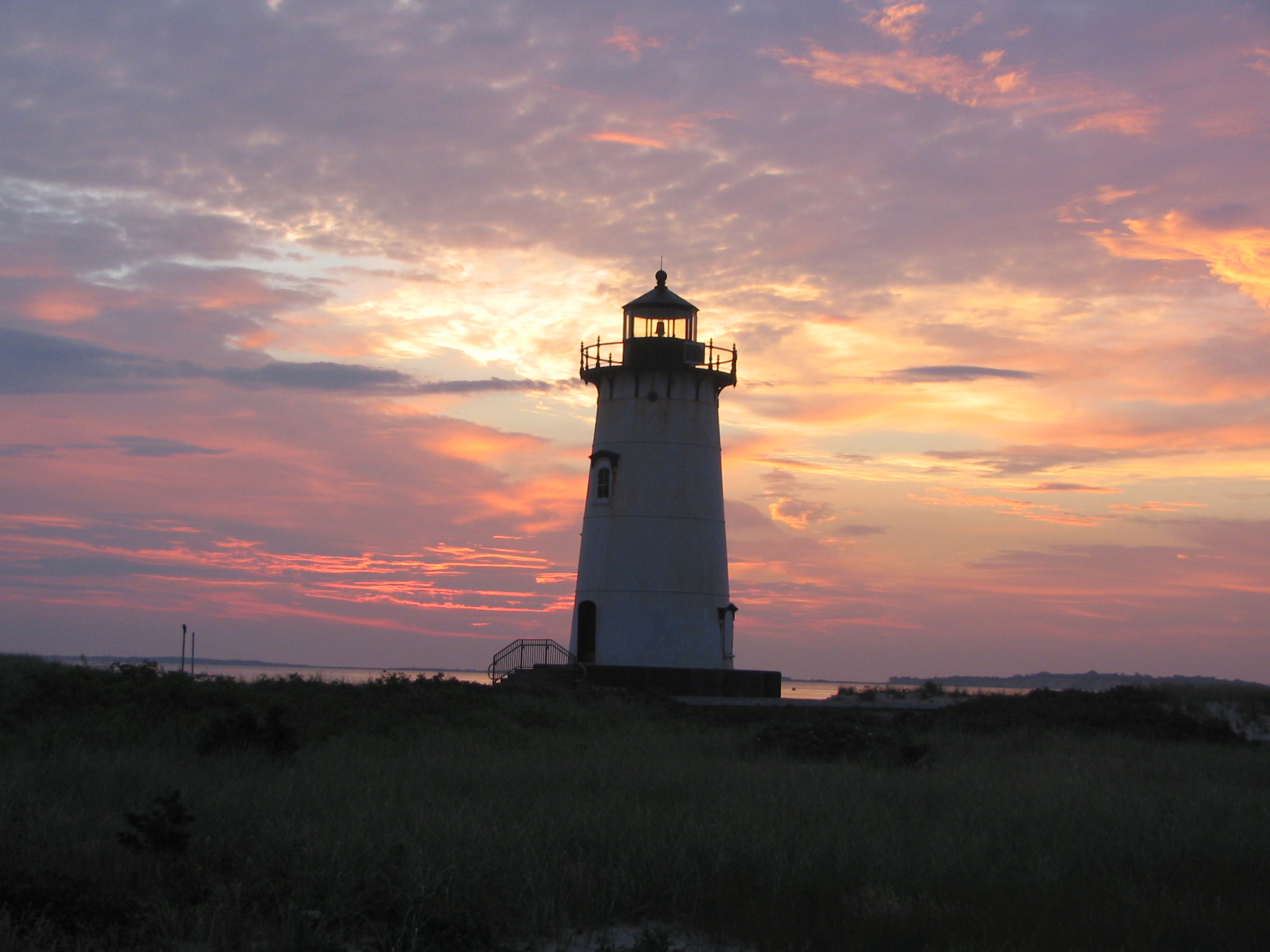
caption = Photo of Edgartown light at dawn, taken in July 2006.
location = Edgartown, Massachusetts
coordinates = coord|41|23|27.20|N|70|30|11.19|W|region:US_type:landmark
yearbuilt = 1828
yearlit = 1939
automated = 1939
yeardeactivated =
foundation = Granite blocks
construction = Cast iron
shape = Conical
marking = White with black lantern
height = 45 ft
lens = Fourth order Fresnel lens
range =
characteristic = Flashing red every six seconds

Edgartown Harbor Light is a lighthouse located in Edgartown, Massachusetts that marks the entrance into Edgartown Harbor and Katama Bay. The lighthouse was originally built in 1828, but it was destroyed in a hurricane in 1938. It was replaced in 1939 with a tower relocated from Ipswich, Massachusetts. [cite web|url=http://www.nps.gov/history/maritime/light/edgar.htm|title=Inventory of Historic Light Stations - Massachusetts - Edgartown Harbor Light|publisher=National Park Service|date=2007|accessdate=2007-12-22]

The [http://www.marthasvineyardhistory.org/ Martha's Vineyard Historical Society] has been the caretaker of the lighthouse since 1993, although the United States Coast Guard owns the structure. The society is currently in the process of restoring the lighthouse. Improvements include replacing boarded-up windows and installing a spiral staircase, with the goal of opening the lighthouse to public access. [cite web|url=http://www.marthasvineyardhistory.org/edglightrestoration.php|title=Restoration of the Edgartown Lighthouse|publisher=Martha's Vineyard Historical Society|date=September 13, 2007|accessdate=2007-12-22]


ee also

*List of Registered Historic Places in Dukes County, Massachusetts

References

External links

* [http://www.lighthouse.cc/edgartown/index.html Edgartown Lighthouse, Martha's Vineyard, Massachusetts]
* [http://www.nps.gov/history/maritime/light/edgar.htm Inventory of Historic Light Stations]


Wikimedia Foundation. 2010.

Игры ⚽ Нужно решить контрольную?

Look at other dictionaries:

  • Newburyport Harbor Light — The current tower, built in 1898. U.S. Coast Guard photo Location Newburyport, Massachusetts Coordinates …   Wikipedia

  • Edgartown, Massachusetts — Infobox Settlement official name = Edgartown, Massachusetts nickname = motto = imagesize = image caption = image mapsize = 250px map caption = Location in Dukes County in Massachusetts mapsize1 = map caption1 = subdivision type = Country… …   Wikipedia

  • Minot's Ledge Light — Minots Ledge Light Minots Light in a storm Location Offshore Cohasset, Massachusetts Year first constructed 1850 (first tower) Year first lit 1860 (current tower) Automated 1947 Deactivated 1851 1860 Foundation …   Wikipedia

  • Duxbury Pier Light — Duxbury Pier lighthouse in Plymouth Harbor Location Plymouth Harbor, Plymouth, Massachusetts Coordinates …   Wikipedia

  • Newburyport Harbor Rear Range Light — U.S. National Register of Historic Places …   Wikipedia

  • Nantucket Harbor Range Lights — This article is about the current range lights in Nantucket Harbor. For the historic range lights, see Nantucket Range Lights. Nantucket Range Rear Light The Nantucket Harbor Range Lights Location Brant Point, Nantucket, Massachusetts Coordinates …   Wikipedia

  • Newburyport Harbor Front Range Light — U.S. National Register of Historic Places …   Wikipedia

  • Deer Island Light — The original 1890 light, replaced in 1982. Location Boston Harbor Coordinates …   Wikipedia

  • Old Scituate Light — in Scituate Location Cedar Point, Scituate Harbor Year first lit 1811 Deactivated 1860–1994 Foundation Natural/emplaced Construction Granite/Brick …   Wikipedia

  • Mayo Beach Light — the second Mayo Beach Light (USCG) Location Mayo Beach on Cape Cod Coordinates …   Wikipedia

Share the article and excerpts

Direct link
Do a right-click on the link above
and select “Copy Link”