- Mount Arlington, New Jersey
-
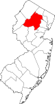
Mount Arlington, New Jersey — Borough — Mount Arlington highlighted in Morris County. Inset map: Morris County highlighted in the State of New Jersey. Census Bureau map of Mount Arlington, New Jersey
Coordinates: 40°55′10″N 74°38′25″W / 40.91944°N 74.64028°WCoordinates: 40°55′10″N 74°38′25″W / 40.91944°N 74.64028°W Country United States State New Jersey County Morris Incorporated November 3, 1890 Government[1] – Type Borough (New Jersey) – Mayor Arthur R. Ondish Area – Total 2.8 sq mi (7.3 km2) – Land 2.1 sq mi (5.5 km2) – Water 0.7 sq mi (1.9 km2) Elevation[2] 1,099 ft (335 m) Population (2007)[1] – Total 5,698 – Density 2,207.1/sq mi (852.2/km2) Time zone Eastern (EST) (UTC-5) – Summer (DST) EDT (UTC-4) ZIP code 07856 Area code(s) 973 FIPS code 34-48690[3][4] GNIS feature ID 0885312[5] Website http://www.ci.mount-arlington.nj.us Mount Arlington is a borough in Morris County, New Jersey, United States. As of the 2000 United States Census, the borough population was 4,663. It is located on the southeast shore of Lake Hopatcong, New Jersey's largest lake (man made) and a major recreational resource.
Mount Arlington was incorporated as a borough by an Act of the New Jersey Legislature on November 3, 1890, from portions of Hanover Township, based on the results of a referendum held two days earlier. Additional territory was acquired from Roxbury Township on July 25, 1891, on May 31, 1893, and on May 31, 1894.[6]
Contents
Geography
Mount Arlington is located at 40°54′52″N 74°38′24″W / 40.914398°N 74.639865°W (40.914398, -74.639865).[7]
According to the United States Census Bureau, the borough has a total area of 2.8 square miles (7.3 km2), of which, 2.1 square miles (5.4 km2) of it is land and 0.7 square miles (1.8 km2) of it (25.44%) is water.
Demographics
As of the census[3] of 2000, there were 4,663 people, 1,918 households, and 1,262 families residing in the borough. The population density was 2,207.1 people per square mile (853.3/km2). There were 2,039 housing units at an average density of 965.1 per square mile (373.1/km2). The racial makeup of the borough was 91.42% White, 1.82% African American, 0.19% Native American, 3.82% Asian, 0.04% Pacific Islander, 1.27% from other races, and 1.44% from two or more races. Hispanic or Latino of any race were 4.55% of the population.
There were 1,918 households out of which 28.3% had children under the age of 18 living with them, 54.5% were married couples living together, 8.7% had a female householder with no husband present, and 34.2% were non-families. 27.9% of all households were made up of individuals and 6.2% had someone living alone who was 65 years of age or older. The average household size was 2.42 and the average family size was 2.99.
In the borough the population was spread out with 22.1% under the age of 18, 5.3% from 18 to 24, 35.5% from 25 to 44, 26.5% from 45 to 64, and 10.6% who were 65 years of age or older. The median age was 38 years. For every 100 females there were 90.6 males. For every 100 females age 18 and over, there were 87.1 males.
The median income for a household in the borough was $67,213, and the median income for a family was $79,514. Males had a median income of $53,049 versus $40,417 for females. The per capita income for the borough was $32,222. About 2.3% of families and 3.3% of the population were below the poverty line, including 5.3% of those under age 18 and 3.4% of those age 65 or over.
Historical populations Census Pop. %± 1930 306 — 1940 456 49.0% 1950 639 40.1% 1960 1,246 95.0% 1970 3,590 188.1% 1980 4,251 18.4% 1990 3,630 −14.6% 2000 4,663 28.5% Est. 2007 5,698 [1] 22.2% Population 1930 - 1990.[8] History
While Mount Arlington is now mostly a suburban residential community, it was once a thriving resort town. In the era before the world wars and the advent of air travel, it was a welcome respite for the residents of nearby New York City and Newark.
Every summer thousands would arrive by train at Landing Station, and then travel by water taxi across Lake Hopatcong to the area's many large resort hotels to escape the city heat and enjoy the famous "Mount Arlington breeze" which always cooled the summer evenings.
There was also a major amusement park, Bertrand Island, which featured a world famous carousel and roller coaster.
Government
Local government
Mount Arlington is governed under the Borough form of New Jersey municipal government. The government consists of a Mayor and a Borough Council comprising six council members, with all positions elected at large. A Mayor is elected directly by the voters to a four-year term of office. The Borough Council consists of six members elected to serve three-year terms on a staggered basis, with two seats coming up for election each year.[9]
As of 2011[update], the Mayor of Mount Arlington is Arthur R. Ondish. Members of the Borough Council are Council President Robert Sorge, Andrew Cangiano, Paula Danchuk, Stephen Sadow, Michael Stanzilis and John Windish.[10]
Federal, state and county representation
Mount Arlington is in the Eleventh Congressional District and is part of New Jersey's 25th state legislative district.[11]
New Jersey's Eleventh Congressional District is represented by Rodney Frelinghuysen (R, Harding Township). New Jersey is represented in the United States Senate by Frank Lautenberg (D, Cliffside Park) and Bob Menendez (D, Hoboken).
25th Legislative District of the New Jersey Legislature, which is represented in the New Jersey Senate by Anthony Bucco (R, Boonton) and in the New Jersey General Assembly by Michael Patrick Carroll (R, Morris Plains) and Tony Bucco (R, Boonton).[12] The Governor of New Jersey is Chris Christie (R, Mendham).[13] The Lieutenant Governor of New Jersey is Kim Guadagno (R, Monmouth Beach).[14]
Morris County is governed by a seven-member Board of Chosen Freeholders, who are elected at-large to three-year terms of office on a staggered basis, with two or three seats coming up for election each year.[15] As of 2011, Morris County's Freeholders are Freeholder Director William J. Chegwidden (Wharton),[16] Deputy Freeholder Director Douglas R. Cabana (Boonton Township),[17] Gene F. Feyl (Denville),[18] Ann F. Grassi (Parsippany-Troy Hills),[19] Thomas J. Mastrangelo (Montville),[20] John J. Murphy (Morris Township)[21] and Margaret Nordstrom (Washington Township).[22][23]
Education
The Mount Arlington School District serves public school students in kindergarten through eighth grade.
The Edith M. Decker School (121 students as of 2005-06[24]) is located along the eastern bank of Lake Hopatcong. It is a public elementary school with students in kindergarten through grade 2 including a pre-school disabilities program. The facility contains a fully equipped computer lab, and a well-stocked children’s library.
The Mount Arlington Public School (294 students as of 2005-06[24]) is located along the eastern bank of Lake Hopatcong. It is an elementary / middle school with students in grades 3 through 8. The facility contains a computer lab, a modern art and music suite, and a state-of-the-art media center.
For grades 9-12, public school students attend Roxbury High School in Roxbury, as part of a sending/receiving relationship with the Roxbury School District.[25]
Notable residents
Notable current and former residents of Mount Arlington include:
- Brendan Buckley, drummer with Shakira's band.[26]
- Lotta Crabtree (1847–1924), actress.[27]
References
- ^ a b c Census data for Mount Arlington borough, United States Census Bureau. Accessed November 22, 2008.
- ^ U.S. Geological Survey Geographic Names Information System: Borough of Mount Arlington, Geographic Names Information System, accessed January 4, 2008.
- ^ a b "American FactFinder". United States Census Bureau. http://factfinder.census.gov. Retrieved 2008-01-31.
- ^ A Cure for the Common Codes: New Jersey, Missouri Census Data Center. Accessed July 14, 2008.
- ^ "US Board on Geographic Names". United States Geological Survey. 2007-10-25. http://geonames.usgs.gov. Retrieved 2008-01-31.
- ^ "The Story of New Jersey's Civil Boundaries: 1606-1968", John P. Snyder, Bureau of Geology and Topography; Trenton, New Jersey; 1969. p. 195.
- ^ "US Gazetteer files: 2010, 2000, and 1990". United States Census Bureau. 2011-02-12. http://www.census.gov/geo/www/gazetteer/gazette.html. Retrieved 2011-04-23.
- ^ New Jersey Resident Population by Municipality: 1930 - 1990, Workforce New Jersey Public Information Network. Accessed March 1, 2007.
- ^ 2005 New Jersey Legislative District Data Book, Rutgers University Edward J. Bloustein School of Planning and Public Policy, April 2005, p. 116.
- ^ Mayor and Borough Council, Borough of Mount Arlington. Accessed May 24, 2011.
- ^ 2011 New Jersey Citizen's Guide to Government, New Jersey League of Women Voters, p. 61. Accessed May 24, 2011.
- ^ "Legislative Roster: 2010-2011 Session". New Jersey Legislature. http://www.njleg.state.nj.us/members/roster.asp. Retrieved 2010-09-07.
- ^ "About the Governor". New Jersey. http://www.nj.gov/governor/about/. Retrieved 2010-01-21.
- ^ "About the Lieutenant Governor". New Jersey. http://www.nj.gov/governor/lt/. Retrieved 2010-01-21.
- ^ What is a Freeholder?, Morris County, New Jersey. Accessed January 5, 2011.
- ^ William J. Chegwidden, Morris County, New Jersey. Accessed January 9, 2011.
- ^ Douglas R. Cabana, Morris County, New Jersey. Accessed January 9, 2011.
- ^ Gene F. Feyl, Morris County, New Jersey. Accessed January 9, 2011.
- ^ Ann F. Grossi, Morris County, New Jersey. Accessed January 9, 2011.
- ^ Thomas J. Mastrangelo, Morris County, New Jersey. Accessed January 9, 2011.
- ^ John J. Murphy, Morris County, New Jersey. Accessed January 9, 2011.
- ^ Margaret Nordstrom, Morris County, New Jersey. Accessed January 9, 2011.
- ^ Meet the Freeholders, Morris County, New Jersey. Accessed January 9, 2011.
- ^ a b Data for the Mount Arlington School District, National Center for Education Statistics. Accessed February 26, 2008.
- ^ O'Dea, Colleen. "State orders impact study of school regionalization", Daily Record (Morristown), November 23, 2008. Accessed January 30, 2011. "Mount Arlington, K-8, sends its high school students to Roxbury, K-12."
- ^ Brendan Buckley Artist profile, RhythmTech. Accessed August 18, 2007.
- ^ Morris County Heritage Commission, Morris County, New Jersey. Accessed September 20, 2007.
External links
- Mount Arlington web site
- Mount Arlington School District
- Mount Arlington School District's 2009–10 School Report Card from the New Jersey Department of Education
- Data for the Mount Arlington School District, National Center for Education Statistics
- Regional area newspaper
- Save the Mt. Arlington Police web site
Municipalities and communities of Morris County, New Jersey Boroughs Butler | Chatham | Chester | Florham Park | Kinnelon | Lincoln Park | Madison | Mendham | Morris Plains | Mount Arlington | Mountain Lakes | Netcong | Riverdale | Rockaway | Victory Gardens | Wharton
Towns Boonton | Dover | Morristown
Townships Boonton | Chatham | Chester | Denville | East Hanover | Hanover | Harding | Jefferson | Long Hill | Mendham | Mine Hill | Montville | Morris | Mount Olive | Parsippany-Troy Hills | Pequannock | Randolph | Rockaway | Roxbury | Washington
CDPs Unincorporated
communitiesBrookside | Cedar Knolls | Cedar Lake | Convent Station | Flanders | Gillette | Green Pond | Green Village | Hibernia | Lake Hiawatha | Lake Swannanoa | Landing | Ledgewood | Millington | Mount Freedom | Mount Tabor | New Vernon | Oak Ridge | Pine Brook | Port Morris | Schooley's Mountain | Shongum | Speedwell | Stirling | Towaco | Union Hill | Vasa Park | Whippany
Categories:- Boroughs in Morris County, New Jersey


Wikimedia Foundation. 2010.