- Yellowstone hotspot
-
 Schematic of the hotspot and the Yellowstone Caldera
 Location of the hotspot in megaannum
The Yellowstone hotspot, also referred to as the Snake River Plain-Yellowstone hotspot, is a volcanic hotspot responsible for large scale volcanism in Oregon, Nevada, Idaho, and Wyoming, United States. It created the eastern Snake River Plain through a succession of caldera forming eruptions. The resulting calderas include the Island Park Caldera, the Henry's Fork Caldera, and the Bruneau-Jarbidge caldera. The hotspot currently lies under the Yellowstone Caldera.[1]
Contents
Snake River Plain
The eastern Snake River Plain is a topographic depression that cuts across Basin and Range Mountain structures, more or less parallel to North American plate motion. Beneath more recent basalts are rhyolite lavas and ignimbrites that erupted as the lithosphere passed over the hotspot. Younger volcanoes that erupted after passing over the hotspot covered the plain with young basalt lava flows in places, including Craters of the Moon National Monument.
The central Snake River plain is similar to the eastern plain, but differs by having thick sections of interbedded lacustrine (lake) and fluvial (stream) sediments, including the Hagerman Fossil Beds.
Nevada-Oregon calderas
Although the McDermitt volcanic field on the Nevada-Oregon border is frequently shown as the site of the initial impingement of the Yellowstone Hotspot, new geochronology and mapping demonstrates that the area affected by this mid-Miocene volcanism is significantly larger than previously appreciated.[2] Three silicic calderas have been newly identified in northwest Nevada, west of the McDermitt volcanic field as well as the Virgin Valley Caldera.[3] These calderas, along with the Virgin Valley and McDermitt Calderas, are interpreted to have formed during a short interval 16.5-15.5 million years ago, in the waning stage of the Steens flood basalt volcanism.[4] The northwest Nevada calderas have diameters ranging from 15–26 km and deposited high temperature rhyolite ignimbrites over approximately 5000 km2.
The Bruneau-Jarbidge caldera erupted between ten and twelve million years ago, spreading a thick blanket of ash in the Bruneau-Jarbidge event and forming a wide caldera. Animals were suffocated and burned in pyroclastic flows within a hundred miles of the event, and died of slow suffocation and starvation much farther away, notably at Ashfall Fossil Beds, located 1000 miles downwind in northeastern Nebraska, where a foot of ash was deposited. There, two hundred fossilized rhinoceros and many other animals were preserved in two meters of volcanic ash. By its characteristic chemical fingerprint and the distinctive size and shape of its crystals and glass shards, the volcano stands out among dozens of prominent ashfall horizons laid down in the Cretaceous, Paleogene, and Neogene periods of central North America. The event responsible for this fall of volcanic ash was identified as Bruneau-Jarbidge. Prevailing westerlies deposited distal ashfall over a vast area of the Great Plains.
Twin Falls and Picabo volcanic fields
Twin Falls volcanic field and Picabo volcanic field were active about 10 million years ago. The Picabo Caldera was notable for producing the Arbon Valley Tuff 10.2 million years ago. The Heise volcanic field of eastern Idaho produced explosive caldera-forming eruptions which began 6.6 million years ago and lasted for more than 2 million years, sequentially producing four large-volume rhyolitic eruptions. The first three caldera-forming rhyolites - Blacktail Tuff, Walcott Tuff and Conant Creek Tuff - totaled at least 2250 km3 of erupted magma. The final, extremely volumous, caldera-forming eruption - the Kilgore Tuff - which erupted 1800 km3 of ash, occurred 4.5 million years ago.[5][6][7][8][9]
Yellowstone Plateau
See also: Yellowstone Caldera Yellowstone sits on top of three overlapping calderas.
The Yellowstone Plateau volcanic field is composed of three adjacent calderas. The Henry's Fork Caldera in Idaho was formed in an eruption of more than 280 km3 1.3 million years ago, and is the source of the Mesa Falls Tuff.[10] The Henry's Fork Caldera is nested inside of the Island Park Caldera and the calderas share a rim on the western side. The earlier Island Park Caldera is much larger and more oval and extends well into Yellowstone Park. Although much smaller than the Island Park Caldera, the Henry's Fork Caldera is still sizeable at 18 miles (29 km) long and 23 miles (37 km) wide and its curved rim is plainly visible from many locations in the Island Park area.
Of the many calderas formed by the Yellowstone Hotspot, including the later Yellowstone Caldera, the Henry's Fork Caldera is the only one that is currently clearly visible. The Henrys Fork of the Snake River flows through the Henry's Fork Caldera and drops out at Upper and Lower Mesa Falls. The caldera is bounded by the Ashton Hill on the south, Big Bend Ridge and Bishop Mountain on the west, by Thurburn Ridge on the North and by Black Mountain and the Madison Plateau on the east. The Henry's Fork caldera is in an area called Island Park. Harriman State Park is situated in the caldera.
The Island Park Caldera is older and much larger than the Henry's Fork Caldera with approximate dimensions of 58 miles (93 km) by 40 miles (64 km). It is the source of the Huckleberry Ridge Tuff that is found from southern California to the Mississippi River near St. Louis. This supereruption occurred 2.1 million years BP and produced 2500 km3 of ash. The Island Park Caldera is sometimes referred to as the First Phase Yellowstone Caldera or the Huckleberry Ridge Caldera. The youngest of the hotspot calderas, the Yellowstone Caldera, formed 640,000 years ago and is about 34 miles (55 km) by 45 miles (72 km) wide. Non-explosive eruptions of lava and less-violent explosive eruptions have occurred in and near the Yellowstone Caldera since the last supereruption.
The most recent lava flow occurred about 70,000 years ago, while the largest violent eruption excavated the West Thumb of Lake Yellowstone around 150,000 years ago. Smaller steam explosions occur as well - an explosion 13,800 years ago left a 5 kilometer diameter crater at Mary Bay on the edge of Yellowstone Lake. Both Heise and Yellowstone produced a series of normal caldera-forming magmas and a series of light post-caldera magmas. The final stage of volcanism at Heise was marked by light magma eruptions. If Heise is any indication, this could mean that the Yellowstone Caldera has entered its final act, but the volcano could exit with a climactic fourth caldera event analogous to the fourth and final caldera-forming light magma of Heise (the Kilgore Tuff). The appearance of light magmas indicates that the uppermost portion of the continental crust has been consumed, exhausting the melting potential of the crust above the mantle plume. In this case Yellowstone could be expiring. It could be another 1-2 million years before a new supervolcano is born to the northeast, and the Yellowstone Plateau volcanic field joins the ranks of its deceased ancestors in the Snake River Plain.
The Yellowstone hotspot is one of the few volcanic hotspots underlying North America; others include the Anahim and Raton hotspots.
Eruptive history
- Hell's Half Acre lava field, southwestern of Idaho Falls; 3.250 ka ±0.15. (3,250 years ago)[12]
- Shoshone lava field, North of Twin Falls, Idaho; 8.400 ka ±0.3.[13]
- Craters of the Moon National Monument and Preserve; Great Rift of Idaho; the lava field was formed during eight eruptive episodes between about 15 and 2 ka.[14]
- Kings Bowl and Wapi lava fields formed about 2.250 ka.[15]
- Yellowstone Caldera; between 70 and 150 ka; 1,000 cubic kilometers (239.9 cu mi) intracaldera rhyolitic lava flows.[10]
- Yellowstone Park
- Yellowstone Caldera (size: 45 x 85 km); 640 ka; VEI 8; more than 1,000 cubic kilometers (240 cu mi) of Lava Creek Tuff.[10]
- Henry's Fork Caldera (size: 16 km wide); 1.3 Ma; VEI 7; 280 cubic kilometers (67.2 cu mi) of Mesa Falls Tuff.[10]
- Island Park Caldera
- Harriman State Park
- Island Park Caldera (size: 100 x 50 km); 2.1 Ma; VEI 8; 2,450 cubic kilometers (588 cu mi) of Huckleberry Ridge Tuff.[10][16]
- Heise volcanic field, Idaho:
- Kilgore Caldera (size: 80 x 60 km); VEI 8; 1,800 cubic kilometers (432 cu mi) of Kilgore Tuff; 4.45 Ma ±0.05.[5][16]
- 4.49 Ma tuff of Heise[17]
- 5.37 Ma tuff of Elkhorn Springs[16]
- 5.51 Ma ±0.13 (Conant Creek Tuff)[5] (but Anders (2009): 5.94 Ma)[17]
- 5.6 Ma; 500 cubic kilometers (120 cu mi) of Blue Creek Tuff.[16]
- 5.81 Ma tuff of Wolverine Creek[17]
- 6.27 Ma ±0.04 (Walcott Tuff).[5]
- 6.57 Ma tuff of Edie School[17]
- Blacktail Caldera (size: 100 x 60 km); 6.62 Ma ±0.03; 1,500 cubic kilometers (360 cu mi) of Blacktail Tuff.[5][16]
- 7.48 Ma tuff of America Falls[17]
- 8.75 Ma tuff of Lost River Sinks[17]
- 9.17 Ma tuff of Kyle Canyon[17]
- 9.34 Ma tuff of Little Chokecherry Canyon[17]
- Twin Falls volcanic field, Twin Falls County, Idaho; 8.6 to 10 Ma.[17]
- Picabo volcanic field, Picabo, Idaho; 10.09 Ma (Arbon Valley Tuff A) and 10.21 Ma ±0.03 (Arbon Valley Tuff B).[5][17]
- Bruneau-Jarbidge volcanic field, Bruneau River/ Jarbidge River, Idaho; 10.0 to 12.5 Ma; Ashfall Fossil Beds eruption.[17]
- Owyhee-Humboldt volcanic field, Owyhee County, Idaho, Nevada, and Oregon; around 12.8 to 13.9 Ma.[17]
- McDermitt volcanic field, Orevada rift, McDermitt, Nevada/ Oregon (five overlapping and nested calderas; satellitic to these are two additional calderas), 20,000 km2 (7,700 sq mi):[18]
- Trout Creek Mountains, East of the Pueblo Mountains, Whitehorse Caldera (size: 15 km wide), Oregon; 15 Ma; 40 cubic kilometers (10 cu mi) of Whitehorse Creek Tuff.[16][19]
- Jordan Meadow Caldera, (size: 10–15 km wide); 15.6 Ma; 350 cubic kilometers (84 cu mi) Longridge Tuff member 2-3.[16][17][19][20]
- Longridge Caldera, (size: 33 km wide); 15.6 Ma; 400 cubic kilometers (96 cu mi) Longridge Tuff member 5.[16][17][19][20]
- Calavera Caldera, (size: 17 km wide); 15.7 Ma; 300 cubic kilometers (72 cu mi) of Double H Tuff.[16][17][19][20]
- Trout Creek Mountains, Pueblo Caldera (size: 20 x 10 km), Oregon; 15.8 Ma; 40 cubic kilometers (10 cu mi) of Trout Creek Mountains Tuff.[16][19][21]
- Hoppin Peaks Caldera, 16 Ma; Hoppin Peaks Tuff.[21]
- Washburn Caldera, (size: 30 x 25 km wide), Oregon; 16.548 Ma; 250 cubic kilometers (60 cu mi) of Oregon Canyon Tuff.[16][19][20]
- Yellowstone hotspot (?), Lake Owyhee volcanic field; 15.0 to 15.5 Ma.[22]
- Yellowstone hotspot (?), Northwest Nevada volcanic field, Virgin Valley, High Rock, Hog Ranch, and unnamed calderas; West of the Pine Forest Range, Nevada; 15.5 to 16.5 Ma; Tuffs: Idaho Canyon, Ashdown, Summit Lake, and Soldier Meadow.[3][23][24][25][26]
- Columbia River Basalt Province: Yellowstone hotspot sets off a huge pulse of volcanic activity, the first eruptions were near the Oregon-Idaho-Washington border. Columbia River and Steens flood basalts, Pueblo, and Malheur Gorge-region, Pueblo Mountains, Steens Mountain, Washington, Oregon, and Idaho, USA; most vigorous eruptions were from 14 to 17 Ma; 180,000 cubic kilometers (43,184 cu mi) of lava.[16][27][28][29][30][31][32][33]
- Crescent volcanics, Olympic Peninsula/ southern Vancouver Island, 50-60 Ma.[39]
- Siletz River Volcanics, Oregon Coast Range, a sequence of basaltic pillow lavas.
- Carmacks Group, Yukon, 63,000 square kilometers (24,324 sq mi), 70 Ma.[40][41][42]
Notes
- Harney Basin (Devine Canyon Tuff), McDermitt volcanic field, Owyhee-Humboldt volcanic field, Lake Owyhee volcanic field (or Jordan Valley volcanic field, Lake Owyhee), Jordan Craters, Santa Rosa - Calico volcanic field, Hawkes Valley - Lone Mountain volcanic field, Northwest Nevada volcanic field, Juniper Mountain caldera complex, and Silver City - Delamar caldera complex (Silver City, Idaho) are nested in one area. Geologic landmarks of the area: Steens Mountain, Northern Nevada Rift, Midas Trough, Santa Rosa Mountains, Bull Run - Tuscarora Mountains, Owyhee Mountains, Oregon-Idaho Graben, and western Snake River Plain.[34]
- Other manifestations of the Yellowstone hotspot: Rexburg Volcanic Field (4.3 Ma), West of Rexburg, Idaho; Henry’s Lake Volcanism (1.3 Ma), Henry's Lake; Blackfoot Volcanic Field (3 Ma), Northwest of Soda Springs, Idaho; Gem Valley Volcanic Field (600 to 50 ka), near Grace, Idaho.[43]
- The initial volcanism is part of the Basin and Range Province and the Oregon-Idaho graben (15.0 to 15.5 Ma).
See also
- Timetable of major worldwide volcanic eruptions
References
- ^ Yellowstone Caldera, Wyoming, USGS
- ^ Brueseke, M.E.; Hart, W.K., and M.T. Heizler (2008). "Chemical and physical diversity of mid-Miocene silicic volcanism in northern Nevada". Bulletin of Volcanology 70: 343–360. doi:10.1007/s00445-007-0142-5. http://www.springerlink.com/content/v7736k18t2257135/.
- ^ a b Matthew A. Coble, and Gail A. Mahood (2008). New geologic evidence for additional 16.5-15.5 Ma silicic calderas in northwest Nevada related to initial impingement of the Yellowstone hot spot. Collapse Calderas Workshop, IOP Conf. Series. doi:10.1088/1755-1307/3/1/012002. http://www.iop.org/EJ/article/1755-1315/3/1/012002/ees8_3_012002.pdf?request-id=fbb453bc-6e79-4194-965a-0d2abf488999. Retrieved 2010-03-23.
- ^ Brueseke, M.E.; Heizler, M.T., Hart, W.K., and S.A. Mertzman (15 March 2007). "Distribution and geochronology of Oregon Plateau (U.S.A.) flood basalt volcanism: The Steens Basalt revisited". Journal of Volcanology and Geothermal Research 161 (3): 187–214. doi:10.1016/j.jvolgeores.2006.12.004.
- ^ a b c d e f Lisa A. Morgan and William C. McIntosh (March 2005). "Timing and development of the Heise volcanic field, Snake River Plain, Idaho, western USA". Geological Society of America Bulletin 117 (3-4): 288–306. doi:10.1130/B25519.1. http://bulletin.geoscienceworld.org/cgi/content/abstract/117/3-4/288.
- ^ Robert J. Fleck, Ted G. Theodore, Andrei Sarna-Wojcicki, and Charles E. Meyer (1998). "Chapter 12, Age and possible source of air-fall tuffs of the Miocene Carlin Formation, Northern Nevada". In Richard M. Tosdal. Contributions to the Gold Metallogeny of Northern Nevada, Open-File Report 98-338. U.S. Geological Survey. http://pubs.usgs.gov/of/1998/of98-338/chapters/chp12.pdf. Retrieved 2010-03-26
- ^ Christiansen, R.L. (2001). "The Quaternary and Pliocene Yellowstone Plateau volcanic field of Wyoming, Idaho and Montana". U.S. Geol. Surv. Prof. Paper 729: 146.
- ^ Lanphere, M.A.; Champion, D.E., Christiansen, R.L., Izett, G.A., and Obradovich, J.D. (2002). "Revised ages for tuffs of the Yellowstone Plateau volcanic field: Assignment of the Huckleberry Ridge Tuff to a new geomagnetic polarity event". Geol. Soc. Am. Bulletin 114: 559–568. doi:10.1130/0016-7606(2002)114<0559:RAFTOT>2.0.CO;2.
- ^ Pierce, K.L., and Morgan, L.A. (1992). "The track of the Yellowstone hot spot: Volcanism, faulting, and uplift". In Link, P.K., Kuntz, M.A., and Platt, L.B.. Regional Geology of Eastern Idaho and Western Wyoming. Memoir 179. Geological Society of America. pp. 1–52
- ^ a b c d e "Yellowstone". Global Volcanism Program, Smithsonian Institution. http://www.volcano.si.edu/world/volcano.cfm?vnum=1205-01-. Retrieved 2008-12-31.
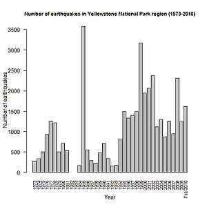
- ^ "Yellowstone National Park Earthquake listings". http://www.quake.utah.edu/EQCENTER/LISTINGS/OTHER/yellowregion.htm. Retrieved 2010-02-01.
- ^ "Hell's Half Acre". Global Volcanism Program, Smithsonian Institution. http://www.volcano.si.edu/world/volcano.cfm?vnum=1204-04-. Retrieved 2008-08-21.
- ^ "Shoshone Lava Field". Global Volcanism Program, Smithsonian Institution. http://www.volcano.si.edu/world/volcano.cfm?vnum=1204-01-. Retrieved 2010-03-27.
- ^ "Craters of the Moon". Global Volcanism Program, Smithsonian Institution. http://www.volcano.si.edu/world/volcano.cfm?vnum=1204-02-. Retrieved 2010-03-27.
- ^ "Wapi Lava Field". Global Volcanism Program, Smithsonian Institution. http://www.volcano.si.edu/world/volcano.cfm?vnum=1204-03-. Retrieved 2010-03-27.
- ^ a b c d e f g h i j k l "Supplementary Table to P.L. Ward, Thin Solid Films (2009) Major volcanic eruptions and provinces". Teton Tectonics. http://www.tetontectonics.org/Climate/Table_S1.pdf. Retrieved 2010-03-16.
- ^ a b c d e f g h i j k l m n o "Mark H. Anders, associate professor: Yellowstone hotspot track". Columbia University, Lamont-Doherty Earth Observatory (LDEO). http://www.ldeo.columbia.edu/~manders/SRP_erupt.html. Retrieved 2010-03-16.
- ^ Rytuba, James J. "Peralkaline Ash Flow Tuffs and Calderas of the McDermitt Volcanic Field, Southeast Oregon and North Central Nevada" (abstract). http://www.agu.org/pubs/crossref/1984/JB089iB10p08616.shtml. Retrieved 2010-11-12. "The McDermitt volcanic field covers an area of 20,000 km<sup2 in southeastern Oregon and northwestern Nevada and consists of seven large-volume ash flow sheets that vented from 16.1 to 15 Ma ago"
- ^ a b c d e f Lipman, P.W. (Sept. 30, 1984). "The Roots of Ash Flow Calderas in Western North America: Windows Into the Tops of Granitic Batholiths". Journal of Geophysical Research 89 (B10): 8801–8841. Bibcode 1984JGR....89.8801L. doi:10.1029/JB089iB10p08801.
- ^ a b c d Steve Ludington, Dennis P. Cox, Kenneth W. Leonard, and Barry C. Moring (1996). "Chapter 5, Cenozoic Volcanic Geology in Nevada". In Donald A. Singer. An Analysis of Nevada's Metal-Bearing Mineral Resources. Nevada Bureau of Mines and Geology, University of Nevada. http://www.nbmg.unr.edu/dox/ofr962/. Retrieved 2010-03-23
- ^ a b Rytuba, J.J.; McKee, E.H. (1984). "Peralkaline ash flow tuffs and calderas of the McDermitt Volcanic Field, southwest Oregon and north central Nevada". Journal of Geophysical Research 89 (B10): 8616–8628. Bibcode 1984JGR....89.8616R. doi:10.1029/JB089iB10p08616. http://www.agu.org/pubs/crossref/1984/JB089iB10p08616.shtml. Retrieved 2010-03-23.
- ^ Rytuba, James J.; John, David A., and McKee, Edwin H. (May 3–5, 2004). "Volcanism Associated with Eruption of the Steens Basalt and Inception of the Yellowstone Hotspot". Rocky Mountain (56th Annual) and Cordilleran (100th Annual) Joint Meeting Paper No. 44-2. http://gsa.confex.com/gsa/2004RM/finalprogram/abstract_72657.htm. Retrieved 2010-03-26.
- ^ Noble, D.C. (1988). "Cenozoic volcanic rocks of the northwestern Great Basin: an overview". Spring Field Trip Guidebook, Special Publication No. 7. Geological Society of Nevada. pp. 31–42
- ^ Castor, S.B., and Henry, C.D. (2000). "Geology, geochemistry, and origin of volcanic rock-hosted uranium deposits in northwest Nevada and southeastern Oregon, USA". Ore Geology Review 16: 1–40. doi:10.1016/S0169-1368(99)00021-9.
- ^ Korringa, Marjorie K. (December 1973). "Linear vent area of the Soldier Meadow Tuff, an ash-flow sheet in northwestern Nevada". Geological Society of America Bulletin 84 (12): 3849–3866. doi:10.1130/0016-7606(1973)84<3849:LVAOTS>2.0.CO;2. http://bulletin.geoscienceworld.org/cgi/content/abstract/84/12/3849.
- ^ Matthew E. Brueseke and William K. Hart (2008). "Geology and Petrology of the Mid-Miocene Santa Rosa-Calico Volcanic Field, Northern Nevada". Nevada Bureau of Mines and Geology Bulletin 113: 44. http://www.nbmg.unr.edu/dox/b113/Text.pdf.
- ^ Carson, Robert J. and Pogue, Kevin R. (1996). Flood Basalts and Glacier Floods:Roadside Geology of Parts of Walla Walla, Franklin, and Columbia Counties, Washington. Washington State Department of Natural Resources (Washington Division of Geology and Earth Resources Information Circular 90). ISBN none.
- ^ Reidel, Stephen P. (January 2005). "A Lava Flow without a Source: The Cohasset Flow and Its Compositional Members". The Journal of Geology 113: 1–21.
- ^ Brueseke, M.E.; Heizler, M.T., Hart, W.K., and S.A. Mertzman (15 March 2007). "Distribution and geochronology of Oregon Plateau (U.S.A.) flood basalt volcanism: The Steens Basalt revisited". Journal of Volcanology and Geothermal Research 161 (3): 187–214. doi:10.1016/j.jvolgeores.2006.12.004.
- ^ SummitPost.org, Southeast Oregon Basin and Range
- ^ USGS, Andesitic and basaltic rocks on Steens Mountain
- ^ GeoScienceWorld, Genesis of flood basalts and Basin and Range volcanic rocks from Steens Mountain to the Malheur River Gorge, Oregon
- ^ "Oregon: A Geologic History. 8. Columbia River Basalt: the Yellowstone hot spot arrives in a flood of fire". Oregon Department of Geology and Mineral Industries. http://www.oregongeology.com/sub/publications/ims/ims-028/unit08.htm. Retrieved 2010-03-26.
- ^ a b c "High Lava Plains Project, Geophysical & Geological Investigation, Understanding the Causes of Continental Intraplate Tectonomagmatism: A Case Study in the Pacific Northwest". Department of Terrestrial Magnetism, Carnegie Institution of Washington. http://www.dtm.ciw.edu/research/HLP/about-the-region-mainmenu-37/18-geologic-setting. Retrieved 2010-03-26.
- ^ Tolan, T.L., Reidel, S.P., Beeson, M.H., Anderson, J.L., Fecht, K.R. and Swanson, D.A. (1989). "Revisions to the estimates of the areal extent and volume of the Columbia River Basalt Group". In Reidel, S.P. and Hooper, P.R.. Volcanism and tectonism in the Columbia River flood basalt province. 239. Geol. Soc. Amer. Spec. Paper. pp. 1–20
- ^ Camp, V.E., and Ross, M.E. (2004). "Mantle dynamics and genesis of mafic magmatism in the intermontane Pacific Northwest". Journal of Geophysical Research 109 (B08204): B08204. Bibcode 2004JGRB..10908204C. doi:10.1029/2003JB002838.
- ^ Carlson, R.W. and Hart, W.K. (1987). "Crustal Genesis on the Oregon Plateau". Journal of Geophysical Research 92 (B7): 6191–6206. Bibcode 1987JGR....92.6191C. doi:10.1029/JB092iB07p06191.
- ^ Hart, W.K., and Carlson, R.W. (1985). "Distribution and geochronology of Steens Mountain-type basalts from the northwestern Great Basin". Isochron/West 43: 5–10.
- ^ Murphy, J. Brendan; Andrew J. Hynes, Stephen T. Johnston, J. Duncan Keppie (2003). "Reconstructing the ancestral Yellowstone plume from accreted". Tectonophysics 365: 185– 194. Bibcode 2003Tectp.365..185M. doi:10.1016/S0040-1951(03)00022-2. http://web.uvic.ca/~stj/Assets/PDFs/03%20Murphy%20et%20al%20tecto.pdf. Retrieved 13 June 2010.
- ^ Johnston, Stephen T.; P. Jane Wynne, Don Francis, Craig J. R. Hart, Randolph J. Enkin, David C. Engebretson (November 1996). "Yellowstone in Yukon: The Late Cretaceous Carmacks Group". Geology 24 (11): 997–1000. doi:10.1130/0091-7613(1996)024<0997:YIYTLC>2.3.CO;2. http://web.uvic.ca/~stj/Assets/PDFs/Johnston%20et%20al%2096.pdf. Retrieved 10 June 2010.
- ^ McCausland, P. J. A.; D. T. A. Symons, C. J. R. Hart (2005). "Rethinking "Yellowstone in Yukon" and Baja British Columbia: Paleomagnetism of the Late Cretaceous Swede Dome stock, northern Canadian Cordillera". Journal Geophysical Research 110 (B12107): 13. Bibcode 2005JGRB..11012107M. doi:10.1029/2005JB003742.
- ^ "O Ma large mafic magmatic events". www.largeigneousprovinces.org. http://www.largeigneousprovinces.org/0events.html. Retrieved 2010-06-10.
- ^ "Snake River Plain-Yellowstone Hot Spot Migration". Idaho Geological Survey. http://www.idahogeology.org/FieldWorkshops/Island_Park_2007b/2007%20Workshop%20Projects/Robinson.pdf. Retrieved 2010-03-26.
Map references
- "Mark H. Anders, associate professor: Yellowstone hotspot track". Columbia University, Lamont-Doherty Earth Observatory (LDEO). http://www.ldeo.columbia.edu/~manders/SRP_erupt.html. Retrieved 2010-03-16.
- "Map of Nevada". Nevada Bureau of Mines and Geology, University of Nevada (NBMG). http://www.nbmg.unr.edu/dox/NVtopo.pdf. Retrieved 2010-03-25.
- "Shaded relief map of the northwestern United States". Nevada Bureau of Mines and Geology, University of Nevada (NBMG). http://www.nbmg.unr.edu/dox/b113/figures/fig1.pdf. Retrieved 2010-03-26.
Further reading
- Smith, Robert B.; Jordan, Michael; Steinberger, Bernhard; Puskas, Christine M.; Farrell, Jamie; Waite, Gregory P.; Husen, Stephan; Chang, Wu-Lung; O'Connell, Richard (20 November 2009). "Geodynamics of the Yellowstone hotspot and mantle plume: Seismic and GPS imaging, kinematics and mantle flow". Journal of Volcanology and Geothermal Research 188 (1-3): 26–56. doi:10.1016/j.jvolgeores.2009.08.020. http://www.uusatrg.utah.edu/PAPERS/smith_jvgr2009complete.pdf.
- DeNosaquo, Katrina R.; Smith, Robert B.; Lowry, Anthony R. (20 November 2009). "Density and lithospheric strength models of the Yellowstone-Snake River Plain volcanic system from gravity and heat flow data". Journal of Volcanology and Geothermal Research 188 (1-3): 108–127. doi:10.1016/j.jvolgeores.2009.08.006.
- Farrell, Jamie; Husen, Stephan; Smith, Robert B. (20 November 2009). "Earthquake swarm and b-value characterization of the Yellowstone volcano-tectonic system". Journal of Volcanology and Geothermal Research 188 (1-3): 260–276. doi:10.1016/j.jvolgeores.2009.08.008.
- Perkins, Michael E.; Nash, Barbara P. (March 2002). "Explosive silicic volcanism of the Yellowstone hotspot: the ash fall tuff record". The Geological Society of America Bulletin 114 (3): 367–381. doi:10.1130/0016-7606(2002)114<0367:ESVOTY>2.0.CO;2.
- Puskas, C.M.; Smith, R.B.; Meertens, C.M.; Chang, W.L. (2007). "Crustal deformation of the Yellowstone-Snake River Plain volcanic system: campaign and continuous GPS observations, 1987–2004". Journal of Geophysical Research 112 (B03401): B03401. Bibcode 2007JGRB..11203401P. doi:10.1029/2006JB004325.
External links
Categories:- Geology of Montana
- Geology of Nevada
- Geology of Idaho
- Geology of Oregon
- Geology of Wyoming
- Volcanism of Wyoming
- Regional geology
- Miocene volcanism
- Pliocene volcanism
- Pleistocene volcanism
- Holocene volcanism
- Hotspots of North America


Wikimedia Foundation. 2010.