- Mohammad Agha District
-
Mohammad Agha
محمد اغهLocation in Afghanistan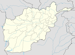
 Mohammad Agha
Coordinates: 34.0°45′N 69.2°45′E / 34.75°N 69.95°ECoordinates: 34.0°45′N 69.2°45′E / 34.75°N 69.95°E Country  Afghanistan
Province Logar Province District Mohammad Agha District Population (1990) - Total 57,690 Mohammad Agha District (Pashto: د محمد اغه ولسوالی) (Persian: ولسوالی محمد آغه) is a district of Logar Province, Afghanistan. It lies next to Kabul Province. The District capital is Mohammad Agha.
Contents
Geography
Mohammad Agha district is located in the north part of Logar Province, 35 km from Kabul City or one hour drive, at an altitude of 1,875 mt.
The District consists of 17 Zones ( Zarghun Shar, Deh Naw, Moghol Khail, Qala Shekhak, Qala Ahmad Zai, Mohammad Agha, Kotubkhel, Gomaran, Safed Sang, Abbazak, Surkh Abad, Dewalak, Surkhab, Burg, Abparan, Dashtak and Karezes), 8 main villages and 15 sub-villages.
Demographics
Pashtuns make 60% of the population while Tajiks make 40% of the population.[1]
Pashtuns live mainly in the zones of Gomaran, Burg, Qala Ahmad Zai, Kotubkhel, Surkhab, Abparan ,Abbazak and Moghul Khail, while Tajiks are present mainly in Deh Now,Zarghun Shahr, Safed Sang, Zayed Abad, Mohammad Agha.
Security and Politics
Mohammad Agha has been severely affected by conflict, mainly during the Soviet invasion, around 85% of houses have been destroyed and a large-scale displacement, mainly to Pakistan, took place. Many refugees returned at the beginning of the 90s, but were again displaced by the fighting between the Mujaheddin and later on between Talibans and Jamiat Party.
On 25 November 2009 a bomb facilitator was captured by ISAF forces in Qal' eh-ye Shayhee along with several other suspected militants.[2]
References
- ^ AIMS UNHCR, http://www.aims.org.af/afg/dist_profiles/unhcr_district_profiles/centra/logar/mohammad_agha.pdf
- ^ "Afghan-ISAF forces detain insurgents in Kandahar and Logar; Afghan director provides donated items; ISAF casualties". NATO. 26 November 2009. Accessed at: http://www.reliefweb.int/rw/rwb.nsf/db900SID/JBRN-7Y6HD5?OpenDocument
Categories:- Districts of Logar Province
- Afghanistan geography stubs

Wikimedia Foundation. 2010.