Trmice

Trmice

Geobox | Settlement
name = Trmice
other_name =
category = Town


image_caption =


symbol =
etymology =
official_name =
motto =
nickname =
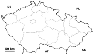
country = Czech Republic
country_

state =
region = Ústí nad Labem
region_type = Region
district = Ústí nad Labem
district_type = District
commune = Ústí nad Labem
municipality =
part =
river =
location =
elevation = 148
lat_d = 50
lat_m = 38
lat_s = 36
lat_NS = N
long_d = 13
long_m = 59
long_s = 57
long_EW = E
highest =
highest_elevation =
highest_lat_d =
highest_long_d =
lowest =
lowest_elevation =
lowest_lat_d =
lowest_long_d =
area = 6.66
area_round = 2
population = 3190
population_date = 2006-08-28
population_density = auto
established = 1305
established_type = First mentioned
mayor =
timezone = CET
utc_offset = +1
timezone_DST = CEST
utc_offset_DST = +2
postal_code = 400 01 - 400 04
area_code =
code =
free =


map_background = Czechia - background map.png map_caption = Location in the Czech Republic
map_locator = Czechia
commons = Trmice
statistics = [http://www.statnisprava.cz/ebe/ciselniky.nsf/i/553697 statnisprava.cz]
website = [http://www.mesta.obce.cz/trmice/ www.mesta.obce.cz/trmice]
footnotes =

Trmice ( _de. Türmitz) is a town in the Czech Republic.

External links

* [http://www.mesta.obce.cz/trmice/ Municipal website]


Wikimedia Foundation. 2010.

Игры ⚽ Нужна курсовая?

Look at other dictionaries:

  • Trmice — Trmice …   Deutsch Wikipedia

  • Trmice — Administration Pays  Tcheque, republique ! …   Wikipédia en Français

  • Trmice — Sp Trmicė Ap Trmice L Čekija …   Pasaulio vietovardžiai. Internetinė duomenų bazė

  • Trmicė — Sp Trmicė Ap Trmice L Čekija …   Pasaulio vietovardžiai. Internetinė duomenų bazė

  • Trmice — Original name in latin Trmice Name in other language Turmitz, Trmitz State code CZ Continent/City Europe/Prague longitude 50.64286 latitude 13.99449 altitude 150 Population 2862 Date 2006 11 25 …   Cities with a population over 1000 database

  • Bahnstrecke Trmice–Bílina — Trmice–Bílina Kursbuchstrecke (SŽDC): 131 Streckenlänge: 25,823 km Spurweite: 1435 mm (Normalspur) Streckenklasse: D4 (2006) Stromsystem: 3 kV = Maximale Neigung …   Deutsch Wikipedia

  • Dubitzer Kirchlein — Řehlovice …   Deutsch Wikipedia

  • D 8 — Streckenführung der D8 Basisdaten Gesamtlänge 92,2 km   75,7 km (in Betrieb)   16,4 km (in Bau) Anschlussstellen …   Deutsch Wikipedia

  • Aussig — Ústí nad Labem …   Deutsch Wikipedia

  • Dálnice 8 — Vorlage:Infobox hochrangige Straße/Wartung/CZ D Dálnice D8 in Tschechien …   Deutsch Wikipedia

Share the article and excerpts

Direct link
Do a right-click on the link above
and select “Copy Link”