- Delmar, New York
-
Delmar Hamlet Formerly: Adams Station, Adamsville Country United States State New York Region Capital District County Albany Municipality Town of Bethlehem Elevation 223 ft (68 m) Coordinates 42°37′5″N 73°50′12″W / 42.61806°N 73.83667°W Area 4.4 sq mi (11 km2) - land 4.4 sq mi (11 km2) - water 0.0 sq mi (0 km2) Population 8,292 (2000) Density 1,892.4 / sq mi (731 / km2) Named 1892 Timezone EST (UTC-5) - summer (DST) EDT (UTC-4) ZIP Code 12054 Area code 518 FIPS code 36-20148[1] GNIS feature ID 0948278[2] 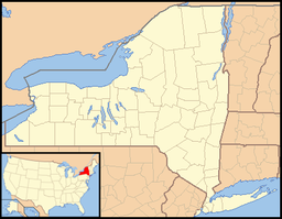
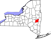
 Location of Delmar within the state of New York
Delmar is a hamlet in the town of Bethlehem, Albany County, New York. A census-designated place (CDP) has been established since 1980 by the US Bureau of Census for tabulating the population of what the census has defined as the boundaries of the urbanized area in and around Delmar. The population was 8,292 at the 2000 census. It is a suburb of the neighboring city of Albany. NY Route 443 (Delaware Avenue) which bisects the community is the major thoroughfare, main street, and route to Albany.
In 2005, CNN/Money Magazine named the Delmar ZIP Code (an area larger than the Delmar hamlet or CDP) as one of the "Best Places to Live" in America, rating it the 22nd best place to live among what it called "Great American Towns."[3][4]
Contents
History
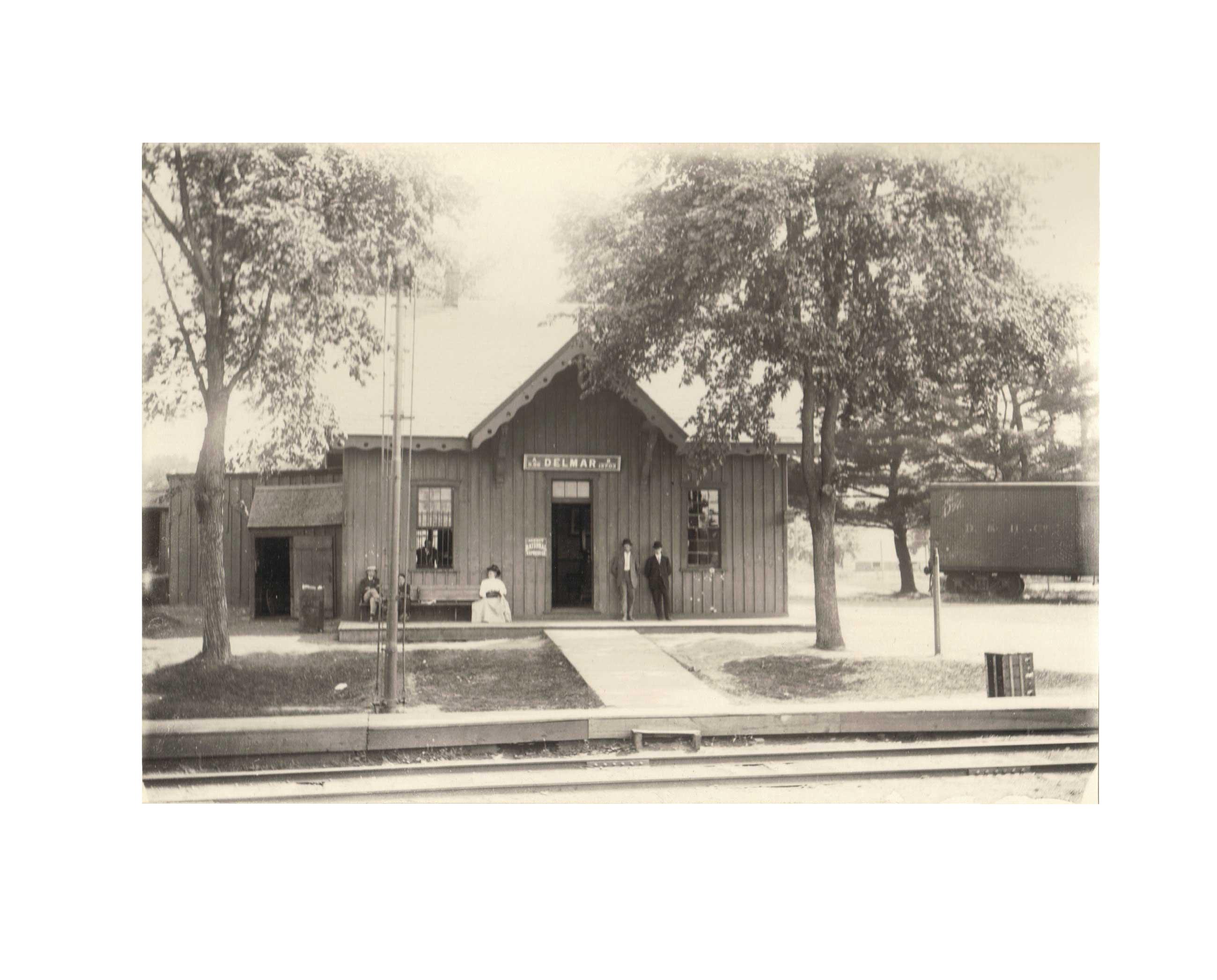
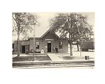 Albany and Susquehanna Railroad's Delmar Station, 1907
Nathaniel Adams moved to the area in 1836 and two years later built a large hotel and made other improvements. When the first post office was built in 1840 he was the first post master.[5] The Adams Hotel was Bethlehem's Town Hall from 1950-1980.[6] In 1841 Nathaniel donated an acre of land for a chapel to be built so that those of the Dutch Reformed Church did not have to travel to Unionville to attend worship though this new church continued to be under the Union Reformed Church. In 1847 the members of the Reformed Church at Adams Station petitioned for their own organization separate from Union, and in 1848 this was granted by both the Union Reformed Church and the Classis of Albany.[7] For Nathaniel Adams, Delmar received its early name of Adamsville.[5]
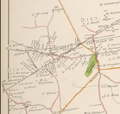
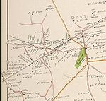 Map of Delmar in 1891
After Adamsville received its post office mail began to get confused with the town of Adams, New York which also had an Adams Village. The name of the post office was changed to Adams Station in an attempt to relieve that confusion. The Albany and Susquehanna Railroad, which had a station on Adams Street north of Kenwood Avenue, however had chosen to change from Adamsville to Delmar. In 1892 a petition by area residents to change the post office to match Delmar was accepted.[6]
Porco trial
On Monday November 15, 2004, a courts officer was ordered to the home of Peter and Joan Porco. Peter, a State Appellate Division court clerk, had not reported to his Albany office for work that morning. Upon entering the two-story home in Delmar, the officer discovered Peter's body near the front door. An Albany County medical examiner would determine that Peter, 52, had sustained massive head injuries causing his death. His wife Joan was also soon discovered by police officers. She was lying in the couple's bed and had suffered severe head and facial trauma. Their son, Christopher Porco would be tried in Goshen, Orange County, on charges of second degree murder for the murder of his father and second degree attempted murder in the severe wounding and disfigurement of his mother.[8] This greatly decreased the property values in the surrounding neighborhoods. The trial lasted 21 days and was one of the most highly-covered Capital District news events in recent memory. The case against Porco received extensive coverage in local newspapers including the Times Union as well as in local television outlets. The case was also the subject of a one hour documentary on 48 Hours Mystery entitled "Memory of Murder," broadcast by CBS on November 4, 2006 as well as an episode of the TruTV series Forensic Files that originally aired on July 17, 2009.[9][10]
Geography
As a hamlet the borders of Delmar are indeterminate, though generally the unincorporated village is considered to be centered on the intersection of Kenwood and Delaware avenues. According to the United States Census Bureau, the CDP has a total area of 4.4 square miles (11 km2), all land.[1] CDP's borders can change from census to census however. As of 2000 the border followed the Normans Kill to the north, and then for the western border it travels south on McCormack Road North to Cherry Ave Extension (New York Route 140) where it turns left and then right on to McCormack Road. At Bridge Avenue in the neighboring hamlet of Slingerlands the CDP's border turns left, and then right onto Albany County Route 52 (Cherry Ave/Elm Ave). The border then turns east (left) onto the Delmar Bypass (New York Route 32) to Elsmere Avenue (New York Route 335) where it then travels north. At the intersection of Elsmere Ave with Delaware Avenue the border turns east onto the later. At Salisbury Road the Delmar CDP border carves a small enclave by turning left onto said road and then right onto Normanside Avenue, then by turning onto Euclid Avenue it travels back southeast to Delaware Avenue once again. After another small jog on Delaware Ave the border turns left for Normanskill Boulevard opposite the Delaware Plaza. After turning right onto Bethlehem Court the border then travels in a straight northeastern line to meet back up at the Normanskill.[11]
Several small creeks and streams flow through Delmar, generally north of Delaware Avenue they flow north to the Normans Kill; south of Delaware Avenue is Dowers Kill which is a south-flowing tributary of the Vloman Kill.
Location

City of Albany Hamlet of Elsmere Hamlet of Slingerlands 
 Hamlet of Delmar

Town of New Scotland
Hamlet of UnionvilleHamlet of Houcks Corners Hamlet of Bethlehem Center Demographics
Delmar Historical Populations Year Pop. ±% 1980 8,423 — 1990 8,360 −0.7% 2000 8,292 −0.8% Sources: Censuses 1980;[12] and 1990 and 2000.[1] As of the census[1] of 2000, there are 8,292 people, 3,420 households, and 2,373 families residing in the CDP. The population density is 1,892.4 per square mile (730.9/km²). There are 3,501 housing units at an average density of 799.0/sq mi (308.6/km²). The racial makeup of the CDP is 96.61% White, 1.18% African American, 0.12% Native American, 1.24% Asian, 0.01% Pacific Islander, 0.25% from other races, and 0.58% from two or more races. 1.23% of the population are Hispanic or Latino of any race.
There are 3,420 households out of which 33.3% have children under the age of 18 living with them, 60.0% are married couples living together, 7.4% have a female householder with no husband present, and 30.6% are non-families. 26.7% of all households are made up of individuals and 12.7% have someone living alone who is 65 years of age or older. The average household size is 2.41 and the average family size is 2.94.
In the CDP the population is spread out with 25.4% under the age of 18, 4.5% from 18 to 24, 24.3% from 25 to 44, 28.9% from 45 to 64, and 16.9% who are 65 years of age or older. The median age is 43 years. For every 100 females there are 90.4 males. For every 100 females age 18 and over, there are 84.9 males.
The median income for a household in the CDP is $64,438, and the median income for a family is $83,219. Males have a median income of $57,038 versus $37,133 for females. The per capita income for the CDP is $35,363. 2.4% of the population and 1.7% of families are below the poverty line. Out of the total population, 3.0% of those under the age of 18 and 0.8% of those 65 and older are living below the poverty line.
References
- ^ a b c d "American FactFinder". United States Census Bureau. http://factfinder.census.gov. Retrieved 2008-01-31.
- ^ "US Board on Geographic Names". United States Geological Survey. 2007-10-25. http://geonames.usgs.gov. Retrieved 2008-01-31.
- ^ Robin Wood (July 14, 2005). Business Review article "Delmar makes list of best places to live". Albany Business Review. http://www.bizjournals.com/albany/stories/2005/07/11/daily34.html Business Review article. Retrieved 2010-02-25.
- ^ MONEY Magazine "Best Places to Live: Top 100 Finalists". CNN, A Time Warner Company. http://money.cnn.com/magazines/moneymag/bplive/2005/top100/top100_1.html MONEY Magazine. Retrieved 2010-02-25.
- ^ a b George Howell and Jonathan Tenney (1886). Bi-Centennial History of Albany: History of the County of Albany from 1609-1886. W.W. Munsell and Company. p. 781. http://books.google.com/books?id=nWkJAQAAIAAJ&pg=PA940&dq=lisha's+kill&cd=5#v=onepage&q=lisha's%20kill&f=false. Retrieved 2010-02-10.
- ^ a b "Town of Bethlehem, NY History". Town of Bethlehem. http://www.townofbethlehem.org/pages/about/history.asp. Retrieved 2010-02-25.[dead link]
- ^ George Howell and Jonathan Tenney (1886). Bi-Centennial History of Albany: History of the County of Albany from 1609-1886. W.W. Munsell and Company. p. 784. http://books.google.com/books?id=nWkJAQAAIAAJ&pg=PA940&dq=lisha's+kill&cd=5#v=onepage&q=lisha's%20kill&f=false. Retrieved 2010-02-10.
- ^ "Porco Trial Archive". CBS 6/Freedom Communications. http://www.cbs6albany.com/sections/porco-trial/. Retrieved 2010-02-25.
- ^ "Memory of a Murder". CBS Interactive Inc.. 2006-11-02. http://www.cbsnews.com/stories/2006/11/02/48hours/main2146113.shtml. Retrieved 2010-02-25.
- ^ "Porco trial on truTV tonight". CBS6/Freedom Communications. July 17, 2009. http://www.cbs6albany.com/articles/trutv-1264861-tonight-porco.html. Retrieved 2010-02-25.
- ^ "Delmar CDP, New York Reference Map" (map). US Bureau of Census. http://factfinder.census.gov/servlet/MapItDrawServlet?geo_id=16000US3620148&_bucket_id=50&tree_id=420&context=saff&_lang=en&_sse=on. Retrieved 2010-02-25.
- ^ 1980 Census of Population; Volume 1: Characteristics of the Population. United States Census Bureau. 1980. p. 34-10. http://books.google.com/books?id=PpUXAAAAYAAJ&pg=SA34-PA10&dq=roessleville+1980+census&lr=&cd=4#v=onepage&q=roessleville%201980%20census&f=false. Retrieved 2010-02-13.
Capital District of New York Central communities Albany (History · City Hall · Coat of Arms) · Schenectady (City Hall) · Troy (History) · List of all incorporated places
Largest communities
(over 20,000 in 2000)Medium-sized communities
(10,000 to 20,000 in 2000)City of Amsterdam · Brunswick · Cohoes · East Greenbush · Glens Falls · Gloversville · Halfmoon · Malta · North Greenbush · Schodack · Watervliet · WiltonSmall communities
(5,000 to 10,000 in 2000)Town of Amsterdam · Ballston Spa · Cobleskill · Village of Colonie · Duanesburg · City of Johnstown · Town of Johnstown · Kinderhook · Mechanicville · New Scotland · Rensselaer · Sand Lake · Scotia · Town of Stillwater · WaterfordCounties Albany · Columbia · Fulton · Greene · Montgomery · Rensselaer · Saratoga · Schenectady · Schoharie · Warren · WashingtonHistory Mohawks · Mahicans · Fort Orange · Rensselaerswyck · Beverwyck · Albany Plan of Union · Timeline of town creation · Toponymies of places · Tech ValleyGeography Hudson River (Valley) · Mohawk River · Erie Canal · Lake Albany · Lake George · Albany Pine Bush (Rensselaer Lake · Woodlawn Preserve) · Adirondack Mountains · Catskill Mountains · Rensselaer PlateauReligion and culture Culture in New York's Capital District · Sports in New York's Capital District · Episcopal Diocese of Albany · Roman Catholic Diocese of AlbanyEducation Public school districtsList of school districts in New York's Capital DistrictHigher educationNewspapers TV/Radio Broadcast television in the Capital District Local stations WRGB (6.1 CBS, 6.2 This TV) • WTEN (10.1 ABC, 10.2 Weather, 10.3 RTV) • WNYT (13.1 NBC, 13.2 Weather, 13.3 Weather Radar) • WMHT (17.1 PBS, 17.2 ThinkBright, 17.3 HD) • WXXA (23.1 Fox, 23.2 The Cool TV) • WNGN-LP 35 / WNGX-LP 42 (FN) • WCWN (45.1 The CW, 45.2 Uni Sp) • WNYA / WNYA-CD (51.1 MNTV, 51.2 Antenna TV) • W52DF 52 (silent)
Outlying area stations WVBK-CA 2 (RSN' Manchester, VT) • W04AJ 4 (PBS; Glens Falls) • W04BD 4 (PBS; Schoharie) •
WNCE-CA 8 (A1; Glens Falls) • WYBN-CA 14 (RSN; Cobleskill) • WCDC (19.1 ABC; Adams, MA) • WVBG-LP 25 (RSN; Greenwich) • W36AX 36 (PBS / VPT; Manchester, VT) • W47CM 47 (silent; Glens Falls) • WYPX (55.1 Ion, 55.2 qubo, 55.3 Life; Amsterdam) • W53AS 53 (PBS / VPT; Bennington, VT)Adjacent locals Cable-only stations YNN Capital Region • TW3 • YES • SNY • MSG Network
Defunct stations New York State television: Albany/Schenectady • Binghamton • Buffalo • Burlington/Plattsburgh • Elmira • New York City • Rochester • Syracuse • Utica • Watertown
Vermont Broadcast television: Albany/Schenectady • Boston, MA • Burlington/Plattsburgh
Massachusetts television: Albany • Boston • Providence • Springfield
Radio stations in the Albany / Schenectady / Troy market by FM frequency 88.3 · 89.1² · 89.7 · 89.9 · 90.3/93.1² · 90.7/94.9 · 90.7 · 90.7 · 90.9 · 91.1 · 91.5 · 92.3 · 92.9 · 93.5 · 93.7 · 94.5 · 94.7 · 95.5 · 95.9 · 96.3 · 96.7 · 97.3 · 97.5 · 97.7 · 97.9 · 98.3² · 98.5 · 98.5 · 99.1 · 99.5² · 100.3 · 100.9 · 101.3 · 101.7 · 101.9 · 102.3² · 102.7 · 103.1² · 103.5 · 103.9 · 104.5 · 104.9 · 105.7² · 106.1 · 106.5² · 107.1 · 107.7²by AM frequency NOAA Weather Radio frequency 162.550by callsign W226AC · W235AY · W256BU · W291BY · WABY · WAJZ · WAMC (AM) · WAMC-FM² · WBAR · WBPM · WCDB · WCKL · WCKM · WCQL · WCSS · WCTW · WDCD · WDCD-FM · WDDY² · WENT · WEQX · WEXT · WFFG · WFLY · WFNY · WGDJ · WGNA² · WGXC · WGY¹² · WGY-FM² · WHAZ · WHAZ-FM · WHUC · WHVP · WIZR · WJIV · WKBE · WKKF² · WKLI · WLJH · WMHT² · WMYY · WNYQ · WOFX² · WOPG · WPGL · WPYX² · WQAR · WQBJ · WQBK · WQSH² · WRIP · WROW · WRPI · WRUC · WRVE² · WSDE · WTMM · WTRY² · WUAM · WVCR · WVKZ · WVTL · WXL34 · WYAI · WYJB · WYKV · WZCR · WZMRDefunct stations New York Radio Markets: Albany-Schenectady-Troy • Binghamton • Buffalo-Niagara Falls • Elmira-Corning • Hamptons-Riverhead • Ithaca • Nassau-Suffolk (Long Island) • New York City • Newburgh-Middletown (Mid Hudson Valley) • Olean • Plattsburgh • Poughkeepsie • Rochester • Syracuse • Utica-Rome • Watertown
Other New York Radio Regions: Jamestown-Dunkirk • North Country • Saratoga
See also: List of radio stations in New YorkMunicipalities and communities of Albany County, New York Cities Albany | Cohoes | Watervliet
Towns Berne | Bethlehem | Coeymans | Colonie | Green Island | Guilderland | Knox | New Scotland | Rensselaerville | Westerlo
Villages Altamont | Colonie | Green Island | Menands | Ravena | Voorheesville
CDPs Coeymans | Delmar | Medusa | Preston-Potter Hollow | Westmere
Other
hamletsAlcove | Boght Corners | Clarksville | Crescent Station | Dunsbach Ferry | Elsmere | Feura Bush | Fort Hunter | Fullers | Glenmont | Guilderland | Guilderland Center | Karner | Latham | Lisha Kill | Loudonville | Mannsville | McKownville | New Salem | Newtonville | Normansville | Roessleville | Selkirk | Slingerlands | South Bethlehem | Verdoy | West Albany
Categories:- Census-designated places in New York
- Hamlets in New York
- Bethlehem, New York
- Populated places in Albany County, New York


Wikimedia Foundation. 2010.