- Powder House Square
-
Powder House Park
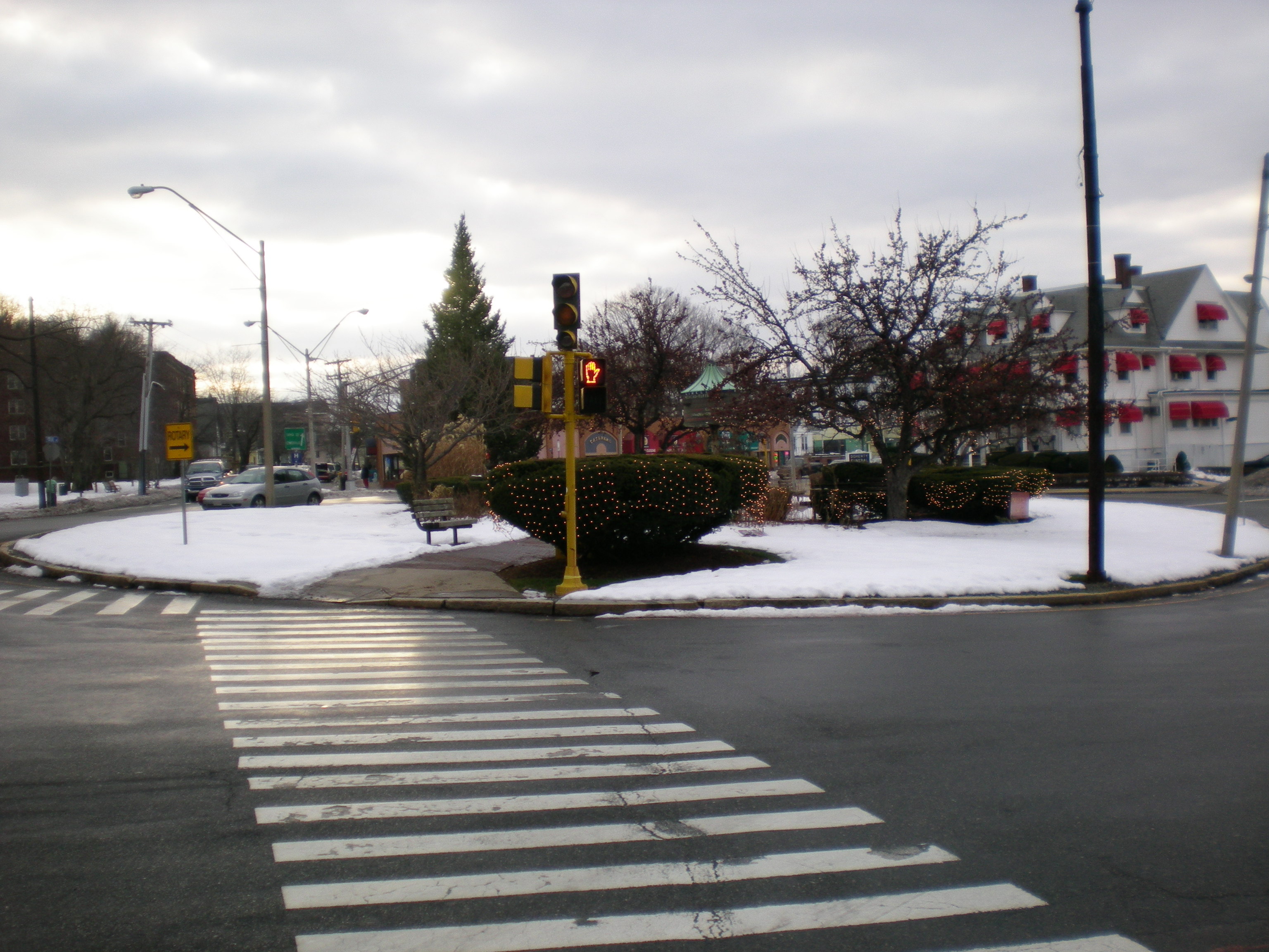
 View of the Powder House Square rotary from Warner Street
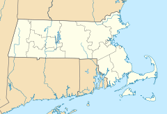

Location: Somerville, Massachusetts, United States Coordinates: 42°24′2″N 71°6′59.5″W / 42.40056°N 71.116528°WCoordinates: 42°24′2″N 71°6′59.5″W / 42.40056°N 71.116528°W Governing body: Local government NRHP Reference#: 75000287 Added to NRHP: May 21, 1975 Powder House Square is a neighborhood and landmark rotary in Somerville, Massachusetts, United States. It is also known locally as Powder House Circle. It is the 6-way intersection of College Avenue, Broadway, Warner Street, and Powder House Boulevard. Powder House Square guards the southern tip of Tufts University's main Somerville/Medford campus, and borders the northern edge of Nathan Tufts Park. The square takes its name from the 18th century Powder House which overlooks the rotary from Nathan Tufts Park.
History
Broadway was one of the earliest highways running through what would later become Somerville, originating in the 17th century. Originally called "Menotomie's Road," it ran from Charlestown to the settlement at Menotomy (present-day Arlington).
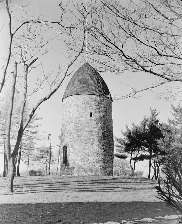
The Powder House was built in 1703 or 1704 by John Mallet. It was originally used as a windmill, but the owning family sold it to the Massachusetts Bay Colony in 1747, and it was used as a powder magazine thereafter.
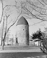 The Old Powder House as it stood in 1935 atop the hill at Nathan Tufts Park, overlooking Powder House Square
On September 1, 1774, British troops landed at the Ten Hills Farm on the Mystic River in present-day Somerville, and marched up Broadway to the Powder House in order to seize all 250 barrels of gunpowder that were stored there. This act led to a massive public reaction known as the Powder Alarm. Thousands of irregulars from surrounding towns prepared to march toward Boston for battle, but the rumors of war turned out to be premature. The public outrage forced the British General Gage to cancel a planned second expedition to seize more arms, and prompted the area colonists to amass their weapons at Concord and other more remote locations. The Powder House would be used as a magazine for militia troops besieging Boston in 1775.
Massachusetts sold the land containing the Powder House to Peter Tufts in 1818. The estate, known as the Powder House Farm, was used as a farm and residence for the Tufts family for most of the 19th century, passing to Peter's heir, Nathan Tufts. Incidentally, another Tufts relative - Charles Tufts - donated the land across Broadway on the Somerville/Medford line to found Tufts College (now Tufts University). The college was founded in 1852, on Walnut Hill slightly to the north of present-day Powder House Square. The descendants of Nathan Tufts donated the Powder House Farm along with its namesake structure to the City of Somerville in 1890, and from this Nathan Tufts Park was established in 1893.
Powder House Boulevard was created in 1900, extending northwest from Broadway at Nathan Tufts Park. According to a plaque placed at the center of the rotary island, the circle was dedicated in 1940 as the James A. Reynolds Traffic Circle after a Tufts College professor.
Nathan Tufts Park (along with the Powder House) was added to the National Register of Historic Places in 1975, the first of many landmarks in Somerville to be added. The City of Somerville designated the park a local historic district in 1985.
An accidental fire damaged the Powder House in 1998, leading to extensive repairs and renovations in 2000-2001.
Powder House Square today
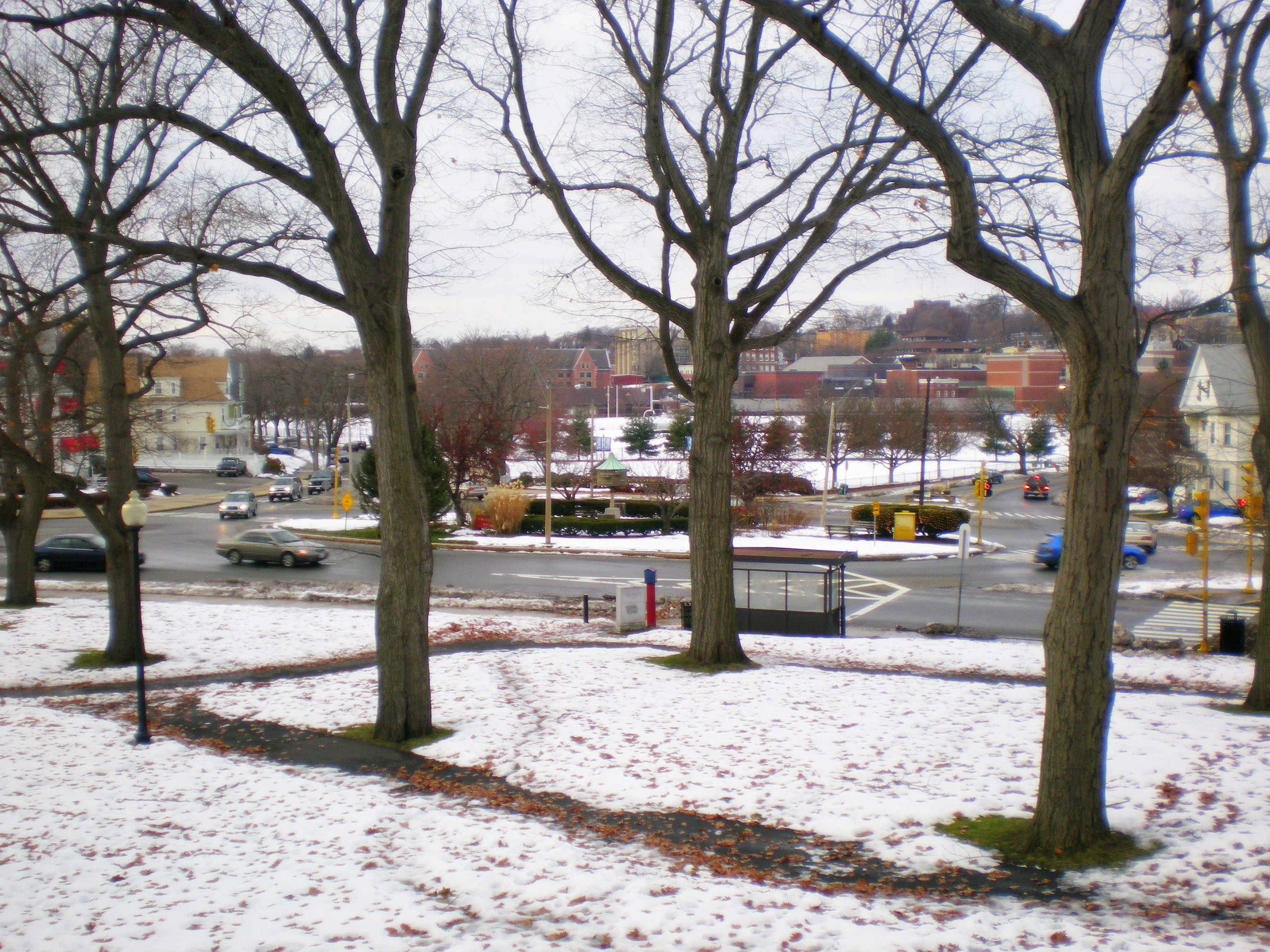
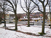 Overlooking Powder House Square from the hill at Nathan Tufts Park. Tufts University is in the background.
 A close-up view of the directory on the island of Powder House Square shows that you can get just about anywhere from here.
The island within the actual traffic circle is a tiny park on its own, complete with walkways, benches, and neatly arranged bushes and other flora. There is a large 360 degree directional post that points in the direction of dozens of different communities (like Arlington, Medford, and Winchester).
Powder House Square is located less than a half mile from Davis Square, Teele Square and Ball Square in Somerville. It is served by MBTA Buses 80 (Arlington Center/Lechmere)[1], 89 (Clarendon Hill/Sullivan Square)[2], 94 (Davis Square/Medford Square)[3], and 96 (Harvard Station/Medford Square)[4]. Red Line subway service to Harvard Square and downtown Boston is conveniently close at Davis Square Station.
A proposed light-rail station at Ball Square, as part of the Green Line Extension project, would put Powder House Square within a half mile of the Green Line in addition to the Red Line station at Davis Square.
Several businesses thrive on or around Powder House Square, including restaurants, several small medical and dental practices, and a funeral home.
External links
- Haskell's Historical Guidebook of Somerville, Massachusetts
- A Visitor's Guide to Nathan Tufts Park
- Brief History of Somerville: 1600-1942
- Map of Somerville, Mass. (1852)
U.S. National Register of Historic Places Topics Lists by states Alabama • Alaska • Arizona • Arkansas • California • Colorado • Connecticut • Delaware • Florida • Georgia • Hawaii • Idaho • Illinois • Indiana • Iowa • Kansas • Kentucky • Louisiana • Maine • Maryland • Massachusetts • Michigan • Minnesota • Mississippi • Missouri • Montana • Nebraska • Nevada • New Hampshire • New Jersey • New Mexico • New York • North Carolina • North Dakota • Ohio • Oklahoma • Oregon • Pennsylvania • Rhode Island • South Carolina • South Dakota • Tennessee • Texas • Utah • Vermont • Virginia • Washington • West Virginia • Wisconsin • WyomingLists by territories Lists by associated states Other Categories:- National Register of Historic Places in Massachusetts
- Somerville, Massachusetts
- Transportation in Middlesex County, Massachusetts
- Named roundabouts in the United States
- Magazines (artillery)


Wikimedia Foundation. 2010.