- Colesville, New York
-
Colesville, New York — Town — Location within the state of New York
 Colesville, New York
Coordinates: 42°10′14″N 75°39′57″W / 42.17056°N 75.66583°WCoordinates: 42°10′14″N 75°39′57″W / 42.17056°N 75.66583°W Country United States State New York County Broome Government – Type Town Council – Town Supervisor Edward A. Mosher – Town Council Members' ListArea – Total 79.2 sq mi (205.2 km2) – Land 78.5 sq mi (203.4 km2) – Water 0.7 sq mi (1.8 km2) Elevation 1,348 ft (411 m) Population (2000) – Total 5,441 – Density 69.3/sq mi (26.8/km2) Time zone Eastern (EST) (UTC-5) – Summer (DST) EDT (UTC-4) ZIP code 13787 Area code(s) 607 FIPS code 36-17046 GNIS feature ID 0978851 Colesville is a town in Broome County, New York, United States. The population was 5,441 at the 2000 census.
The Town of Colesville is in the northeast part of the county and is northeast of Binghamton.
Contents
History
The area was first settled around 1785. The Town of Colesville was established in 1821 from the part of the Town of Windsor. Robert Harpur, an early developer, has lent his name to the community of Harpursville. He is believed to be responsible for the many classical names assigned to communities in Central New York.
Geography
According to the United States Census Bureau, the town has a total area of 79.2 square miles (205 km2), of which, 78.5 square miles (203 km2) of it is land and 0.7 square miles (1.8 km2) of it (0.87%) is water.
The north town line is the border of Chenango County. The Susquehanna River flows southward through the town.
Interstate 88 passes across the town. New York State Route 7 and New York State Route 79 are important highways in Colesville. New York State Route 235 intersects NY-7 north of Harpursville and I-88.
Demographics
As of the census[1] of 2000, there were 5,441 people, 1,944 households, and 1,458 families residing in the town. The population density was 69.3 people per square mile (26.8/km²). There were 2,189 housing units at an average density of 27.9 per square mile (10.8/km²). The racial makeup of the town was 97.85% White, 0.29% African American, 0.31% Native American, 0.35% Asian, 0.06% Pacific Islander, 0.02% from other races, and 1.12% from two or more races. Hispanic or Latino of any race were 0.74% of the population.
There were 1,944 households out of which 36.3% had children under the age of 18 living with them, 58.4% were married couples living together, 10.8% had a female householder with no husband present, and 25.0% were non-families. 19.2% of all households were made up of individuals and 6.8% had someone living alone who was 65 years of age or older. The average household size was 2.79 and the average family size was 3.11.
In the town the population was spread out with 29.4% under the age of 18, 6.5% from 18 to 24, 28.7% from 25 to 44, 23.9% from 45 to 64, and 11.4% who were 65 years of age or older. The median age was 37 years. For every 100 females there were 100.0 males. For every 100 females age 18 and over, there were 98.6 males.
The median income for a household in the town was $38,444, and the median income for a family was $40,333. Males had a median income of $31,462 versus $22,917 for females. The per capita income for the town was $15,816. About 6.7% of families and 10.3% of the population were below the poverty line, including 11.8% of those under age 18 and 9.5% of those age 65 or over.
Government
The current town supervisor is Edward Mosher (Republican).
Communities and locations in Colesville
- Belden – A hamlet northwest of Harpursville on NY Route 7.
- Center Village - A hamlet south of Harpursville on NY Route 79.
- Doraville – A hamlet in the eastern part of the town.
- Harpursville – The principal community in the town, located on NY-79. The Harpursville United Methodist Church was listed on the National Register of Historic Places in 2006.[2]
- New Ohio – A hamlet in the northeast part of the town.
- Nineveh – A hamlet northeast of Harpursville and on the north town line.
- North Colesville – A hamlet in the northwest part of the town on NY-79.
- Ouaquaga – A hamlet in the south part of the town.
- Sanitaria Springs – A hamlet at the west town line, northwest of West Colesville on Route 217. It was formerly called "Osborne Hollow."
- Tunnel – A location south of New Ohio.
- West Colesville – A hamlet on the south town line.
References
- ^ "American FactFinder". United States Census Bureau. http://factfinder.census.gov. Retrieved 2008-01-31.
- ^ "National Register Information System". National Register of Historic Places. National Park Service. 2009-03-13. http://nrhp.focus.nps.gov/natreg/docs/All_Data.html.
External links
Municipalities and communities of Broome County, New York City 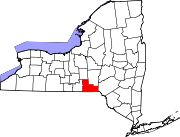
Towns Villages Deposit‡ | Endicott | Johnson City | Lisle | Port Dickinson | Whitney Point | Windsor
CDP Other
hamletsChenango Bridge | Chenango Forks | Hillcrest | Nineveh
Footnotes ‡This populated place also has portions in an adjacent county or counties
Categories:- Towns in New York
- Binghamton metropolitan area
- Populated places in Broome County, New York


Wikimedia Foundation. 2010.