- Streymoy
Island of the Faroe Islands
name = Streymoy
municipality =
area = 373
area_rank = 1
population = 21 900
population_rank = 1
population_year = 2007
population_density = 58,7
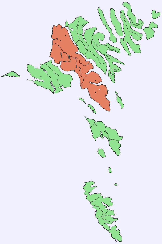
location = coord|62|08|N|7|01|W||Streymoy is the largest and most populated island of the
Faroe Islands . The capital,Tórshavn is located there. The name means "island of currents".Geography
The island is oblong in shape and stretches roughly in Northwest-Southeast direction with a length of 47 km (29 miles) and a width of around 10 km (six miles). There are two deeply indented
fjord s in the Southeast: Kollafjørður and Kaldbaksfjørður. The island is mountainous, especially in the Northwest, with the highest peak Kopsenni (789 metres). That area is dominated by over 500-metre high cliffs.Like the rest of the
Faroe Islands there are numerous short streams and minor lakes. The main vegetation is grass, with no trees.Streymoy is separated from the nearby
Eysturoy , second largest island of theFaroe Islands by the narrow sound ofSundini in the east. To the West lies the island ofVágar , and to the South the island ofSandoy . Three additional smaller islands are situated around the Southern tip of Streymoy:Koltur ,Hestur andNólsoy .Population
There are about 21,000 inhabitants on the island, which represents more than 40% of the whole population of the
Faroe Islands . The majority of them reside in the capitalTórshavn which has a population of about 15,000. Besides being the seat of the government it is also the chief port, seat of the university and the commercial centre of the islands.Towns and villages
The other important towns include:
Vestmanna , the former ferry port in the West,Kollafjørður at the centre and the picturesque villages ofSaksun andTjørnuvík in the North. From a historic point of view the village ofKirkjubøur near the Southern tip of the island is very important as it was an episcopal center during the Middle Ages.Transportation
All the settlements are connected by surfaced roads. The main entry road to
Tórshavn passes through a 2.8 km long tunnel. The connection to the islandEysturoy is via a bridge over the Sundini sound. Since 2002, a 4 km long undersea tunnel connects Streymoy toVágar thereby completing the road connections of the three "mainland" islands.Streymoy is connected by regular ferry service to the islands of
Sandoy andSuðuroy . In summertime, scheduled ferry connectsTórshavn withHanstholm inDenmark ,Lerwick in theShetland Islands (Scotland ,United Kingdom ), Bergen inNorway andSeyðisfjörður inIceland . The closest airport is onVágar island.External links
* [http://heima.olivant.fo/%7Eanfinn/streymoy.htm personal website] with 25 aerial photos of Streymoy
Wikimedia Foundation. 2010.