- Morehouse, New York
-
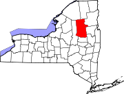
Morehouse, New York — Town — Location within the state of New York
 Morehouse, New York
Coordinates: 43°26′N 74°44′W / 43.433°N 74.733°WCoordinates: 43°26′N 74°44′W / 43.433°N 74.733°W Country United States State New York County Hamilton Government - Type Town Council - Town Supervisor William G. Farber (R) - Town Council Members' ListArea - Total 194.7 sq mi (504.4 km2) - Land 191.1 sq mi (495.0 km2) - Water 3.6 sq mi (9.4 km2) Elevation 2,287 ft (697 m) Population (2000) - Total 151 - Density 0.8/sq mi (0.3/km2) Time zone Eastern (EST) (UTC-5) - Summer (DST) EDT (UTC-4) FIPS code 36-48340 GNIS feature ID 0979237 Morehouse is a town in Hamilton County, New York, United States. The population was 151 at the 2000 census. The name is that of an early settler, Andrew Morehouse.
The Town of Morehouse is in the Adirondack Park. The town is in the southwestern corner of the county and is north of Utica.
Contents
History
Morehouse was formed from part of the Town of Lake Pleasant in 1835. Part of the town was later taken and added to the Town of Long Lake. An additional part of Morehouse was taken for Long Lake in 1861. In 1901, the Town of Inlet was formed from the northern end of the town.
The town is notable for many failed attempts to develop it economically. Ultimately, those parts of the original town only became important after separation from Morehouse.
One of the most newsworthy events to occur in town was the crash landing of an American Airways Curtis Condor in December 1934 and daring rescue of the crew by locals on snowshoes in the southern end of town.
Geography
According to the United States Census Bureau, the town has a total area of 194.7 square miles (504 km2), of which, 191.1 square miles (495 km2) of it is land and 3.6 square miles (9.3 km2) of it (1.86%) is water.
The western and southern town lines of Morehouse are the border of Herkimer County.
The West Canada Creek flows out the west town line, and other tributaries of that stream flow through the town. The Moose River marks the north town line.
New York State Route 8, an east-west highway, is the only significant road in Hoffmeister.
Demographics
As of the census[1] of 2000, there were 151 people, 65 households, and 46 families residing in the town. The population density was 0.8 people per square mile (0.3/km²). There were 293 housing units at an average density of 1.5 per square mile (0.6/km²). The racial makeup of the town was 97.35% White, 1.32% Native American, 1.32% from other races. Hispanic or Latino of any race were 1.32% of the population.
There were 65 households out of which 18.5% had children under the age of 18 living with them, 66.2% were married couples living together, 3.1% had a female householder with no husband present, and 27.7% were non-families. 20.0% of all households were made up of individuals and 6.2% had someone living alone who was 65 years of age or older. The average household size was 2.32 and the average family size was 2.57.
In the town the population was spread out with 17.9% under the age of 18, 2.0% from 18 to 24, 23.2% from 25 to 44, 37.1% from 45 to 64, and 19.9% who were 65 years of age or older. The median age was 50 years. For every 100 females there were 125.4 males. For every 100 females age 18 and over, there were 129.6 males.
The median income for a household in the town was $25,417, and the median income for a family was $27,500. Males had a median income of $21,750 versus $15,000 for females. The per capita income for the town was $12,864. There were 4.2% of families and 7.3% of the population living below the poverty line, including no under eighteens and 6.3% of those over 64.
Communities and locations in Morehouse
Communities
- Hoffmeister – A hamlet on NY-8 east of Morehouse, named after an early settler. This community is little more than a thin scattering of houses.
- Morehouseville – A hamlet, also called "Morehouse" and previously known as "Bethunville," is on NY-8 east of the county line. This is the principal community in the town.
- Mountain Home – A location north of Hoffmeister on Mountain Home Road.
Geographical features
- Beaver Lake – A lake by the north town line.
- The Floe – An artificial lake between Mountain Home and Hoffmeister, on the South Branch of West Canada Creek.
- Fort Noble Mountain – An elevation at the west town line, northwest of Morehouseville (Altitude: 2310 feet, 704.09 meters).
- Indian Lake – A Lake in the northern par of Morehouse, south of Squaw Lake.
- Jerseyfield Lake – A lake at the south town line.
- Moose River—A river marking the north town line.
- Morehouse Lake – A small lake south of Morehouse Mountain.
- Morehouse Mountain – A mountain near the east town line, south of NY-8.
- Pine Lake – A lake by the east town line, northeast of Hoffmeister.
- Squaw Lake – A lake in the northern part of the town, south of Beaver Lake.
- South Branch West Canada Creek – A small river flowing west, north of NY-8.
- Wilmurt Lake – A lake north of NY-8.
References
- ^ "American FactFinder". United States Census Bureau. http://factfinder.census.gov. Retrieved 2008-01-31.
External links
Municipalities and communities of Hamilton County, New York County seat: Lake Pleasant Towns Arietta | Benson | Hope | Indian Lake | Inlet | Lake Pleasant | Long Lake | Morehouse | Wells
Village Hamlets Categories:- Towns in New York
- Populated places in Hamilton County, New York


Wikimedia Foundation. 2010.