- Cold Brook, New York
-
Cold Brook, New York — Village — Signage entering Cold Brook via Herkimer County Route 224, approaching New York State Route 8. Location within the state of New York
 Cold Brook, New York
Coordinates: 43°14′27″N 75°2′21″W / 43.24083°N 75.03917°WCoordinates: 43°14′27″N 75°2′21″W / 43.24083°N 75.03917°W Country United States State New York County Herkimer Area – Total 0.4 sq mi (1.1 km2) – Land 0.4 sq mi (1.1 km2) – Water 0.0 sq mi (0.0 km2) Elevation 945 ft (288 m) Population (2000) – Total 336 – Density 761.2/sq mi (293.9/km2) Time zone Eastern (EST) (UTC-5) – Summer (DST) EDT (UTC-4) ZIP code 13324 Area code(s) 315 FIPS code 36-16815 GNIS feature ID 0947025 Cold Brook is a village in Herkimer County, New York, United States. The population was 336 at the 2000 census. The village is named after a stream passing through the village.
The Village of Cold Brook is located in the south part of the Town of Russia and is northeast of Utica.
Contents
History
The water power of Cold Brook encouraged settlers, who arrived after 1800. The 1857 Cold Brook Feed Mill was listed on the National Register of Historic Places in 1974.[1]
Geography
Cold Brook is located at 43°14′27″N 75°2′21″W / 43.24083°N 75.03917°W (43.240968, -75.039221)[2].
According to the United States Census Bureau, the village has a total area of 0.4 square miles (1.0 km2), all of it land.
The main street of Cold Brook is New York State Route 8. The village is on sloping terrain with occasionally steep roadways.
Cold Brook is located on NY-8 east of the Village of Poland.
Demographics
As of the census[3] of 2000, there were 336 people, 123 households, and 93 families residing in the village. The population density was 761.2 people per square mile (294.8/km²). There were 133 housing units at an average density of 301.3 per square mile (116.7/km²). The racial makeup of the village was 99.70% White and 0.30% Asian.
There were 123 households out of which 39.8% had children under the age of 18 living with them, 55.3% were married couples living together, 14.6% had a female householder with no husband present, and 23.6% were non-families. 19.5% of all households were made up of individuals and 6.5% had someone living alone who was 65 years of age or older. The average household size was 2.73 and the average family size was 3.12.
In the village the population was spread out with 31.5% under the age of 18, 7.1% from 18 to 24, 25.6% from 25 to 44, 22.0% from 45 to 64, and 13.7% who were 65 years of age or older. The median age was 34 years. For every 100 females there were 107.4 males. For every 100 females age 18 and over, there were 101.8 males.
The median income for a household in the village was $30,455, and the median income for a family was $33,333. Males had a median income of $22,500 versus $18,542 for females. The per capita income for the village was $13,674. About 12.0% of families and 10.9% of the population were below the poverty line, including 15.2% of those under age 18 and 8.6% of those age 65 or over.
References
- ^ "National Register Information System". National Register of Historic Places. National Park Service. 2009-03-13. http://nrhp.focus.nps.gov/natreg/docs/All_Data.html.
- ^ "US Gazetteer files: 2010, 2000, and 1990". United States Census Bureau. 2011-02-12. http://www.census.gov/geo/www/gazetteer/gazette.html. Retrieved 2011-04-23.
- ^ "American FactFinder". United States Census Bureau. http://factfinder.census.gov. Retrieved 2008-01-31.
Municipalities and communities of Herkimer County, New York City 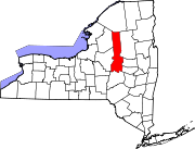
Towns Villages Cold Brook | Dolgeville‡ | Frankfort | Herkimer | Ilion | Middleville | Mohawk | Newport | Poland | West Winfield
Hamlets Footnotes ‡This populated place also has portions in an adjacent county or counties
Categories:- Villages in New York
- Utica–Rome metropolitan area
- Populated places in Herkimer County, New York


Wikimedia Foundation. 2010.