- Mendon, New York
-
Mendon Town Motto: Preserving, Protecting, Promoting Country United States State New York County Monroe Elevation 561 ft (171 m) Coordinates 42°59′52″N 77°30′16″W / 42.99778°N 77.50444°W Area 40.0 sq mi (103.6 km2) - land 39.8 sq mi (103 km2) - water 0.1 sq mi (0 km2), 0.25% Population 9,152 (2010) Density 209 / sq mi (80.7 / km2) Established 1813 Town Supervisor John D. Moffitt (R) First elected 2009 - Mark F. Cottle (D)
- Shari F. Stottler (D)
- Karla F. Boyce (R)
- Moe Bickweat (D)
Timezone EST (UTC-5) - summer (DST) EDT (UTC-4) ZIP code 14506 Area code 585 
 Location of Mendon in New York
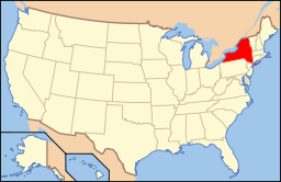 Location of New York in the United States
Website: http://www.townofmendon.org/ Mendon is a town in Monroe County, New York, United States, and an affluent suburb of Rochester, New York. The population was 9,152 at the 2010 census.
The Town of Mendon is on the south border of the county. Directly south of the Town of Pittsford, Mendon is among the higher-income eastern suburbs of Rochester.
Contents
History
The Town of Mendon was organized in 1813 in Ontario County, New York and was annexed by Monroe County when the county was created in 1821. Mendon got its name from Caleb Taft, an early settler, who came from Mendon, Massachusetts.
Geography
The town is bordered on the north by the town of Pittsford, on the west by the towns of Henrietta and Rush, and on the south and east by Ontario County. Honeoye Creek enters across the south town line. The town is made up mostly of horse farms and family homes. The highest elevations in Monroe County are in Mendon, at 1028 feet above sea level.
According to the United States Census Bureau, the town has a total area of 40.0 square miles (104 km2), of which, 39.8 square miles (103 km2) of it is land and 0.1 square miles (0.26 km2) of it (0.35%) is water.
Just south of the town, hills and a meandering creek were used to create Mendon Golf Club. The Pete Craig designed course was completed in 1961.
Demographics
As of the census[1] of 2000, there were 8,370 people, 3,070 households, and 2,348 families residing in the town. The population density was 210.3 people per square mile (81.2/km²). There were 3,138 housing units at an average density of 78.8 per square mile (30.4/km²). The racial makeup of the town was 98.47% White, 0.42% African American, 0.07% Native American, 0.88% Asian, 0.13% from other races, and 0.54% from two or more races. Hispanic or Latino of any race were 0.96% of the population.
There were 3,070 households out of which 39.3% had children under the age of 18 living with them, 67.6% were married couples living together, 6.6% had a female householder with no husband present, and 23.5% were non-families. 19.3% of all households were made up of individuals and 8.5% had someone living alone who was 65 years of age or older. The average household size was 2.70 and the average family size was 3.13.
In the town the population was spread out with 28.8% under the age of 18, 4.4% from 18 to 24, 27.5% from 25 to 44, 28.4% from 45 to 64, and 10.8% who were 65 years of age or older. The median age was 40 years. For every 100 females there were 95.1 males. For every 100 females age 18 and over, there were 90.9 males.
The median income for a household in the town was $116,369, and the median income for a family was $129,827. Males had a median income of men is $99,750 versus $77,309 for females. The per capita income for the town was $81,949. About 1.1% of families and 1.3% of the population were below the poverty line, including 2.3% of those under age 18 and 2.3% of those age 65 or over.
Communities and locations in Mendon
- Dann Corner – Located at the junction of Route 15A and Honeoye Falls No 6 Road just west of the village of Honeoye Falls
- Ford Corner – Located at the junction of West Bloomfield Road and Cheese Factory Road
- Honeoye Falls – A village in the southwest part of the town on the Honeoye Creek.
- Hamlet of Mendon – A hamlet in the eastern part of the town at the junction of Routes 64 and 251.
- Mendon Center – Located at the junction of Route 251 and Mendon Center Road, near the southeast corner of Mendon Ponds Park
- Mendon Ponds Park – A large county park and National Natural Landmark
- Moran Corner – Located at the junction of Route 15A and Monroe Street just northwest of the village of Honeoye Falls
- Rochester Junction – Located at the junction of routes 251 and 65
- Sibleyville – Located at the junction of Route 15A and Sibley Road
- Tomlinson Corners – Located near the junction of Route 64 and Boughton Hill Road
Education
Mendon is served by the Pittsford Central School District in the north and the Honeoye Falls-Lima Central School District in the south.
References
- ^ "American FactFinder". United States Census Bureau. http://factfinder.census.gov. Retrieved 2008-01-31.
External links
- Town of Mendon, NY webpage
- Populated Places in Monroe County
- Mendon Fire Dept.
- Lehigh Valley Railroad Rochester Junction Station.
Municipalities and communities of Monroe County, New York City 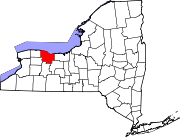
Towns Villages Brockport | Churchville | East Rochester | Fairport | Hilton | Honeoye Falls | Pittsford | Scottsville | Spencerport | Webster
CDPs Other
hamletsAdams Basin | Garbutt | Gates Center | Mumford
Categories:- Towns in New York
- Rochester, New York metropolitan area
- Populated places in Monroe County, New York


Wikimedia Foundation. 2010.