- East Massapequa, New York
Infobox Settlement
official_name = East Massapequa, New York
settlement_type = CDP
nickname =
motto =
imagesize =
image_caption =
image_pushpin_
pushpin_label_position = none
pushpin_map_caption =Location within the state of New York
pushpin_mapsize =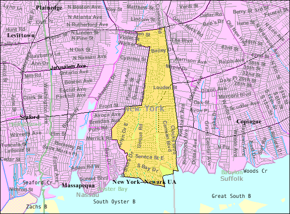
mapsize = 250px
map_caption = U.S. Census Map
mapsize1 =
map_caption1 =subdivision_type = Country
subdivision_name =United States
subdivision_type1 = State
subdivision_name1 =New York
subdivision_type2 = County
subdivision_name2 = Nassau
government_footnotes =
government_type =
leader_title =
leader_name =
leader_title1 =
leader_name1 =
established_title =
established_date =area_footnotes =
area_magnitude =
area_total_km2 = 9.3
area_land_km2 = 9.1
area_water_km2 = 0.2
area_total_sq_mi = 3.6
area_land_sq_mi = 3.5
area_water_sq_mi = 0.1population_as_of = 2000
population_footnotes =
population_total = 19565
population_density_km2 = 2159.4
population_density_sq_mi = 5592.8timezone = Eastern (EST)
utc_offset = -5
timezone_DST = EDT
utc_offset_DST = -4
elevation_footnotes =
elevation_m = 4
elevation_ft = 13
latd = 40 |latm = 40 |lats = 26 |latNS = N
longd = 73 |longm = 26 |longs = 9 |longEW = Wpostal_code_type =
ZIP code
postal_code = 11758
area_code = 516
blank_name = FIPS code
blank_info = 36-22480
blank1_name = GNIS feature ID
blank1_info = 1867402
website =
footnotes =East Massapequa is a hamlet (and
census-designated place ) in Nassau County,New York ,United States . The population was 19,565 at the 2000 census.East Massapequa is in the Town of Oyster Bay and lies in New York's 3rd congressional district.
Geography
East Massapequa is located at coor dms|40|40|26|N|73|26|9|W|city (40.674006, -73.435963)GR|1.
According to the
United States Census Bureau , the CDP has a total area of 3.6square mile s (9.3km² ), of which, 3.5 square miles (9.1 km²) of it is land and 0.1 square miles (0.2 km²) of it (2.51%) is water.Demographics
As of the
census GR|2 of 2000, there were 19,565 people, 6,432 households, and 5,107 families residing in the CDP. Thepopulation density was 5,592.8 per square mile (2,158.3/km²). There were 6,535 housing units at an average density of 1,868.1/sq mi (720.9/km²). The racial makeup of the CDP was 80.82% White, 12.34% African American, 0.20% Native American, 2.23% Asian, 0.03% Pacific Islander, 2.47% from other races, and 1.90% from two or more races. Hispanic or Latino of any race were 7.49% of the population.There were 6,432 households out of which 36.6% had children under the age of 18 living with them, 64.6% were married couples living together, 11.0% had a female householder with no husband present, and 20.6% were non-families. 16.4% of all households were made up of individuals and 8.9% had someone living alone who was 65 years of age or older. The average household size was 3.00 and the average family size was 3.37.
In the CDP the population was spread out with 25.1% under the age of 18, 6.6% from 18 to 24, 31.1% from 25 to 44, 23.0% from 45 to 64, and 14.2% who were 65 years of age or older. The median age was 38 years. For every 100 females there were 93.4 males. For every 100 females age 18 and over, there were 88.9 males.
The median income for a household in the CDP was $75,565, and the median income for a family was $83,373. Males had a median income of $56,032 versus $37,885 for females. The
per capita income for the CDP was $28,585. About 2.4% of families and 3.4% of the population were below thepoverty line , including 2.8% of those under age 18 and 5.5% of those age 65 or over.Students in East Massapequa attend schools in three districts. Students west of Carmans Road attend Massapequa Public schools. This area is generally thought of Massapequa Park as it has the Massapequa park mailing address and zipcode. East of Carmans Road, students attend Amityville district schools. While the CDP is fairly racially diverse, the two school districts serve as a split. The portions of the CDP within the Massapequa school district is about 95% white, however the portion of the CDP within the Amityville school district is very racially diverse with almost as many African Americans as there are whites. Also, a small portion of the CDP (on both sides of Carmans Road, just south of the Southern State Parkway) attend
Farmingdale School District.References
External links

Wikimedia Foundation. 2010.