Taghmon

Taghmon

Infobox Irish Place
name = Taghmon
gaeilge = Teach Munna
crest

motto =
map

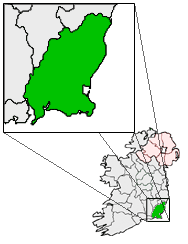
pin coords = left: 53px; top: 88px
north coord = 52.32
west coord = 6.66
irish grid =
area =
elevation =
province = Leinster
county = County Wexford
dailconstituency = Wexford
EU constituency = East
stdcode =
town pop = 674
rural pop =
census yr = 2006
web =

Taghmon (Irish place name|Teach Munna|House of Munn) is a village in County Wexford, Ireland. It lies some 14 km west of Wexford town and 24 km east-southeast of New Ross.

History

It can be established, from historical records, that the area now comprising the village of Taghmon has been inhabited since at least as early as 595 AD. Saint Fintan was granted land there in "circa" 597 by a chieftain whose name has passed down through the annals. Dimma Mac Hugh, with his followers, was residing in the area then known as 'Achadh Liathdrom', which translates as 'the grey field on (or near) the ridge of a hill'.

Geography

Many Irish place names are topographically descriptive, and 'Achadh Liathdrom' is no exception. From the western side of the Forth Mountain, as it slopes down towards Ballintlea, a succession of gradual hills and valleys undulate their way across this part of County Wexford towards Camross, Bree and Carrigbyrne Hills. It is on one of these hills or ridges that the village of Taghmon is situated.

Modern Taghmon

Being a large growing village, Taghmon has many businesses that contribute to the local economy.

Transport

Rural Bus provides links with Wexford town, and a taxi company is situated in the village.


Wikimedia Foundation. 2010.

Игры ⚽ Поможем написать курсовую

Look at other dictionaries:

  • Mary Sinnott — Personal information Irish name Máire Ní Sionoid Sport Camogie …   Wikipedia

  • Battle of Three Rocks — Infobox Military Conflict conflict=Battle of Three Rocks partof=1798 Rebellion caption=Monument at the site of the battle. Erected in 1952. date=May 30, 1798 place=Forth Mountain, Wexford result=Rebel victory, Wexford town captured combatant1=… …   Wikipedia

  • History of County Wexford — Infobox Irish Place name = County Wexford gaeilge = Contae Loch Garman crest motto = Exemplar Hiberniae map area = 2,352 km² county town = Wexford code = WX population = 131,615 census yr = 2006 province = Leinster web = www.wexford.ie |County… …   Wikipedia

  • County Wexford (1914-1923) — County Wexford (Irish: Contae Loch Garman ) is a county located in the south east of Ireland. The period 1916 1923 was one of the most turbulent in the county s history. In 1914 Ireland was still part of the British Empire. During World War 1… …   Wikipedia

  • Foulkesmill — is small village located in the south of County Wexford, Ireland.A battle was fought near here on 20 June 1798, during the Irish Rebellion of 1798. It is known as the Battle of Horetown (or Goff s Bridge, or Foulksmills). A large contingent of… …   Wikipedia

  • Fintan — Cette page d’homonymie répertorie les différents sujets et articles partageant un même nom. Fintan est un nom propre qui désigne plusieurs personnages : Mythologie Fintan, héros de la mythologie celtique irlandaise. Saints et bienheureux… …   Wikipédia en Français

  • Тамон — Деревня Ирландии Тамон англ. Taghmon, ирл. Teach Munna Страна Ирланд …   Википедия

  • Sts. Fintan —     Sts. Fintan     † Catholic Encyclopedia ► Sts. Fintan     St. Fintan of Clonenagh     A Leinster saint, b. about 524; d. 17 February, probably 594, or at least before 597. He studied under St. Columba of Terryglass, and in 550 settled in the… …   Catholic encyclopedia

  • County Wexford (1914–1923) — Main article: History of County Wexford County Wexford (Irish: Contae Loch Garman) is a county located in the south east of Ireland. The period 1916 1923 was one of the most turbulent in the county s history. In 1914 Ireland was still part of the …   Wikipedia

  • County Wexford — Contae Loch Garman Coat of arms …   Wikipedia

Share the article and excerpts

Direct link
Do a right-click on the link above
and select “Copy Link”