- North Hills, New York
-
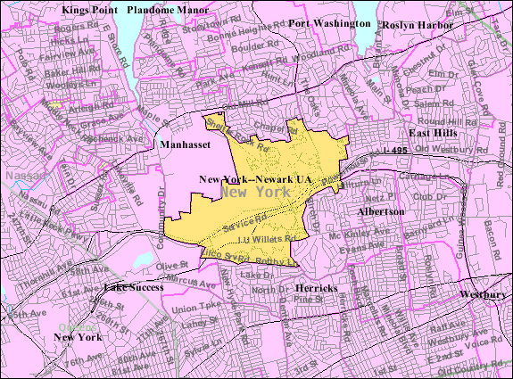
North Hills, New York — Village — U.S. Census Map Location within the state of New York

Coordinates: 40°46′33″N 73°40′22″W / 40.77583°N 73.67278°WCoordinates: 40°46′33″N 73°40′22″W / 40.77583°N 73.67278°W Country United States State New York County Nassau Area - Total 2.8 sq mi (7.2 km2) - Land 2.8 sq mi (7.2 km2) - Water 0.0 sq mi (0.0 km2) Elevation 217 ft (66 m) Population (2010) - Total 5,075 Time zone Eastern (EST) (UTC-5) - Summer (DST) EDT (UTC-4) ZIP code 11030, 11040, 11042 & 11576 Area code(s) 516 FIPS code 36-53022 GNIS feature ID 0972865 North Hills is a village in Nassau County, New York in the United States. The population was 5,075 at the 2010 census.
The Village of North Hills is located in the Town of North Hempstead.
Contents
Geography
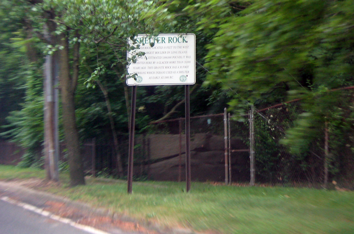
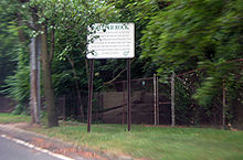 Shelter Rock, very close to the border between North Hills and Manhasset.
North Hills is located at 40°46′33″N 73°40′22″W / 40.77583°N 73.67278°W (40.775822, -73.672662)[1].
According to the United States Census Bureau, the village has a total area of 2.8 square miles (7.3 km2), all of it land.
North Hills is adjacent to Interstate 495 (Long Island Expressway) and the Northern State Parkway.
North Hills was ranked one of the wealthiest towns in the United States, as well as all of Long Island by Businessweek. (http://images.businessweek.com/ss/09/03/0317_richest_zips/23.htm)
History
The glacial action that formed much of Long Island deposited Shelter Rock in what is now North Hills approximately 11,000 years ago. The Matinecock had a village in the area. Farming developed in North Hills in mid 17th century. Around this time a long fence was built along the road later known as Northern Boulevard, to the North of North Hills. The lands of the Cow Neck peninsula enclosed by the fence (present day Manhasset and Port Washington) were used for grazing. Later, in the 19th century, one of the largest farms in the area was owned by I.U. Willets.[2]
Demographics
As of the census[3] of 2000, there were 4,301 people, 1,808 households, and 1,424 families residing in the village. The population density was 1,542.5 people per square mile (595.2/km²). There were 1,907 housing units at an average density of 683.9 per square mile (263.9/km²). The racial makeup of the village was 81.42% White, 0.91% African American, 15.83% Asian, 0.14% from other races, and 1.70% from two or more races. Hispanic or Latino of any race were 1.44% of the population.
There were 1,808 households out of which 19.0% had children under the age of 18 living with them, 73.5% were married couples living together, 3.8% had a female householder with no husband present, and 21.2% were non-families. 18.1% of all households were made up of individuals and 9.2% had someone living alone who was 65 years of age or older. The average household size was 2.37 and the average family size was 2.66.
In the village the population was spread out with 14.5% under the age of 18, 4.0% from 18 to 24, 17.2% from 25 to 44, 36.9% from 45 to 64, and 27.3% who were 65 years of age or older. The median age was 54 years. For every 100 females there were 91.3 males. For every 100 females age 18 and over, there were 89.1 males.
The median income for a household in the village was $149,122, and the median income for a family was $184,223. Males had a median income of $100,000 versus $60,789 for females. The per capita income for the village was $100,093. About 3.4% of families and 6.3% of the population were below the poverty line, including 16.1% of those under age 18 and 6.0% of those age 65 or over.
Government influence
As the general housing situation of the village of North Hills is private, gated community style living, there is little communal activity. However, in the early first decade of the 21st century, the mayor decided that the buying of the Deepdale Golf Club would make it a better place, and raise home values. Deepdale, whose lands include the former estate of Joseph P. Grace, served the village with legal papers, claiming that they were abusing government power by trying to close a country club for residents only. After much dispute in and out of court, the case eventually dissolved, leaving the club in the hands of its members.
References
- ^ "US Gazetteer files: 2010, 2000, and 1990". United States Census Bureau. 2011-02-12. http://www.census.gov/geo/www/gazetteer/gazette.html. Retrieved 2011-04-23.
- ^ Aronson, Harvey, ed. Home Town Long Island. (Newsday, 1999). ISBN 1885134215.
- ^ "American FactFinder". United States Census Bureau. http://factfinder.census.gov. Retrieved 2008-01-31.
Town of North Hempstead, New York County Villages Baxter Estates · East Hills · East Williston · Floral Park · Flower Hill · Garden City · Great Neck · Great Neck Estates · Great Neck Plaza · Kensington · Kings Point · Lake Success · Manorhaven · Mineola · Munsey Park · New Hyde Park · North Hills · Old Westbury · Plandome · Plandome Heights · Plandome Manor · Port Washington North · Roslyn · Roslyn Estates · Roslyn Harbor · Russell Gardens · Saddle Rock · Sands Point · Thomaston · Westbury · Williston Park
Hamlets Albertson · Carle Place · Floral Park Centre · Garden City Park · Glenwood Landing · Great Neck Gardens · Greenvale · Harbor Hills · Herricks · Lakeville Estates · Manhasset · Manhasset Hills · New Cassel · New Hyde Park · North New Hyde Park · Port Washington · Roslyn Heights · Saddle Rock Estates · Searingtown · University Gardens
Website: northhempstead.comCategories:- Town of North Hempstead, New York
- Villages in New York
- Populated places in Nassau County, New York

Wikimedia Foundation. 2010.