- Clay, New York
-
Clay, New York — Town — Clay town hall Location within the state of New York
 Clay, New York
Coordinates: 43°9′2″N 76°11′39″W / 43.15056°N 76.19417°WCoordinates: 43°9′2″N 76°11′39″W / 43.15056°N 76.19417°W Country United States State New York County Onondaga Government – Type Town Council – Town Supervisor Damian M. Ulatowski (R) – Town Council Members' ListArea – Total 48.8 sq mi (126.4 km2) – Land 48.0 sq mi (124.3 km2) – Water 0.8 sq mi (2.0 km2) Elevation 377 ft (115 m) Population (2000) – Total 58,805 – Density 1,224.9/sq mi (473.0/km2) Time zone Eastern (EST) (UTC-5) – Summer (DST) EDT (UTC-4) ZIP code 13041 Area code(s) 315 FIPS code 36-16067 GNIS feature ID 0978835 Clay is a town in Onondaga County, New York, USA. As of the 2000 census, the town had a total population of 58,805, making it Syracuse's largest suburb. The town was named after Henry Clay, statesman.
The Town of Clay is northwest of Syracuse. It is the largest town in the county and contains part of the Village of North Syracuse, New York. It contains the major retail strip of Syracuse's northwesterly suburbs, along NY-31, including the Great Northern Mall.
 North Medical Center.
Contents
History
Clay was within the Central New York Military Tract. The town was first settled by outsiders around 1791 and was previously known as West Cicero, NY.
The Town of Clay was formed in 1827 from the Town of Cicero, one of the original townships of the military tract.
Most famous son: actor Richard Gere.
Geography
According to the United States Census Bureau, the town has a total area of 48.8 square miles (126 km2), of which, 48.0 square miles (124 km2) of it is land and 0.8 square miles (2.1 km2) of it (1.60%) is water.
 Newer homes built in the Town of Clay.
The north town line is the border of Oswego County, New York, marked by the Oneida River. The Seneca River marks the west town line. Both these rivers join into the Oswego River near the community of Three Rivers. The renovated Erie Canal follows the rivers around the border of Clay.
 Interstate 481 from the Route 31 bridge.
 Town of Clay neighborhood.
New York State Route 31 is an east-west highway through the town. New York State Route 481 intersects NY-31 west of Euclid.
Clay is north of Onondaga Lake.
Demographics
As of the census[1] of 2000, there were 58,805 people, 22,294 households, and 15,940 families residing in the town. The population density was 1,224.9 people per square mile (472.9/km²). There were 23,398 housing units at an average density of 487.4 per square mile (188.2/km²). The racial makeup of the town was 92.13% White, 3.50% African American, 0.47% Native American, 2.01% Asian, 0.02% Pacific Islander, 0.38% from other races, and 1.48% from two or more races. Hispanic or Latino of any race were 1.39% of the population.
 Great Northern Mall was built in the Town of Clay in 1988. It is one of three major enclosed malls in the Syracuse area.
There were 22,294 households out of which 38.0% had children under the age of 18 living with them, 56.9% were married couples living together, 11.0% had a female householder with no husband present, and 28.5% were non-families. 22.3% of all households were made up of individuals and 6.4% had someone living alone who was 65 years of age or older. The average household size was 2.63 and the average family size was 3.11.
In the town the population was spread out with 27.7% under the age of 18, 7.3% from 18 to 24, 32.5% from 25 to 44, 23.1% from 45 to 64, and 9.3% who were 65 years of age or older. The median age was 35 years. For every 100 females there were 93.0 males. For every 100 females age 18 and over, there were 90.1 males.
 An Upscale neighborhood in the Town of Clay.
The median income for a household in the town was $50,412, and the median income for a family was $57,493. Males had a median income of $40,387 versus $27,996 for females. The per capita income for the town was $22,011. About 4.1% of families and 5.7% of the population were below the poverty line, including 7.5% of those under age 18 and 6.2% of those age 65 or over.
Communities and locations in Clay
- Bayberry – a suburban residential community in the town.
- Belgium – A hamlet on NY-31 near the west town line.
- Cherry Estates – A hamlet near the east town line.
- Clay – The hamlet of Clay is located on NY-31.
- Elmcrest – A hamlet in the southwest part of Clay.
- Euclid – a hamlet in the northern part of the town on NY-31.
- Fairway East - A sprawling subdivision linking Morgan Rd. with Soule Rd. There are many streets and approximately 500 homes.
- Gatewood – a neighborhood in the eastern part of the town off of Maple Road. Consists of three streets and 72 houses
- Great Northern Mall – A Large Regional Mall at the junction of NY-31 and NY-481.
- Kimbrook – a suburban residential community.
- Lawton Valley Hunt --a very large (and still-growing) housing development between Caughdenoy Rd, NY-31, and Lawton Rd.
- Lynelle Meadows-- a suburban residential community.
- Moyers Corners – A hamlet on NY-31 near the west town line, east of Belgium.
- North Syracuse – The Village of North Syracuse is mostly within the town.
- Rodger Corner – A hamlet south of Clay village.
- Three Rivers – A hamlet at the west town line at the junction of the Oneida, Oswego, and Seneca Rivers.
- Woodard – A hamlet in the southwest part of Clay.
- Youngs – A hamlet north of Clay village.
References
- ^ "American FactFinder". United States Census Bureau. http://factfinder.census.gov. Retrieved 2008-01-31.
Law enforcement
Onondaga County Sheriff Department
Fire departments
Parts of Clay are covered by Moyers Corners Fire Department and Clay Fire Department
External links
Municipalities and communities of Onondaga County, New York City 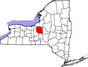
Towns Villages Baldwinsville | Camillus | East Syracuse | Elbridge | Fabius | Fayetteville | Jordan | Liverpool | Manlius | Marcellus | Minoa | North Syracuse | Skaneateles | Solvay | Tully
CDPs Brewerton‡ | Bridgeport‡ | Fairmount | Galeville | Lakeland | Lyncourt | Mattydale | Nedrow | Seneca Knolls | Village Green | Westvale
Other
hamletsAmber | Amboy | Apulia | Apulia Station | Borodino | Cardiff | Cedarvale | Clintonville | Collingwood | Delphi | Delphi Falls | Geddes | Hart Lot | Hinsdale | Howlett Hill | Indian Village | Jack's Reef | Jamesville | Long Branch | Marietta | Memphis | Messina Springs | Mottville | Mycenae | Navarino | Onondaga Hill | Oran | Otisco | Plainville | Pompey Center | Rose Hill | Shepard Settlement | Skaneateles Falls | South Onondaga | South Spafford | Southwood | Spafford Valley | Split Rock | State Fair Grounds | Taunton | Thorn Hill | Vesper | Warners | Watervale
Indian
reservationFootnotes ‡This populated place also has portions in an adjacent county or counties
Categories:- Towns in New York
- Syracuse metropolitan area
- Populated places in Onondaga County, New York


Wikimedia Foundation. 2010.