- Corby Glen
-
 Village sign in Corby Glen
Corby Glen is a village in southwest Lincolnshire, England.
Contents
Geography
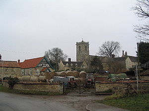
The village of Corby Glen (grid reference TF0025) is in South Kesteven District in Lincolnshire. It lies mainly to the north of the A151, a former toll road, and to the east of the West Glen River, near where the Glen flows through a small graben in the Jurassic limestone.
Until the 1950s the name of the village was simply Corby, Lincs. However, in the nearby county of Northamptonshire another Corby had been greatly enlarged by the addition of a steel works and housing to match. Some confusion arose between the two Corbys, so British Railways consulted the villagers to choose an additional name to distinguish the two. The villagers chose "Glen" in reference to the western branch of the River Glen which flows through the village.
History
 Corby Glen.
The Church of England parish church of Saint John the Evangelist dates in part from the 12th century[1] and has a notable collection of 14th and 15th century murals. Corby Glen's other Christian congregations are the Roman Catholic church of Our Lady of Mount Carmel and a Methodist chapel.
In 1238 King Henry III chartered a weekly market and an annual sheep fair. The sheep fair has continued ever since, and is claimed to be the longest-established such event in Britain.[2]
The Willoughby Memorial Library and Art Gallery[3] is housed in a 17th century building that was originally Reads Grammar School. The school was founded in 1669 by the bequest of Charles Read (1604-1669), who was born at Darlton in Nottinghamshire and became a wealthy shipper in Hull. Read also founded grammar schools at Tuxford in Notts. and Drax in Yorkshire. Reads Grammar School in Corby Glen closed in 1909.[4] The building was restored and reopened for its current uses in 1965.
In 1852 the Great Northern Railway opened the East Coast Main Line through Corby Glen. In 1853 the GNR opened Corby Glen railway station on the main line about 1 mile (1½ kilometres) from the village. Corby Glen was served by local trains between Peterborough and Grantham. In July 1938 the London and North Eastern Railway locomotive Mallard passed through Corby Glen on the way to achieving its world speed record for a steam locomotive a few miles further south at Stoke Bank. British Railways closed Corby Glen station in 1959 and its yard is now occupied by a sawmill.
Education
A new secondary school opened in Corby Glen in 1963. The school became a comprehensive, and in 1999 it was renamed the Charles Read High School.[5]
Corby Glen also has a community primary school.[6]
References
External links
- About the village
- St John the Evangelist parish church
- St John's wall painting: Nativity
- St John's wall painting: St. Anne
- Sheep fair
- Charles Read High School
- Corby Glen Community Primary School
- Willoughby Memorial Trust Gallery exhibition programme
Coordinates: 52°48′48″N 0°31′04″W / 52.81328°N 0.51775°W
Categories:- Villages in Lincolnshire
- Civil parishes in Lincolnshire
- Lincolnshire geography stubs


Wikimedia Foundation. 2010.