- Clarendon, New York
-
Clarendon, New York — Town — Location within the state of New York
 Clarendon, New York
Coordinates: 43°10′28″N 78°3′15″W / 43.17444°N 78.05417°W Country United States State New York County Orleans Area - Total 35.2 sq mi (91.2 km2) - Land 35.2 sq mi (91.2 km2) - Water 0.0 sq mi (0.0 km2) Elevation 610 ft (186 m) Population (2000) - Total 3,392 - Density 96.3/sq mi (37.2/km2) Time zone Eastern (EST) (UTC-5) - Summer (DST) EDT (UTC-4) ZIP code 14429 Area code(s) 585 FIPS code 36-15880 GNIS feature ID 0978830 Clarendon is a town in Orleans County, New York, United States. The population was 3,392 at the 2000 census. The name is derived from Clarendon, Vermont.
The Town of Clarendon is in the southeast part of the county. New York State Route 31A and New York State Route 237 intersect in the town.
Contents
History
The town was first settled around 1811. The Town of Clarendon was created in 1820 before Orleans County was established. It was originally known as "Farwell's Mills," a name derived from one of the first settlers, who arrived in 1810. Clarendon was once noted for its quarries and cement plants.
In late 2006, a stone church was taken down, for unknown reasons, that was built circa 1830 and served the community until 1980 when the church's contents were sold off. The church was a landmark for Clarendon for many years. The present owner of the property where the church once stood has retained the original bell which was manufactured in Troy, NY by the Meneely Bell Company.
Persons of note in Clarendon
Museum exhibitor and artist, Carl Akeley was born in Clarendon in 1864. Akely Hall in the American Museum of Natural History in New York City is named after him.
Geography
According to the United States Census Bureau, the town has a total area of 35.2 square miles (91 km2), all of it land.
The east town line is the border of Monroe County (Town of Sweden). The south town line is the border of Genesee County (Town of Byron).
The Clarendon-Linden fault system is named in part for Clarendon; the fault produces a prominent rise in the topography just west of Route 237.
Demographics
As of the census[1] of 2000, there were 3,392 people, 1,230 households, and 928 families residing in the town. The population density was 96.3 people per square mile (37.2/km²). There were 1,331 housing units at an average density of 37.8 per square mile (14.6/km²). The racial makeup of the town was 96.46% White, 0.94% African American, 0.41% Native American, 0.50% Asian, 0.62% from other races, and 1.06% from two or more races. Hispanic or Latino of any race were 1.62% of the population.
There were 1,230 households out of which 36.3% had children under the age of 18 living with them, 62.3% were married couples living together, 8.5% had a female householder with no husband present, and 24.5% were non-families. 18.5% of all households were made up of individuals and 5.4% had someone living alone who was 65 years of age or older. The average household size was 2.76 and the average family size was 3.15.
In the town the population was spread out with 28.5% under the age of 18, 6.6% from 18 to 24, 31.0% from 25 to 44, 24.6% from 45 to 64, and 9.3% who were 65 years of age or older. The median age was 36 years. For every 100 females there were 100.8 males. For every 100 females age 18 and over, there were 98.4 males.
The median income for a household in the town was $46,667, and the median income for a family was $52,064. Males had a median income of $34,432 versus $22,545 for females. The per capita income for the town was $18,553. About 2.6% of families and 8.1% of the population were below the poverty line, including 10.8% of those under age 18 and 1.9% of those age 65 or over.
Communities and locations in Clarendon
- Bennetts Corners – A hamlet east of Clarendon village on NY-31A.
- Clarendon – This hamlet, the original Farwell settlement, is centered around the intersection of Routes NY-31A and NY-237.
- Honest Hill – A hamlet south of Clarendon village on NY-237.
- Manning – A hamlet, also previously known as "West Clarendon" or "Mudville," is located on NY-31A west of Clarendon village.
References
- ^ "American FactFinder". United States Census Bureau. http://factfinder.census.gov. Retrieved 2008-01-31.
External links
Municipalities and communities of Orleans County, New York Towns 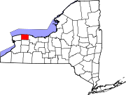
Villages Albion | Holley | Lyndonville | Medina
Hamlets Barre Center | Childs | Millville | Oak Orchard
Coordinates: 43°11′36″N 78°03′53″W / 43.19333°N 78.06472°W
Categories:- Towns in New York
- Rochester, New York metropolitan area
- Populated places in Orleans County, New York


Wikimedia Foundation. 2010.