- Orwell, New York
-
Orwell, New York — Town — Location within the state of New York
 Orwell, New York
Coordinates: 43°33′30″N 75°57′3″W / 43.55833°N 75.95083°W Country United States State New York County Oswego Area – Total 41.3 sq mi (107.0 km2) – Land 39.8 sq mi (103.0 km2) – Water 1.6 sq mi (4.0 km2) Elevation 1,001 ft (305 m) Population (2000) – Total 1,254 – Density 31.5/sq mi (12.2/km2) Time zone Eastern (EST) (UTC-5) – Summer (DST) EDT (UTC-4) ZIP code 13426 Area code(s) 315 FIPS code 36-55453 GNIS feature ID 0979320 Orwell is a town in Oswego County, New York, United States. The population was 1,254 at the 2000 census. The town was named after Orwell, Vermont.
The Town of Orwell is in the north-central part of the county.
Contents
History
The town was first settled around 1806. The Town of Orwell was created from part of the Town of Richland in 1817. In 1828, Orwell was reduced by the founding of the Town of Boylston, but more territory was obtained from Richland in 1844.
Geography
According to the United States Census Bureau, the town has a total area of 41.3 square miles (107 km2), of which, 39.8 square miles (103 km2) of it is land and 1.5 square miles (3.9 km2) of it (3.75%) is water.
Demographics
As of the census[1] of 2000, there were 1,254 people, 419 households, and 300 families residing in the town. The population density was 31.5 people per square mile (12.2/km²). There were 701 housing units at an average density of 17.6 per square mile (6.8/km²). The racial makeup of the town was 98.17% White, 0.88% African American, 0.32% Native American, 0.08% Asian, and 0.56% from two or more races. Hispanic or Latino of any race were 0.48% of the population.
There were 419 households out of which 35.1% had children under the age of 18 living with them, 58.7% were married couples living together, 7.4% had a female householder with no husband present, and 28.4% were non-families. 21.2% of all households were made up of individuals and 7.2% had someone living alone who was 65 years of age or older. The average household size was 2.79 and the average family size was 3.23.
In the town the population was spread out with 28.6% under the age of 18, 7.0% from 18 to 24, 28.1% from 25 to 44, 26.5% from 45 to 64, and 9.7% who were 65 years of age or older. The median age was 36 years. For every 100 females there were 120.0 males. For every 100 females age 18 and over, there were 124.9 males.
The median income for a household in the town was $35,000, and the median income for a family was $37,500. Males had a median income of $34,000 versus $21,500 for females. The per capita income for the town was $15,256. About 16.6% of families and 21.5% of the population were below the poverty line, including 25.7% of those under age 18 and 10.4% of those age 65 or over.
Communities and locations in Orwell
- Beecherville – A hamlet in the southeast part of the town, northeast of Stillwater.
- Bennett Bridge – A location south of Pekin.
- Castor Corners – A location northwest of Orwell village.
- Chateaugay – A hamlet east of Orwell village. It was also called "Shatagee."
- Little America – A location southeast of Stillwater.
- New Scriba – A hamlet on the north town line east of Vorea.
- Orwell – The hamlet of Orwell, sometimes called "Orwell Corners," is at the junction of Routes 2 and 22.
- Salmon River Reservoir – Part of the reservoir is in the southeast part of the town.
- Stillwater – A hamlet in the southeast part of the town.
- Vorea – A hamlet northeast of Orwell village near the north town line.
References
- ^ "American FactFinder". United States Census Bureau. http://factfinder.census.gov. Retrieved 2008-01-31.
External links
Municipalities and communities of Oswego County, New York Cities 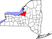
Towns Albion | Amboy | Boylston | Constantia | Granby | Hannibal | Hastings | Mexico | Minetto | New Haven | Orwell | Oswego | Palermo | Parish | Redfield | Richland | Sandy Creek | Schroeppel | Scriba | Volney | West Monroe | Williamstown
Villages Altmar | Central Square | Cleveland | Hannibal | Lacona | Mexico | Parish | Phoenix | Pulaski | Sandy Creek
CDPs Brewerton‡ | Constantia | Minetto | Sand Ridge
Other
hamletsAlbion Center | Bardeen Corners | Beecherville | Bernhards Bay | Boylston Center | Bundy Crossing | Butterfly Corners | Cains Corners | Carley Mills | Carterville | Catfish | Caughdenoy | Clifford | Cribbs Corners | Cummings Bridge | Demster | Demster Beach | Doris Park | Drakes Corner | Dugway | Dutcherville | East Amboy | East Boylston | East Palermo | Fairdale | Farley Corners | Fruit Valley | Furmiss | Gayville | Gilbert Mills | Graftons Square | Greenboro | Hannibal Center | Happy Valley | Hastings Center | Hinmansville | Howardville | Ingalls Crossing | Kasoag | Little France | Loomis Corner | Lycoming | Mallory | Mallory Station | Maple Hill | McMahon Corners | Morse | Mosher Corners | Mud Hill | Mungers Corners | New Scriba | Nicholsville | North Amboy | North Boylston | North Constantia | North Church Corner | North Hannibal | North Scriba | North Shores | North Volney | Oswego Beach | Oswego Center | Panther Lake | Peacock Corners | Peat Corners | Pennellville | Pineville | Plantz Corners | Pleasant Point Crossing | Prattham | Red Mill | Ricard | Roosevelt Corners | Russ Mills | Sala | Sandy Pond | Shephard Corners | Smartville | South Hannibal | South New Haven | South Scriba | Stewart Corners | Texas | The Elms | Toad Harbor | Upson Corner | Vermillion | Vorea | Vorhees Corners | West Amboy
Footnotes ‡This populated place also has portions in an adjacent county or counties
Coordinates: 43°34′29″N 75°59′47″W / 43.57472°N 75.99639°W
Categories:- Towns in New York
- Syracuse metropolitan area
- Populated places in Oswego County, New York


Wikimedia Foundation. 2010.