- Petersburgh, New York
-
Petersburgh — Town — Location within Rensselaer County and New York Location within the state of New York
 Petersburgh
Coordinates: 42°46′6″N 73°20′36″W / 42.76833°N 73.34333°WCoordinates: 42°46′6″N 73°20′36″W / 42.76833°N 73.34333°W Country United States State New York County Rensselaer Area – Total 41.6 sq mi (107.8 km2) – Land 41.6 sq mi (107.8 km2) – Water 0.0 sq mi (0.0 km2) Elevation 554 ft (169 m) Population (2000) – Total 1,563 – Density 37.6/sq mi (14.5/km2) Time zone Eastern (EST) (UTC-5) – Summer (DST) EDT (UTC-4) ZIP code 12138 Area code(s) 518 FIPS code 36-57441 GNIS feature ID 0979359 Petersburgh is a town located in the northeast section of Rensselaer County, New York, United States. The population was 1,563 at the 2000 census. The town was named after an early settler.
Contents
History
The area was settled around the middle of the 18th Century and was part of the Manor of Rensselaerswyck. The town was created in 1791 from the Town of Stephentown. The size of this town was diminished by the formation of other towns in the county, including the Towns of Berlin and Lansingburgh (see Troy) in 1806, and Grafton and Nassau in 1807.
The town was named after an individual named Peter Simmons, an early settler.[1]
Geography
According to the United States Census Bureau, the town has a total area of 41.6 square miles (108 km2), all land.
On the east the town borders on Massachusetts and Vermont.
The Little Hoosick River joins the Hoosic River in the north part of the town.
Demographics
As of the census[2] of 2000, there were 1,563 people, 587 households, and 433 families residing in the town. The population density was 37.6 people per square mile (14.5/km²). There were 695 housing units at an average density of 16.7 per square mile (6.5/km²). The racial makeup of the town was 98.08% White, 0.19% African American, 0.06% Native American, 0.90% Asian, 0.19% from other races, and 0.58% from two or more races. Hispanic or Latino of any race were 0.45% of the population.
There were 587 households out of which 33.9% had children under the age of 18 living with them, 62.9% were married couples living together, 7.2% had a female householder with no husband present, and 26.1% were non-families. 21.1% of all households were made up of individuals and 7.8% had someone living alone who was 65 years of age or older. The average household size was 2.66 and the average family size was 3.07.
In the town the population was spread out with 26.2% under the age of 18, 6.5% from 18 to 24, 28.3% from 25 to 44, 26.4% from 45 to 64, and 12.5% who were 65 years of age or older. The median age was 39 years. For every 100 females there were 103.3 males. For every 100 females age 18 and over, there were 99.3 males.
The median income for a household in the town was $45,909, and the median income for a family was $49,125. Males had a median income of $35,500 versus $25,208 for females. The per capita income for the town was $21,249. About 9.8% of families and 12.3% of the population were below the poverty line, including 16.8% of those under age 18 and 10.3% of those age 65 or over.
Communities and locations in Petersburgh
- North Petersburgh – A hamlet in the north part of the town on Routes 22 and 346. The U.S. Postal Service treats the name as unacceptable in mailing addresses, preferring "Petersburg".[3]
- Petersburgh (or Petersburg) – A hamlet on Routes 2 and 22, including the town hall. It was formerly called "South Petersburg" and "Rensselaer Mills", and USPS prefers the Petersburg spelling.[3]
- The following hamlets are not officially recognized by USPS:[3]
- Petersburgh Junction – By the north town line.
- Stillman – Northwest of Petersburgh village on Route 2.
References
- ^ "Profile for Petersburgh, New York". ePodunk. http://www.epodunk.com/cgi-bin/genInfo.php?locIndex=1413. Retrieved 2010-05-18.
- ^ "American FactFinder". United States Census Bureau. http://factfinder.census.gov. Retrieved 2008-01-31.
- ^ a b c USPS ZIP Code Lookup -- Search by city
Further reading
- Anderson, George Baker (1897). Landmarks of Rensselaer County New York. Syracuse, New York: D. Mason and Company. OCLC 1728151. http://www.archive.org/stream/landmarksofrenss00ande#page/n5/mode/2up.
- Hayner, Rutherford (1925). Troy and Rensselaer County New York: A History. New York: Lewis Historical Publishing Company, Inc. OCLC 22524006.
- Sylvester, Nathaniel Bartlett (1880). History of Rensselaer Co., New York with Illustrations and Biographical Sketches of its Prominent Men and Pioneers. Philadelphia: Everts & Peck. OCLC 3496287.
- Weise, Arthur James (1880). History of the Seventeen Towns of Rensselaer County from the Colonization of the Manor of Rensselaerwyck to the Present Time. Troy, New York: J. M. Francis & Tucker. OCLC 6637788. http://www.archive.org/stream/cu31924064123015#page/n5/mode/2up.
External links
Municipalities and communities of Rensselaer County, New York Cities 
Towns Berlin | Brunswick | East Greenbush | Grafton | Hoosick | Nassau | North Greenbush | Petersburgh | Pittstown | Poestenkill | Sand Lake | Schaghticoke | Schodack | Stephentown
Villages CDPs Other
hamletsCherry Plain | Cropseyville | Defreestville | Eagle Bridge | East Schodack | Johnsonville | Melrose | Schodack Center | Speigletown
Capital District of New York Central communities Albany (History · City Hall · Coat of Arms) · Schenectady (City Hall) · Troy (History) · List of all incorporated places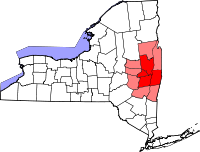
Largest communities
(over 20,000 in 2000)Medium-sized communities
(10,000 to 20,000 in 2000)City of Amsterdam · Brunswick · Cohoes · East Greenbush · Glens Falls · Gloversville · Halfmoon · Malta · North Greenbush · Schodack · Watervliet · WiltonSmall communities
(5,000 to 10,000 in 2000)Town of Amsterdam · Ballston Spa · Cobleskill · Village of Colonie · Duanesburg · City of Johnstown · Town of Johnstown · Kinderhook · Mechanicville · New Scotland · Rensselaer · Sand Lake · Scotia · Town of Stillwater · WaterfordCounties Albany · Columbia · Fulton · Greene · Montgomery · Rensselaer · Saratoga · Schenectady · Schoharie · Warren · WashingtonHistory Mohawks · Mahicans · Fort Orange · Rensselaerswyck · Beverwyck · Albany Plan of Union · Timeline of town creation · Toponymies of places · Tech ValleyGeography Hudson River (Valley) · Mohawk River · Erie Canal · Lake Albany · Lake George · Albany Pine Bush (Rensselaer Lake · Woodlawn Preserve) · Adirondack Mountains · Catskill Mountains · Rensselaer PlateauReligion and culture Culture in New York's Capital District · Sports in New York's Capital District · Episcopal Diocese of Albany · Roman Catholic Diocese of AlbanyEducation Public school districtsList of school districts in New York's Capital DistrictHigher educationNewspapers TV/Radio Broadcast television in the Capital District Local stations WRGB (6.1 CBS, 6.2 This TV) • WTEN (10.1 ABC, 10.2 Weather, 10.3 RTV) • WNYT (13.1 NBC, 13.2 Weather, 13.3 Weather Radar) • WMHT (17.1 PBS, 17.2 ThinkBright, 17.3 HD) • WXXA (23.1 Fox, 23.2 The Cool TV) • WNGN-LP 35 / WNGX-LP 42 (FN) • WCWN (45.1 The CW, 45.2 Uni Sp) • WNYA / WNYA-CD (51.1 MNTV, 51.2 Antenna TV) • W52DF 52 (silent)
Outlying area stations WVBK-CA 2 (RSN' Manchester, VT) • W04AJ 4 (PBS; Glens Falls) • W04BD 4 (PBS; Schoharie) •
WNCE-CA 8 (A1; Glens Falls) • WYBN-CA 14 (RSN; Cobleskill) • WCDC (19.1 ABC; Adams, MA) • WVBG-LP 25 (RSN; Greenwich) • W36AX 36 (PBS / VPT; Manchester, VT) • W47CM 47 (silent; Glens Falls) • WYPX (55.1 Ion, 55.2 qubo, 55.3 Life; Amsterdam) • W53AS 53 (PBS / VPT; Bennington, VT)Adjacent locals Cable-only stations YNN Capital Region • TW3 • YES • SNY • MSG Network
Defunct stations New York State television: Albany/Schenectady • Binghamton • Buffalo • Burlington/Plattsburgh • Elmira • New York City • Rochester • Syracuse • Utica • Watertown
Vermont Broadcast television: Albany/Schenectady • Boston, MA • Burlington/Plattsburgh
Massachusetts television: Albany • Boston • Providence • Springfield
Radio stations in the Albany / Schenectady / Troy market by FM frequency 88.3 · 89.1² · 89.7 · 89.9 · 90.3/93.1² · 90.7/94.9 · 90.7 · 90.7 · 90.9 · 91.1 · 91.5 · 92.3 · 92.9 · 93.5 · 93.7 · 94.5 · 94.7 · 95.5 · 95.9 · 96.3 · 96.7 · 97.3 · 97.5 · 97.7 · 97.9 · 98.3² · 98.5 · 98.5 · 99.1 · 99.5² · 100.3 · 100.9 · 101.3 · 101.7 · 101.9 · 102.3² · 102.7 · 103.1² · 103.5 · 103.9 · 104.5 · 104.9 · 105.7² · 106.1 · 106.5² · 107.1 · 107.7²by AM frequency NOAA Weather Radio frequency 162.550by callsign W226AC · W235AY · W256BU · W291BY · WABY · WAJZ · WAMC (AM) · WAMC-FM² · WBAR · WBPM · WCDB · WCKL · WCKM · WCQL · WCSS · WCTW · WDCD · WDCD-FM · WDDY² · WENT · WEQX · WEXT · WFFG · WFLY · WFNY · WGDJ · WGNA² · WGXC · WGY¹² · WGY-FM² · WHAZ · WHAZ-FM · WHUC · WHVP · WIZR · WJIV · WKBE · WKKF² · WKLI · WLJH · WMHT² · WMYY · WNYQ · WOFX² · WOPG · WPGL · WPYX² · WQAR · WQBJ · WQBK · WQSH² · WRIP · WROW · WRPI · WRUC · WRVE² · WSDE · WTMM · WTRY² · WUAM · WVCR · WVKZ · WVTL · WXL34 · WYAI · WYJB · WYKV · WZCR · WZMRDefunct stations New York Radio Markets: Albany-Schenectady-Troy • Binghamton • Buffalo-Niagara Falls • Elmira-Corning • Hamptons-Riverhead • Ithaca • Nassau-Suffolk (Long Island) • New York City • Newburgh-Middletown (Mid Hudson Valley) • Olean • Plattsburgh • Poughkeepsie • Rochester • Syracuse • Utica-Rome • Watertown
Other New York Radio Regions: Jamestown-Dunkirk • North Country • Saratoga
See also: List of radio stations in New YorkCategories:- Towns in New York
- Populated places in Rensselaer County, New York


Wikimedia Foundation. 2010.