- Chestnut Ridge, New York
-
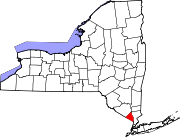
Chestnut Ridge — Village — Location of village within the town of Ramapo and Rockland County, New York. Location within the state of New York
 Chestnut Ridge
Coordinates: 41°4′55″N 74°3′5″W / 41.08194°N 74.05139°WCoordinates: 41°4′55″N 74°3′5″W / 41.08194°N 74.05139°W Country United States State New York County Rockland Area – Total 4.9 sq mi (12.8 km2) – Land 4.9 sq mi (12.8 km2) – Water 0.0 sq mi (0.0 km2) Elevation 413 ft (126 m) Population (2000) – Total 7,829 – Density 1,584.6/sq mi (611.8/km2) Time zone Eastern (EST) (UTC-5) – Summer (DST) EDT (UTC-4) ZIP codes 10952, 10965, 10977 Area code(s) 845 FIPS code 36-15400 GNIS feature ID 0979942 Chestnut Ridge is a village in the Town of Ramapo Rockland County, New York, United States located north of the state of New Jersey; east of Monsey; south of Spring Valley and west of Nanuet. The population was 7,829 at the 2000 census.
Chestnut Ridge was incorporated in 1986. Prior to 1986, Chestnut Ridge was an unincorporated area within the Town of Ramapo often referred to as "South Spring Valley" (its fire district) as many postal addresses carried the Spring Valley designation.
Contents
Geography
According to the United States Census Bureau, the village has a total area of 4.9 square miles (13 km2), all of it land.
Demographics
As of the census[1] of 2000, there were 7,829 people, 2,551 households, and 2,107 families residing in the village. The population density was 1,584.6 people per square mile (611.9/km²). There were 2,601 housing units at an average density of 526.4 per square mile (203.3/km²). The racial makeup of the village was 73.96% White, 13.87% African American, 0.13% Native American, 6.74% Asian, 0.06% Pacific Islander, 2.68% from other races, and 2.55% from two or more races. Hispanic or Latino of any race were 8.09% of the population.
There were 2,551 households out of which 32.3% had children under the age of 18 living with them, 72.2% were married couples living together, 7.3% had a female householder with no husband present, and 17.4% were non-families. 13.6% of all households were made up of individuals and 6.6% had someone living alone who was 65 years of age or older. The average household size was 2.87 and the average family size was 3.12.
In the village the population was spread out with 22.7% under the age of 18, 5.8% from 18 to 24, 27.0% from 25 to 44, 29.1% from 45 to 64, and 15.4% who were 65 years of age or older. The median age was 42 years. For every 100 females there were 94.8 males. For every 100 females age 18 and over, there were 89.2 males.
The median income for a household in the village was $86,468, and the median income for a family was $95,551. Males had a median income of $57,420 versus $43,548 for females. The per capita income for the village was $33,227. About 0.9% of families and 3.5% of the population were below the poverty line, including 0.3% of those under age 18 and 5.0% of those age 65 or over.
Tourism
Historical markers
- Haring Homestead, 606 S. Pascack Road
Landmarks and places of interest
- Duryea Farm of the Fellowship Education Foundation (Fellowship Community) - 101 Ackertown Rd., Chestnut Ridge, NY 10952 356-1988. Founded in 1883. Beginning in 1960, the Duryeas invited the public to the harvest. The farm is now owned and operated by the Rudolf Steiner Fellowship Foundation, which converted the orchards and gardens to produce biodynamic organic fruits and vegetables. The farm includes the Jessup Learning Center, which offers an exhibit of agricultural artifacts and classes.
- Little Red Schoolhouse Museum - 50 Schoolhouse Road, east of Route 45. Once a one-room schoolhouse, now a museum owned and operated by the east Ramapo Central School District. Built in 1890 and used until early 1970s when pre-kindergarten classes were held there. Open most Sundays 2:30 p.m. Telephone 577-6099 or 354-1518.
- The Fellowship Community, a residential community for the elderly.
Education
- Public schools
- Margetts Elementary School
- Eldorado Elementary School
- Fleetwood Elementary School
- Chestnut Ridge Middle School
- Private schools
- Green Meadow Waldorf School, a pre-kindergarten through 12th grade Waldorf school. 307 Hungry Hollow Road, Chestnut Ridge, New York 10977
- Colleges and adult education centers
- Sunbridge College, a Waldorf teacher training college
- School of Eurythmy, a movement arts training in Eurythmy
- The Pfeiffer Center, a biodynamic gardening and agricultural training center
- The Threefold Educational Center, an educational trust
Religious institutions
- Faith Assembly Of God, 921 Chestnut Rdg Rd.
- Congregation Shaarey Tfiloh, 972 Chestnut Rdg Rd
- Mosque of the Jerrahi Order. 884 Chestnut Ridge Rd.
- Christian Community, 15 Margetts Rd.
Noted employers
- LeCroy Corporation, A manufacturer of oscilloscopes and other testing gear.
References
- ^ "American FactFinder". United States Census Bureau. http://factfinder.census.gov. Retrieved 2008-01-31.
External links
- Green Meadow Waldorf School
- Hungry Hollow Food Co-op
- South Spring Valley Fire Department
- Threefold Educational Center
Municipalities and communities of Rockland County, New York Towns Clarkstown | Haverstraw | Orangetown | Ramapo | Stony Point
Villages Airmont | Chestnut Ridge | Grand View-on-Hudson | Haverstraw | Hillburn | Kaser | Montebello | New Hempstead | New Square | Nyack | Piermont | Pomona | Sloatsburg | South Nyack | Spring Valley | Suffern | Upper Nyack | Wesley Hills | West Haverstraw
CDPs Bardonia | Blauvelt | Congers | Hillcrest | Monsey | Mount Ivy | Nanuet | New City | Orangeburg | Pearl River | Stony Point | Tappan | Thiells | Valley Cottage | Viola | West Nyack
Other
hamletsCentenary | Central Nyack | Doodletown | Garnerville | Grassy Point | Johnsontown | Jones Point | Ladentown | Middletown | Nauraushaun | Palisades | Rockland Lake | Sandyfield | Sickletown | Sparkill | St. John's in the Wilderness | Sterlington | Tallman | Tomkins Cove
Categories:- Villages in New York
- Populated places in Rockland County, New York


Wikimedia Foundation. 2010.