- Merton Priory
-
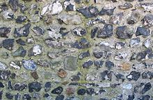 Only a few stretches of wall, including this piece in knapped flint, now survive from the priory.
 A ceiling boss from the Priory, discovered in excavations of Nonsuch Palace, on display in the Museum of London.
Merton Priory was founded in 1114 by Gilbert Norman, Sheriff of Surrey under Henry I. It was located in Merton, Surrey, England (now the Colliers Wood area in the London Borough of Merton) at the point where the Roman Stane Street crossed the River Wandle.
By 1117 the foundation was colonised by Canons Regular from the Augustinian priory at Huntingdon and re-sited in Merton, close to the River Wandle. The priory became distinguished as an important centre of learning attracting such pupils as Nicholas Breakspeare in 1125 (who became Adrian IV, the first English Pope, in 1154), and Thomas Becket in 1130.
Walter de Merton (Lord Chancellor, Bishop of Rochester, and founder of Merton College, Oxford) took his name from the Priory, having been educated there in the 1230s.
In 1236 Henry III held a Parliament at the Priory at which the Statute of Merton was agreed allowing amongst other matters Lords of the Manor to enclose common land provided that sufficient pasture remained for their tenants. As this was the first recorded statute of the first recorded parliament its real significance is as the starting point for parliamentary democracy as now practised world wide, and gives Merton Priory a claim to world heritage status. (Magna Carta although earlier doesn't qualify as it was not the result of a meeting of parliament, as such, and was only formally adopted into statute law in 1297).
The Priory was demolished in 1538, under Henry VIII's Dissolution of the Monasteries and much of the masonry was reused at Nonsuch Palace. The site of the Priory is now occupied by Sainsbury's Merton branch. Remains of the Priory's Chapter House are now underneath a major road and can be accessed from the foot tunnel under Merantun Way, between Sainsbury's and Merton Abbey Mills.
External links
- The Heritage Trail
- Merton Priory Trust
- Engraving of Merton Priory
- Excavation of Ruins
- BBC video of the site
Monasteries in Surrey Bermondsey Abbey · Chertsey Abbey · Gornshall Grange · Guildford Black Friary · Guildford Friary of the Sack · Horsley Priory · Oxenford Farm · Merton Priory · Newark Priory · Sheen Friary · Sheen Priory · Southwark Cathedral · Syon Priory · Tandridge Priory · Wanborough Grange · Waverley Abbey
Coordinates: 51°24′52.26″N 0°10′52.58″W / 51.4145167°N 0.1812722°W
Categories:- Religion in Merton
- Monasteries in London
- Monasteries in Surrey
- 1114 establishments
- 1538 disestablishments
- Religious organizations established in the 1110s
- History of Merton
- Christian monasteries established in the 12th century


Wikimedia Foundation. 2010.