- East Islip, New York
-
East Islip, New York — hamlet — U.S. Census Map Location within the state of New York
 East Islip, New York
Coordinates: 40°43′55″N 73°11′6″W / 40.73194°N 73.185°WCoordinates: 40°43′55″N 73°11′6″W / 40.73194°N 73.185°W Country United States State New York County Suffolk Area – Total 4.4 sq mi (11.3 km2) – Land 4.1 sq mi (10.6 km2) – Water 0.3 sq mi (0.7 km2) Elevation 16 ft (5 m) Population (2000) – Total 14,078 – Density 3,428.5/sq mi (1,323.7/km2) Time zone Eastern (EST) (UTC-5) – Summer (DST) EDT (UTC-4) ZIP code 11730 Area code(s) 631 FIPS code 36-22315 GNIS feature ID 0949137  Map showing the location of East Islip, New York on Long Island
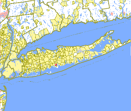
East Islip is a hamlet and CDP in the Town of Islip, Suffolk County, New York, (USA). At the time of the 2000 census, the CDP had 4,578 households and a population of 14,078.
Contents
History and overview
Originally referred to as "East of Islip," the name was acquired in 1890 from the estate of William Nicoll, an English aristocrat who purchased surrounding land on the 29th of November, 1683, to erect a family residence. Nicoll's purchase comprised 51,000 acres (210 km2) from the Secatogue Indians, reaching as far as Bayport, to the East, Babylon to the West and Ronkonkoma, to the North. His mansion, Islip Grange, named after his family's ancestral estate at Northampshire, England, stood near the shoreline of what is now Heckscher State Park. East Islip, as well as many hamlets along Long Island's south shore, was once an enclave for some of the nations wealthiest families.
Today the hamlet is no longer a haven to New York and the social elite. What remains are much smaller, yet affluent communities and few estates. Many of these newer communities were built on the land that was once part of former estates that were sold off; most notably the estate of Percy G. Williams. The Moorings, an opulent waterfront guard-gated private community is one of the hamlet's premier neighborhoods. Other neighborhoods within the hamlet include Deer Run and Percy Williams Cove.
Geography
East Islip is located at 40°43′55″N 73°11′6″W / 40.73194°N 73.185°W (40.731938, -73.185135)[1].
According to the United States Census Bureau, the CDP has a total area of 4.4 square miles (11 km2), of which, 4.1 square miles (11 km2) of it is land and 0.2 square miles (0.52 km2) of it (5.73%) is water.
Demographics
As of the census[2] of 2000, there were 4,578 households, and 3,731 families residing in the CDP. The population density was 3,428.5 per square mile (1,322.5/km²). There were 4,661 housing units, at an average density of 1,135.1/sq mi (437.9/km²). The racial makeup of the CDP was 96.20% White, 3.89% Hispanic, 0.57% African American, 0.06% Native American, 1.41% Asian, 0.02% Pacific Islander, 0.96% from other races, and 0.78% from two or more races.
East Islip currently borders 5 other hamlets. These hamlets are Oakdale, Islip, Bay Shore, Great River and Islip Terrace.
There were 4,578 households out of which 42.9% had children under the age of 18 living with them, 68.0% were married couples living together, 10.0% had a female householder with no husband present, and 18.5% were non-families. 15.2% of all households were made up of individuals and 7.3% had someone living alone who was 65 years of age or older. The average household size was 3.03 and the average family size was 3.38.
The population of the CDP was spread out with 28.5% under the age of 18, 6.3% from 18 to 24, 32.3% from 25 to 44, 21.1% from 45 to 64, and 11.8% who were 65 years of age or older. The median age was 37 years. For every 100 females there were 95.2 males. For every 100 females age 18 and over, there were 90.1 males.
The median income for a household in the CDP was $71,106, and the median income for a family was $77,593. Males had a median income of $51,554 versus $36,959 for females. The per capita income for the CDP was $27,356. About 2.8% of families and 3.7% of the population were below the poverty line, including 4.3% of those under age 18 and 4.0% of those age 65 or over.
Notable residents
- Jay F. Carlisle: famed investment banker and former Chair of American Stock Exchange (resided at Rosemary, estate built by E.W. Howell & Co.)
- Boomer Esiason: Former NFL quarterback (Cincinnati Bengals, New York Jets, Arizona Cardinals)
- Ron Wikso: Drummer of Foreigner (band), Cher, David Lee Roth, Richie Sambora, Gregg Rolie, Randy Meisner, Denny Laine, Player (band), and Ronn Moss
- Kathy Troccoli: contemporary Christian singer
- Margaret Becker: contemporary Christian singer
- Tony Graffanino: former Major League Baseball infielder
- Henry B. Hollins: one time partner of J. P. Morgan (resided at Meadow Farm, a 600 acres (2.4 km2) estate)
- Charles L. Lawrance: aircraft engineer, designed engine for Lindbergh's Spirit of St. Louis (resided on 116 acres (0.47 km2) waterfront estate which William Miller later developed into The Moorings; a sub-division of Meadow Farm)
- Ralph Macchio: actor, resided in East Islip as well as Dix Hills, New York, best known for appearing in the movie, The Karate Kid
- Rohan Murphy: Double-amputee paralympic athlete, and motivational speaker
- Rosanne Sorrentino: Actress/Singer; "Annie" 3rd National Tour, Pepper in "Annie" (Columbia Pictures)
References
- ^ "US Gazetteer files: 2010, 2000, and 1990". United States Census Bureau. 2011-02-12. http://www.census.gov/geo/www/gazetteer/gazette.html. Retrieved 2011-04-23.
- ^ "American FactFinder". United States Census Bureau. http://factfinder.census.gov. Retrieved 2008-01-31.
Town of Islip, New York County Villages CDPs Dunewood · Fair Harbor · Kismet · Lonelyville
Hamlets Bay Shore · Bayport · Baywood · Bohemia · Brentwood · Central Islip · East Islip · Great River · Hauppauge · Holbrook · Holtsville · Islip · Islip Terrace · Lake Ronkonkoma · North Bay Shore · North Great River · Oakdale · Ronkonkoma · Sayville · West Bay Shore · West Islip · West Sayville
Website: Town of IslipCategories:- Islip (town), New York
- Census-designated places in New York
- Hamlets in New York
- Populated places in Suffolk County, New York


Wikimedia Foundation. 2010.