- Cochecton, New York
-
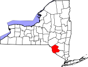
Cochecton, New York — Town — Location within the state of New York
 Cochecton, New York
Coordinates: 41°40′32″N 74°59′49″W / 41.67556°N 74.99694°W Country United States State New York County Sullivan Area - Total 37.4 sq mi (96.8 km2) - Land 36.7 sq mi (94.9 km2) - Water 0.7 sq mi (1.9 km2) Elevation 1,250 ft (381 m) Population (2000) - Total 1,328 - Density 36.2/sq mi (14.0/km2) Time zone Eastern (EST) (UTC-5) - Summer (DST) EDT (UTC-4) ZIP code 12726 Area code(s) 845 FIPS code 36-16661 GNIS feature ID 0978844 Cochecton is a town located in west-central Sullivan County, New York, USA. The population was 1,328 at the 2000 census. The name is an aboriginal word for "low land."
The Town of Cochecton (its official name) is situated on the Delaware River, directly across from Damascus, Pennsylvania, to which a bridge over the river provides access. The village of Cochecton has a ZIP code of 12726; the ZIP codes for two other communities located within the town's boundaries — Cochecton Center and Lake Huntington — are 12727 and 12752 respectively.
Contents
History
Cochecton was reportedly the home of Tammany, a Native American sage of the Lenape.
In the original charter of 1664, Cochecton marked the border between New York and New Jersey.along the Delaware river, a spot was marked named "station rock". this literal rock was the point of connection, summoning the borders between New York, New Jersey and Pennsylvania. After a long dispute - the New York-New Jersey Line War - the final border was set further South, near Port Jervis.
The town was formed from the Town of Bethel in 1828. The Town of Delaware was formed from part of Cochecton in 1869.
The town once had a station on the Binghamton branch of the Erie Lackawanna Railway, but passenger service on this branch ceased in 1971; the branch has since been taken over by Conrail.the Cochecton train station is the oldest surviving station in New York state. moved from its original site in the early 1990s, a local group of folks banded together to save the station from destruction. the local business Cochecton Mills, owned by the Nearing Family, gave the group, called the "Cochecton Preservation society" one year to dismantle the ancient building and get it off their property, so that business could continue. in that time the station was carefully, and successfully moved roughly one mile up stream to a spot on RT 97; still resting along the Erie railroad. More recently, various proposals were made to restore service on the line, but none have yet been adopted.
The correct pronunciation of the town's name is "cuh-SHEK-ton," leading many to mistakenly believe the name is of French origin; the name is in fact derived from "Cushektunk," a local Native American word meaning "low land" and "land of red rock" indicating the abundance of red shale rock throughout the town. (alluding to the town's location in the upper Delaware Valley).
Geography
The west town line is the border of Pennsylvania.
According to the United States Census Bureau, the town has a total area of 37.4 square miles (97 km2), of which, 36.7 square miles (95 km2) of it is land and 0.7 square miles (1.8 km2) of it (1.95%) is water.
Demographics
As of the census[1] of 2000, there were 1,328 people, 555 households, and 376 families residing in the town. The population density was 36.2 people per square mile (14.0/km²). There were 955 housing units at an average density of 26.1 per square mile (10.1/km²). The racial makeup of the town was 96.54% White, 0.90% African American, 0.08% Native American, 0.60% Asian, 0.98% from other races, and 0.90% from two or more races. Hispanic or Latino of any race were 1.66% of the population.
There were 555 households out of which 27.2% had children under the age of 18 living with them, 56.0% were married couples living together, 7.0% had a female householder with no husband present, and 32.1% were non-families. 26.8% of all households were made up of individuals and 12.1% had someone living alone who was 65 years of age or older. The average household size was 2.38 and the average family size was 2.89.
In the town the population was spread out with 22.5% under the age of 18, 5.5% from 18 to 24, 27.3% from 25 to 44, 27.3% from 45 to 64, and 17.4% who were 65 years of age or older. The median age was 42 years. For every 100 females there were 101.2 males. For every 100 females age 18 and over, there were 99.0 males.
The median income for a household in the town was $41,250, and the median income for a family was $46,875. Males had a median income of $34,583 versus $24,844 for females. The per capita income for the town was $19,841. About 5.0% of families and 7.2% of the population were below the poverty line, including 10.5% of those under age 18 and 8.6% of those age 65 or over.
The peak population, reached during the 19th century, was about 3,000.
Communities and locations in Cochecton
- Cochecton (formerly Cushetunk) – The hamlet of Cochecton is on Route 97 by the Delaware River.
- Cochecton Center (formerly Stephensburgh) – A hamlet south of Lake Huntingdon on Route 52. The former Cochecton Center Methodist Episcopal Church was listed on the National Register of Historic Places in 2000.[2]
- East Cochecton – A hamlet between Cochecton and Fosterdale.
- Fosterdale – A hamlet in the eastern part of the town at Routes 17B and 52.
- Lake Huntington – A hamlet south of Fosterdale on Route 52. The Jewish Center of Lake Huntington was listed on the National Register of Historic Places in 2009.[2]
- Nobody Station – A location in the southwest part of the town.
- Skinners Falls – A location by the Delaware River, south of Cochection village.
- Tylertown – A location in the southeast part of the town.
References
- ^ "American FactFinder". United States Census Bureau. http://factfinder.census.gov. Retrieved 2008-01-31.
- ^ a b "National Register Information System". National Register of Historic Places. National Park Service. 2009-03-13. http://nrhp.focus.nps.gov/natreg/docs/All_Data.html.
External links
Coordinates: 41°42′21″N 75°03′38″W / 41.70583°N 75.06056°W
Municipalities and communities of Sullivan County, New York County seat: Monticello Towns Bethel | Callicoon | Cochecton | Delaware | Fallsburg | Forestburgh | Fremont | Highland | Liberty | Lumberland | Mamakating | Neversink | Rockland | Thompson | Tusten
Villages CDPs Other
hamletsBarryville | Bridgeville | Debruce | Grahamsville | Harris | Kiamesha Lake | Lew Beach‡ | Loch Sheldrake | Minisink Ford | Mountain Dale | Spring Glen | Summitville | White Lake | White Sulphur Springs | Woodbourne
Footnotes ‡This populated place also has portions in an adjacent county or counties
Categories:- Towns in New York
- Populated places in Sullivan County, New York


Wikimedia Foundation. 2010.