- Newfield, New York
-
Newfield, New York — Town — Location within the state of New York
 Newfield, New York
Coordinates: 42°21′16″N 76°36′1″W / 42.35444°N 76.60028°W Country United States State New York County Tompkins Area – Total 59.0 sq mi (152.7 km2) – Land 58.9 sq mi (152.5 km2) – Water 0.1 sq mi (0.2 km2) Elevation 1,601 ft (488 m) Population (2000) – Total 5,108 – Density 86.8/sq mi (33.5/km2) Time zone Eastern (EST) (UTC-5) – Summer (DST) EDT (UTC-4) ZIP code 14867 Area code(s) 607 FIPS code 36-50254 GNIS feature ID 0979263 Newfield is a town in Tompkins County, New York, United States. The population was 5,108 at the 2000 census. The town's name is derived from the many unoccupied tracts of land that were once in the town.
The Town of Newfield is in the southwest part of the county and is southwest of Ithaca, New York.
Contents
History
Newfield was formed, before Tompkins County was created, from the Town of Spencer (in Tioga County) in 1811 as the "Town of Cayuta." In 1822, the town assumed its current name.
During the Depression many abandoned farms were turned into conservation lands. Newfield contains one of New York State's few remaining covered bridges.
Geography
According to the United States Census Bureau, the town has a total area of 59.0 square miles (153 km2), of which, 58.9 square miles (153 km2) of it is land and 0.1 square miles (0.26 km2) of it (0.15%) is water.
The south and west town lines are the border of Schuyler County.
New York State Route 13 is a northeast to southwest highway in Newfield. Conjoined New York State Route 34 and New York State Route 96 form a north-south highway in the eastern part of the town.
Demographics
As of the census[1] of 2000, there were 5,108 people, 2,052 households, and 1,352 families residing in the town. The population density was 86.8 people per square mile (33.5/km²). There were 2,203 housing units at an average density of 37.4 per square mile (14.4/km²). The racial makeup of the town was 96.06% White, 1.08% African American, 0.55% Native American, 0.37% Asian, 0.49% from other races, and 1.45% from two or more races. Hispanic or Latino of any race were 1.04% of the population.
There were 2,052 households out of which 34.4% had children under the age of 18 living with them, 50.0% were married couples living together, 11.4% had a female householder with no husband present, and 34.1% were non-families. 25.0% of all households were made up of individuals and 7.6% had someone living alone who was 65 years of age or older. The average household size was 2.49 and the average family size was 2.98.
In the town the population was spread out with 27.2% under the age of 18, 7.6% from 18 to 24, 31.5% from 25 to 44, 24.9% from 45 to 64, and 8.8% who were 65 years of age or older. The median age was 36 years. For every 100 females there were 93.4 males. For every 100 females age 18 and over, there were 91.7 males.
The median income for a household in the town was $36,693, and the median income for a family was $43,147. Males had a median income of $29,353 versus $27,064 for females. The per capita income for the town was $17,735. About 6.9% of families and 9.1% of the population were below the poverty line, including 11.3% of those under age 18 and 3.0% of those age 65 or over.
Communities and locations in Newfield
- Connecticut Hill Wildlife Management Area – A conservation area in the northwest part of Newfield.
- Kellogg Corners – A location south of Newfield village.
- Newfield – The hamlet of Newfield is located on NY-13.
- Newfield Station – A location northeast of Newfield village on NY-34
- Robert H. Treman State Park – A state park partly in the north part of the town.
- Stratton – A hamlet in the eastern part of the town on NY-34.
- Trumbull Corners – A hamlet northwest of Newfield village.
References
- ^ "American FactFinder". United States Census Bureau. http://factfinder.census.gov. Retrieved 2008-01-31.
External links
- Town of Newfield, NY
- [www.newfieldschools.org Newfield School]
Coordinates: 42°21′43″N 76°35′27″W / 42.36194°N 76.59083°W
Municipalities and communities of Tompkins County, New York City 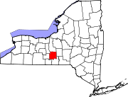
Towns Villages Cayuga Heights | Dryden | Freeville | Groton | Lansing | Trumansburg
CDPs Other
hamletsCategories:- Towns in New York
- Populated places in Tompkins County, New York


Wikimedia Foundation. 2010.