- Stone Ridge, New York
Infobox Settlement
official_name = Stone Ridge, New York
settlement_type = CDP
nickname =
motto =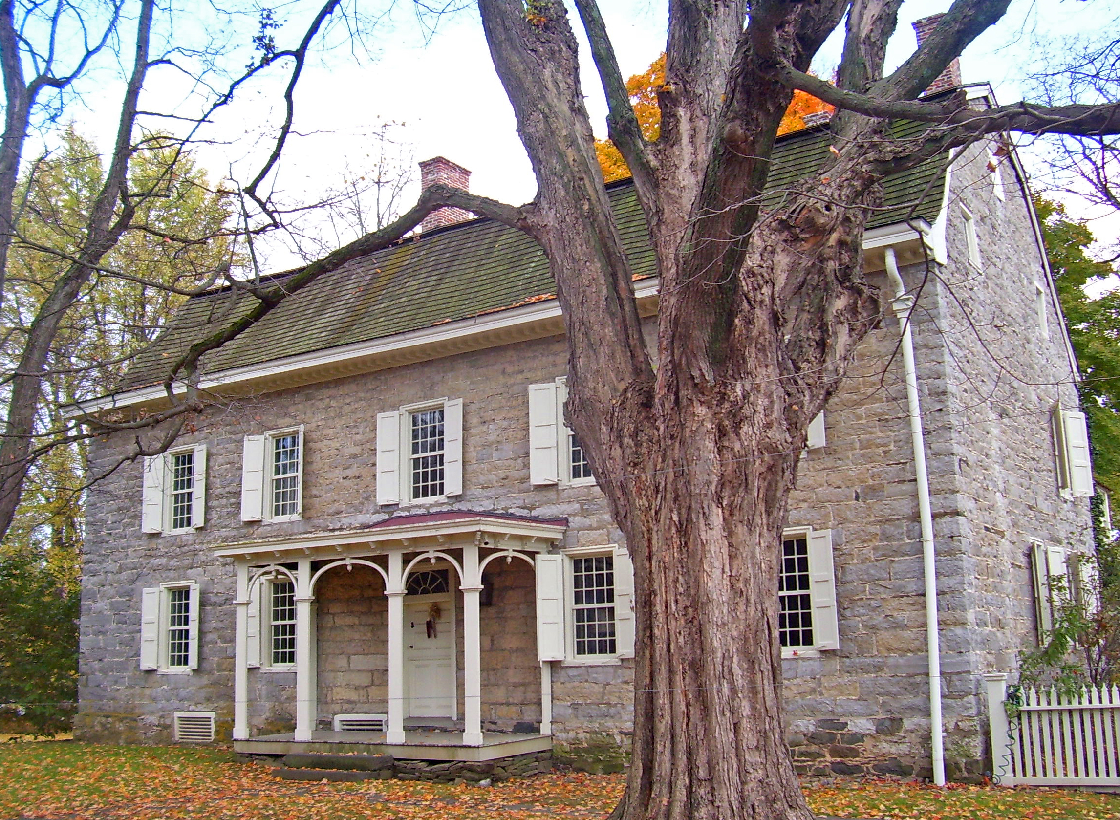
imagesize = 300px
image_caption =George Washington slept in Cornelius Wynkoop's house, part of the Main Street Historic District
image_|pushpin_
pushpin_label_position =
pushpin_map_caption =Location within the state of New York
pushpin_mapsize =
mapsize =
map_caption =
mapsize1 =
map_caption1 =subdivision_type = Country
subdivision_name =United States
subdivision_type1 = State
subdivision_name1 =New York
subdivision_type2 = County
subdivision_name2 = Ulster
government_footnotes =
government_type =
leader_title =
leader_name =
leader_title1 =
leader_name1 =
established_title =
established_date =area_footnotes =
area_magnitude =
area_total_km2 = 13.6
area_land_km2 = 13.5
area_water_km2 = 0.1
area_total_sq_mi = 5.2
area_land_sq_mi = 5.2
area_water_sq_mi = 0.0population_as_of = 2000
population_footnotes =
population_total = 1173
population_density_km2 = 86.9
population_density_sq_mi = 225.0timezone = Eastern (EST)
utc_offset = -5
timezone_DST = EDT
utc_offset_DST = -4
elevation_footnotes =
elevation_m = 111
elevation_ft = 364
latd = 41 |latm = 50 |lats = 45 |latNS = N
longd = 74 |longm = 9 |longs = 23 |longEW = Wpostal_code_type =
ZIP code
postal_code = 12484
area_code = 845
blank_name = FIPS code
blank_info = 36-71597
blank1_name = GNIS feature ID
blank1_info = 0966515
website =
footnotes =Stone Ridge is a hamlet (and
census-designated place ) in Ulster County,New York ,United States . The population was 1,173 at the 2000 census.Stone Ridge is located in the Town of Marbletown, along US 209 where it overlaps NY 213.
Geography
Stone Ridge is located at 41°50'45" North, 74°9'23" West (41.845867, -74.156494)GR|1.
According to the
United States Census Bureau , the CDP has a total area of 5.2square mile s (13.6km² ), of which, 5.2 square miles (13.5 km²) of it is land and 0.04 square miles (0.1 km²) of it (0.76%) is water.Demographics
As of the
census GR|2 of 2000, there were 1,173 people, 458 households, and 327 families residing in the CDP. Thepopulation density was 225.0 per square mile (86.9/km²). There were 501 housing units at an average density of 96.1/sq mi (37.1/km²). The racial makeup of the CDP was 94.46% White, 1.71% Black or African American, none Native American, 1.88% Asian, none Pacific Islander, 0.51% from other races, and 1.45% from two or more races. Hispanic or Latino of any race were 3.41% of the population.There were 458 households out of which 30.3% had children under the age of 18 living with them, 59.4% were married couples living together, 7.0% had a female householder with no husband present, and 28.6% were non-families. 25.1% of all households were made up of individuals and 9.6% had someone living alone who was 65 years of age or older. The average household size was 2.50 and the average family size was 3.01.
In the CDP the population was spread out with 22.3% under the age of 18, 6.6% from 18 to 24, 25.3% from 25 to 44, 30.2% from 45 to 64, and 15.5% who were 65 years of age or older. The median age was 43 years. For every 100 females there were 91.0 males. For every 100 females age 18 and over, there were 90.6 males.
The median income for a household in the CDP was $39,271, and the median income for a family was $68,977. Males had a median income of $35,000 versus $26,176 for females. The
per capita income for the CDP was $21,465. About 8.3% of families and 12.2% of the population were below thepoverty line , including 8.6% of those under age 18 and 7.9% of those age 65 or over.References
External links
* [http://www.nutshellrealty.com/StoneRidge.php Stone Ridge New York Real Estate] NutshellRealty.com Ulster County's Number 1 source for real estate listings
* [http://www.stoneridgelibrary.org/ Stone Ridge Public Library]

Wikimedia Foundation. 2010.