- Northwest, North Carolina
-
Northwest, North Carolina — City — Location of Northwest, North Carolina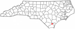
Coordinates: 34°18′34″N 78°9′10″W / 34.30944°N 78.15278°WCoordinates: 34°18′34″N 78°9′10″W / 34.30944°N 78.15278°W Country United States State North Carolina County Brunswick Area – Total 6.1 sq mi (15.9 km2) – Land 6.1 sq mi (15.9 km2) – Water 0.0 sq mi (0.0 km2) Elevation 52 ft (16 m) Population (2000) – Total 671 – Density 109.2/sq mi (42.2/km2) Time zone Eastern (EST) (UTC-5) – Summer (DST) EDT (UTC-4) FIPS code 37-47860[1] GNIS feature ID 1027435[2] Northwest is a city in Brunswick County, North Carolina, United States. The population was 671 at the 2000 census. It is part of the Wilmington Metropolitan Statistical Area.
Geography
Northwest is located at 34°18′34″N 78°9′10″W / 34.30944°N 78.15278°W (34.309517, -78.152817).[3]
According to the United States Census Bureau, the city has a total area of 6.1 square miles (16 km2), all of it land.
Demographics
As of the census[1] of 2000, there were 671 people, 260 households, and 185 families residing in the city. The population density was 109.2 people per square mile (42.2/km²). There were 293 housing units at an average density of 47.7 per square mile (18.4/km²). The racial composition of the city was: 26.83% White, 71.83% Black or African American, 0.75% Hispanic or Latino American, 0.30% Asian American, 0.45% Native American, 0.03% Native Hawaiian or Other Pacific Islander, 0.15% other races, and 0.45% two or more races.
There were 260 households out of which 32.3% had children under the age of 18 living with them, 48.5% were married couples living together, 18.5% had a female householder with no husband present, and 28.5% were non-families. 24.2% of all households were made up of individuals and 8.5% had someone living alone who was 65 years of age or older. The average household size was 2.58 and the average family size was 3.07.
In the city the population was spread out with 26.7% under the age of 18, 5.5% from 18 to 24, 27.9% from 25 to 44, 27.0% from 45 to 64, and 13.0% who were 65 years of age or older. The median age was 40 years. For every 100 females there were 79.4 males. For every 100 females age 18 and over, there were 80.9 males.
The median income for a household in the city was $31,250, and the median income for a family was $37,500. Males had a median income of $29,821 versus $19,479 for females. The per capita income for the city was $16,419. About 14.0% of families and 17.6% of the population were below the poverty line, including 21.8% of those under age 18 and 15.6% of those age 65 or over.
References
- ^ a b "American FactFinder". United States Census Bureau. http://factfinder.census.gov. Retrieved 2008-01-31.
- ^ "US Board on Geographic Names". United States Geological Survey. 2007-10-25. http://geonames.usgs.gov. Retrieved 2008-01-31.
- ^ "US Gazetteer files: 2010, 2000, and 1990". United States Census Bureau. 2011-02-12. http://www.census.gov/geo/www/gazetteer/gazette.html. Retrieved 2011-04-23.
Municipalities and communities of Brunswick County, North Carolina Cities Boiling Spring Lakes | Northwest | Southport
Towns Belville | Bolivia | Calabash | Carolina Shores | Caswell Beach | Holden Beach | Leland | Navassa | Oak Island | Ocean Isle Beach | Sandy Creek | Shallotte | St. James | Sunset Beach | Varnamtown
Townships Lockwoods Folly | Northwest | Shallotte | Smithville | Town Creek | Waccamaw
Village Unincorporated
communitiesCategories:- Cities in North Carolina
- Populated places in Brunswick County, North Carolina
- Populated places in North Carolina with African American majority populations


Wikimedia Foundation. 2010.