- Conover, North Carolina
-
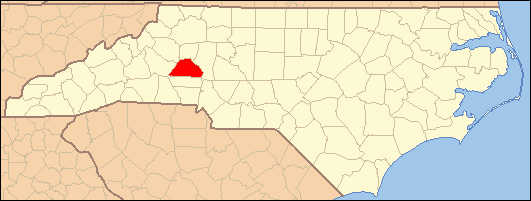
Conover, North Carolina — City — Nickname(s): "Wye Town""Canova" Motto: Community and Industry Location of Conover, North Carolina
Coordinates: 35°42′40″N 81°13′11″W / 35.71111°N 81.21972°WCoordinates: 35°42′40″N 81°13′11″W / 35.71111°N 81.21972°W Country United States State North Carolina County Catawba Government – Type Council-Manager – Mayor Area – Total 10.845 sq mi (26.5 km2) – Land 10.845 sq mi (26.5 km2) – Water 0.0 sq mi (0.0 km2) Elevation 1,060 ft (323 m) Population (2010) – Total 8,180 – Density 749.4/sq mi (249.2/km2) Time zone Eastern (EST) (UTC-5) – Summer (DST) EDT (UTC-4) ZIP code 28613 Area code(s) 828 FIPS code 37-14340[1] GNIS feature ID 0983463[2] Website http://www.conovernc.gov Conover is a city in Catawba County, North Carolina, United States. The population was 8,180 at the 2010 census. It is part of the Hickory–Lenoir–Morganton Metropolitan Statistical Area. Conover is home to the Greater Hickory Classic at Rock Barn.
Contents
Geography
Conover is located at 35°42′40″N 81°13′11″W / 35.71111°N 81.21972°W (35.711232, -81.219608)[3].
According to the United States Census Bureau, the city has a total area of 10.845 square miles (28.09 km2), all of it land.
Demographics
As of the census[1] of 2010, there were 8,180 people, 3,456 households, and 2,945 families residing in the city. The population density was 749.4 people per square mile (249.2/km²). There were 3,654 housing units at an average density of 336.9 per square mile (108.7/km²). The racial makeup of the city was 84.40% White, 8.43% African American, 0.23% Native American, 3.13% Asian, 0.03% Pacific Islander, 2.62% from other races, and 1.15% from two or more races. Hispanic or Latino of any race were 7.83% of the population.
There were 3,654 households out of which 27.3% had children under the age of 18 living with them, 52.3% were married couples living together, 11.6% had a female householder with no husband present, and 32.1% were non-families. 27.5% of all households were made up of individuals and 10.5% had someone living alone who was 65 years of age or older. The average household size was 2.46 and the average family size was 2.90.
In the city the population was spread out with 21.4% under the age of 18, 8.2% from 18 to 24, 31.0% from 25 to 44, 24.0% from 45 to 64, and 15.4% who were 65 years of age or older. The median age was 38 years. For every 100 females there were 90.5 males. For every 100 females age 18 and over, there were 88.4 males.
The median income for a household in the city was $45,806, and the median income for a family was $48,681. Males had a median income of $31,250 versus $25,581 for females. The per capita income for the city was $19,985. About 8.1% of families and 11.9% of the population were below the poverty line, including 21.8% of those under age 18 and 9.6% of those age 65 or over.
History
The City of Conover began to develop in the mid 1800's as a "Y" intersection of the railroad traversing North Carolina. Although originally called Wye Town, legend says the name Canova was adopted, but transposed to Conover, over several years.
The town of Conover had its beginning in the year 1871, when, according to early history of the community, the late Francis Smyre secured a portion of land from J. P. Spencer and erected a home for himself and his bride who was before her marriage Miss Ellen Miller, daughter of Ephriam and Amy Isenhower Miller.
Their son, Clinton Eugene Smyre was the first child to be born here."
The site chosen by the Smyres for Conover's first residence was known as the "WYE" and was a junction point from which the Southern Railway ran a branch line or track to the town of Newton, three miles to the south. This junction point served as a turn table for trains going either North or South.
Transportation
Conover is located in the western piedmont area of North Carolina. Conover is located approximately 50 miles northwest of Charlotte; 60 miles west of Winston-Salem; and 80 miles east of Asheville, and is the geographic center of Catawba County.
Interstate 40 traverses the City along with other major roads including US 70, US 321, US Highway 70A, and NC 16, making it easy to access the City from any direction.
Mass Transit
- Greenway Bus Transportaion(Main office located in Conover)
- Conover has been designated a stop on the future Western NC Rail service.
Education
Elementary Schools
- Shuford Elementary School
- South Newton Elementary School
- Thorton Elementary School
- Conover School
- Lyle Creek Elementary School-(Catawba County Schools)
Middle Schools
- Newton-Conover Middle School
High Schools
- Newton-Conover High School
- Newton-Conover Health and Science High
Private Schools
- Tri-City Christian School,(Baptist)
- Concordia Christian Day School
- University Christian High School
Higher Education
- Catawba Valley Community College
- Hickory Metro Higher Education Center
- Lenoir-Rhyne University
- NC Center for Engineering Technologies
Notable people
- Birthplace of Pauletta Pearson Washington-(wife of actor Denzel Washington)
- Birthplace of Dale Jarrett-NASCAR Driver
- Morgan Shepherd- NASCAR Driver
- Glenn Jarrett- Former NASCAR Driver
- Ned Jarrett- Former NASCAR Driver, And two-time NASCAR Champion.
- Rachel Lee Carter- professional model, beauty queen, Christian speaker, actor, author and Bible teacher
- Margret "Sparky" Sparkman- National Gourd Lady.
Media
- The Claremont Courier, free monthly publication.
- The Hickory Daily Record is published 7 days a week.
- Local television station is WHKY-TV, channel 14.
References
- ^ a b "American FactFinder". United States Census Bureau. http://factfinder.census.gov. Retrieved 2008-01-31.
- ^ "US Board on Geographic Names". United States Geological Survey. 2007-10-25. http://geonames.usgs.gov. Retrieved 2008-01-31.
- ^ "US Gazetteer files: 2010, 2000, and 1990". United States Census Bureau. 2011-02-12. http://www.census.gov/geo/www/gazetteer/gazette.html. Retrieved 2011-04-23.
External links
Municipalities and communities of Catawba County, North Carolina City 
Towns CDPs Unincorporated
communitiesFootnotes ‡This populated place also has portions in an adjacent county or counties
Categories:- Cities in North Carolina
- Populated places in Catawba County, North Carolina
- The Unifour

Wikimedia Foundation. 2010.