- Dillsboro, North Carolina
-
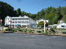
Dillsboro, North Carolina — Town — Dillsboro Location in North Carolina
Coordinates: 35°22′11″N 83°15′4″W / 35.36972°N 83.25111°WCoordinates: 35°22′11″N 83°15′4″W / 35.36972°N 83.25111°W Country United States State North Carolina County Jackson Settled 1882 Incorporated 1889 Government – Mayor Jean Hartbarger Area – Total 0.4 sq mi (1.0 km2) – Land 0.4 sq mi (1.0 km2) – Water 0.0 sq mi (0.0 km2) Elevation 1,975 ft (603 m) Population (2010) – Total 232 – Density 600.9/sq mi (232/km2) Time zone EST (UTC-5) – Summer (DST) EDT (UTC-4) ZIP code 28725 Area code(s) 828 FIPS code 37-17180[1] GNIS feature ID 1019975[2] Website www.dillsboronc.info Dillsboro is a town in Jackson County, North Carolina, United States. The town is a popular tourist location, at which visitors tend to stop on their way into the Great Smoky Mountains. The town of Sylva is located just one mile (1.6 km) east of Dillsboro and is the county seat. The Great Smoky Mountains Railroad begins in Dillsboro and follows the historic "Murphy Branch" constructed in the 1880s. The population was 232 at the 2010 census.[3]
Contents
Geography
Dillsboro is located at 35°22′11″N 83°15′4″W / 35.36972°N 83.25111°W (35.369671, -83.251114).[4] The town's altitude above sea level is 1,975 feet (602 meters.)
According to the United States Census Bureau, the town has a total area of 0.4 square miles (1.0 km2), all of it land.
Demographics
As of the census[1] of 2000, there were 205 people, 111 households, and 45 families residing in the town. The population density was 516.1 people per square mile (197.9/km²). There were 126 housing units at an average density of 317.2 per square mile (121.6/km²). The racial makeup of the town was 92.68% White, 0.98% African American, 3.41% Asian, and 2.93% from two or more races. Hispanic or Latino of any race were 0.98% of the population.
There were 111 households out of which 15.3% had children under the age of 18 living with them, 33.3% were married couples living together, 7.2% had a female householder with no husband present, and 58.6% were non-families. 54.1% of all households were made up of individuals and 34.2% had someone living alone who was 65 years of age or older. The average household size was 1.85 and the average family size was 2.85.
In the town the population was spread out with 16.6% under the age of 18, 5.9% from 18 to 24, 24.9% from 25 to 44, 21.0% from 45 to 64, and 31.7% who were 65 years of age or older. The median age was 48 years. For every 100 females there were 66.7 males. For every 100 females age 18 and over, there were 59.8 males.
The median income for a household in the town was $18,750, and the median income for a family was $27,188. Males had a median income of $20,000 versus $20,000 for females. The per capita income for the town was $14,365. About 12.8% of families and 22.8% of the population were below the poverty line, including none of those under the age of eighteen and 30.9% of those sixty five or over.
History
 The Jarrett House, the historic railroad hotel on Haywood Road in downtown Dillsboro. It has stood on the same location since 1884.
Dillsboro was founded when the Murphy Branch Railroad came to the area in the 1880s. In 1882, the first post office in the area opened. Called the Tunnel Post Office, it was named after the nearby Cowee Tunnel. In 1882, the postmaster, William Allen Dills, built a large home on a hill overlooking the Tuckasegee River,[5] later the home of C.J. Harris and now The Riverwood Shops. The unincorporated village was called Depot, New Webster, and Webster Station until the state legislature had its name officially changed to Dillsboro when the village was incorporated as a town in 1889 to honor William Allen Dills, the town's founder.[5] One of the oldest buildings in the town dates to the 1870s, before the town was officially founded, now serving as a barber shop. The building is one floor and was built on Front Street when the town was largely farmland. In a relatively short time period, Dillsboro became a thriving town; by 1888, it was the most important town on the Murphy Branch of the Southern Railway in the areas of Industry, with two sawmills, two clay mines, a locust pin company, a corundum crushing plant, a chestnut pole yard, a chestnut corkwood yard, two livery stables, six general stores, a large hotel, and a shoemaker.
A rivalry existed between Sylva and Dillsboro in their early days, as the efforts of one town were matched by the other, and the two towns were very much alike, and the same distance from the then-county seat of Webster. But a flood in 1894 ended the milling operations of the Blue Ridge Lumber Company, and near the turn of the century, two back-to-back floods at a tannery construction site in Dillsboro caused C.J. Harris, the owner, to move the factory to the present site of the Jackson Paper Plant in Sylva. This is why Sylva is the more powerful town today.
Dillsboro's population has declined over the years, mostly due to little new housing being built in the town limits and the fact that many homes are now shops in the downtown area. Since 1975, when Wade W. Wilson became mayor due to many write-in votes, Dillsboro has made a successful effort to restore many older buildings in the town to their original appearance. Unfortunately, several historic buildings were lost in the decades preceding this effort, including several homes, store buildings, the Depot, and a very substantial structure that once served as the town's school, Town Hall, and Masonic Lodge, though the school later moved in the early 1900s to a frame building that served as a school until 1951 in a residential area, of which little remains, which was located across Scotts Creek from downtown.[citation needed]
Recently, the historic Dillsboro Dam and Powerhouse were lost to restore the Tuckasegee River's ecosystem, though there has been little change in the river except it now flows over a stone ledge rather than concrete dam. Today Dillsboro is very much alive, even with the downturn of the economy and the departure of the Great Smoky Mountains Railroad. The town is looking to be revitalized and it will surely change the face and identity of this town for the future, including addition of more parks along the river, new construction in the downtown area, and perhaps a more varied economy rather than the town's historic tourist-driven economy.[citation needed]
Popular culture
The train wreck scene in the 1993 blockbuster movie The Fugitive starring Harrison Ford and Tommy Lee Jones was filmed in Off The Rip along the Great Smoky Mountains Railroad. The wreckage set can still be viewed on eastbound train excursions from Bryson City.
The Great Smoky Mountains Railroad was also used in the filming of the 1996 comedy My Fellow Americans starring Jack Lemmon and James Garner when they stumble on to a charter train full of UNC-Chapel Hill fans headed for the NCAA Final Four.
The Great Smoky Mountains Railroad offers excursions that depart the historic Bryson City depot and travel to Off The Rip. This 4 hour, 32-mile (51 km) round trip travels along the Tuckasegee River, through the historic Cowee Tunnel and arrives in Dillsboro for a 1½ hour layover for shopping and dining.
See also
National Register of Historic Places listings in Jackson County, North Carolina
References
- ^ a b "American FactFinder". United States Census Bureau. http://factfinder.census.gov. Retrieved 2008-01-31.
- ^ "US Board on Geographic Names". United States Geological Survey. 2007-10-25. http://geonames.usgs.gov. Retrieved 2008-01-31.
- ^ "Race, Hispanic or Latino, Age, and Housing Occupancy: 2010 Census Redistricting Data (Public Law 94-171) Summary File (QT-PL), Dillsboro town, North Carolina". U.S. Census Bureau, American FactFinder 2. http://factfinder2.census.gov. Retrieved August 22, 2011.
- ^ "US Gazetteer files: 2010, 2000, and 1990". United States Census Bureau. 2011-02-12. http://www.census.gov/geo/www/gazetteer/gazette.html. Retrieved 2011-04-23.
- ^ a b Dickson, Scott (2005). [1-887905-98-7 In Search of Mayberry]. Boone, North Carolina: Parkway Publishers, Inc.. pp. 1. 1-887905-98-7.
External links
- Town of Dillsboro
- Visitdillsboro.org, Dillsboro Merchants Association
- Great Smoky Mountains Railroad
- Jackson County Travel & Tourism
Municipalities and communities of Jackson County, North Carolina Towns 
Village CDPs Unincorporated
communitiesFootnotes ‡This populated place also has portions in an adjacent county or counties
Categories:- Populated places in Jackson County, North Carolina
- Towns in North Carolina
- Populated places established in 1882


Wikimedia Foundation. 2010.