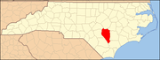
- Clinton, North Carolina
-
Clinton, North Carolina — City — 
SealLocation within the state of North Carolina
 Clinton, North Carolina
Coordinates: 35°0′9″N 78°19′44″W / 35.0025°N 78.32889°WCoordinates: 35°0′9″N 78°19′44″W / 35.0025°N 78.32889°W Country  United States
State  North Carolina
County Sampson County Settled 1740 Incorporated 1852 Government – Type Council-manager – Mayor Lew Starling Area – Total 7.75 sq mi (20.07 km2) – Land 7.75 sq mi (20.07 km2) – Water 0.04 sq mi (0.1 km2) Elevation 157 ft (48 m) Population (2010) – Total 8,639 – Density 1,114.7/sq mi (430.4/km2) Time zone EST (UTC-5) – Summer (DST) EDT (UTC-4) ZIP codes 28328-28329 Area code(s) 910 FIPS code 37-13240[1] GNIS feature ID 0983293[2] Website http://www.cityofclintonnc.com/ Clinton is the county seat of Sampson County, North Carolina, United States. The population of Clinton is 8,639 according to the 2010 US Census. Clinton is named for American Revolution General Richard Clinton.[3]
Contents
History
The first European settlers came to the Clinton area around 1740. The community was originally Clinton Courthouse. There was an earlier incorporated town of Clinton in Rowan County (now Davie County); however, the town folded in 1822. The City of Clinton was incorporated in 1852. The General Assembly appointed five commissioners: James Moseley, Isaac Boykin, Dr. Henry Bizzel, John Beaman, and Alfred Johnson. The corporate limits of the town at that time extended a half mile each way from the courthouse. The first records of an election were in February 1852 and the first tax rate was $0.50 per $100 valuation of real property. Clinton is the geographic center of the county, and because Sampson County is primarily rural farmland, Clinton developed as the major agricultural marketing center.
Geography
Clinton is located at 35°0′9″N 78°19′44″W / 35.0025°N 78.32889°W (35.002418, -78.328803).[4]
According to the United States Census Bureau, the city has a total area of 7.75 square miles (20.1 km2), 0.04 square miles (0.10 km2) of it (0.28%) is water.
Demographics
As of the census[1] of 2010, there were 8,639 people, 3,392 households, and 2,068 families residing in the city. The population density was 1,114.7 people per square mile (430.4/km²). There were 3,711 housing units at an average density of 478.8 per square mile (184.9/km²). The racial makeup of the city was 48.9% White, 40.5% African American, 1.2% Native American, 1.1% Asian, 0.03% Pacific Islander, 6.1% from other races, and 2.2% from two or more races. Hispanic or Latino of any race were 9.2% of the population.
There were 3,392 households, out of which 25.3% had children under the age of 18 living with them, 36.4% were married couples living together, 20.5% had a female householder with no husband present, and 39.0% were non-families; 36.6% of all households were made up of individuals and 18.1% had someone living alone who was 65 years of age or older. The average household size was 2.27 and the average family size was 2.95.
The age distruibution of the city was 23.6% under the age of 20, 23.8% from 20 to 39, 32.1% from 40 to 64, and 21.5% age 65 years or older. The median age was 42.1 years. For every 100 females there were 90.4 males. For every 100 females age 18 and over, there were 86.1 males.
The median income for a household in the city was $25,904, and the median income for a family was $36,144. Males had a median income of $30,605 versus $21,654 for females. The per capita income for the city was $15,672. About 18.1% of families and 23.3% of the population were below the poverty line, including 31.5% of those under age 18 and 25.2% of those age 65 or over.
Notable people
- Gabriel Holmes - Governor of North Carolina 1821–1824, (1769 - Sep. 26, 1829)
- William Rufus DeVane King - 13th Vice-President of the United States, (Apr. 7, 1786 – Apr. 18, 1853)
- Theophilus H. Holmes - U.S. Army officer and Confederate general in the American Civil War (Nov. 13, 1804 – Jun. 21, 1880)
- Lauch Faircloth - U.S. Senator (R-NC) 1993-99, born: Jan. 14, 1928
- Dennis Owens - Former NFL player (New England Patriots), born: Feb. 24, 1960
- Jerris McPhail - Former NFL player (Miami Dolphins and Detroit Lions), born: Jun. 26, 1972
- Leonard Henry - Former NFL player (Miami Dolphins, NY Jets, and Oakland Raiders), born: Jan. 5, 1978
- Willie Parker - Running back for the Pittsburgh Steelers, Washington Redskins, and Virginia Destroyers, born: Nov. 11, 1980
- Sam Aiken - Wide receiver for the New England Patriots, Buffalo Bills, and Cleveland Browns, born: Dec 14, 1980
- Curtis Smith - IHRA World Champion Drag Racer. Also holds many records in drag racing
- E.R. Mason - statesman, artist, blues musician, assistant principal, born: March 14, 1916
- Pearl Fryar - Topiary Artist
References
- ^ a b "American FactFinder". United States Census Bureau. http://factfinder.census.gov. Retrieved 2008-01-31.
- ^ "US Board on Geographic Names". United States Geological Survey. 2007-10-25. http://geonames.usgs.gov. Retrieved 2008-01-31.
- ^ "A History of Sampson County". Archived from the original on 2006-10-22. http://web.archive.org/web/20061022223133/http://www.carolana.com/sampson_county_nc.html. Retrieved 2008-11-30.
- ^ "US Gazetteer files: 2010, 2000, and 1990". United States Census Bureau. 2011-02-12. http://www.census.gov/geo/www/gazetteer/gazette.html. Retrieved 2011-04-23.
External links
- Official Clinton, NC website
- Clinton-Sampson Chamber of Commerce
- Clinton City Schools
- Sampson Community College
- Sampson County Arts Council
- Sampson Community Theatre
- Sampson County History Museum
- Sampson County Convention & Visitors Bureau
Municipalities and communities of Sampson County, North Carolina County seat: ClintonCity Clinton
Towns Autryville | Faison‡ | Falcon‡ | Garland | Harrells‡ | Newton Grove | Roseboro | Salemburg | Turkey
CDPs Bonnetsville | Delway | Ingold | Ivanhoe | Keener | Plain View | Spivey's Corner | Vann Crossroads
Unincorporated
communitiesFootnotes ‡This populated place also has portions in an adjacent county or counties
Categories:- Cities in North Carolina
- Populated places in Sampson County, North Carolina
- County seats in North Carolina
- Populated places established in 1740


Wikimedia Foundation. 2010.