- Dura, Hebron
-
Dura Other transcription(s) - Arabic دورا - Also spelled Durrah (official) 
Municipal Seal of DuraLocation of Dura within the Palestinian territories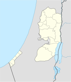
 Dura
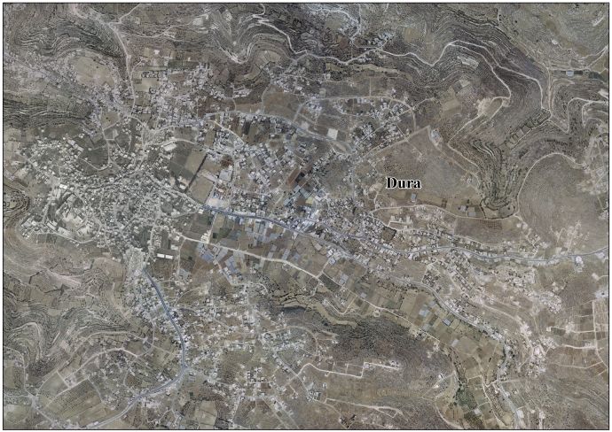
DuraCoordinates: 31°30′24.45″N 35°01′39.78″E / 31.5067917°N 35.0277167°ECoordinates: 31°30′24.45″N 35°01′39.78″E / 31.5067917°N 35.0277167°E Governorate Hebron Government - Type City (from 1967) - Head of Municipality Mustafa Khalil Rjoub Population (2007) - Jurisdiction 28,268 Dura (Arabic: دورا) is a Palestinian town located eleven kilometers southwest of Hebron in the Hebron Governorate in the southern West Bank. According to the Palestinian Central Bureau of Statistics, the town had a population of over 28,268 in 2007.[1] The current mayor is Mustafa Khalil Rjoub.
Contents
Etymology
According to the municipality, the name "Dura" is derived from a Canaanite word meaning house and not the Arabic word for corn.
Its ancient name is Adoraim, and is mentioned in the Bible (2 Chronicles 11:9) as one of the cities fortified by Rehoboam.
The town was referred to as "Adora" during the Hellenistic and Roman periods. Between the years 57 and 47 BCE, the region of ancient Palestine was divided into five districts, or synedria, with Adora likely serving as the capital of eastern Idumaea.[2] After this, Idumaea became attached to the district of Judaea to the north, and the once heavily Hellenized city became predominantly Jewish.[3] It seems to have remained so until the spread of Christianity in Palestine in the Byzantine period (beginning in the late fourth century CE).
For more information on the Biblical reference to Adora/Adurim/Adoraim see Adurim.History
In the early Muslim period, Dura was famous for its vineyards and a type of raisin called Duri.[4]
In 1596, Dura appeared in Ottoman tax registers as being in the Nahiya of Khalil of the Liwa of Quds. It had a population of 49 Muslim households and paid taxes on wheat, barley, olives, vines or fruit trees, and goats or beehives.[5]
In 1883, the Survey of Western Palestine described Dura as "A large and nourishing village on the flat slope of a hill, with open ground on the east for about a mile. This plain is cultivated with corn. To the north of Dura are a few olives, and others on the south. The houses are of stone. South of the village are two Mukams with white domes; and on the west, higher than the village, is the tomb of Neby Nuh. Near these there are rock-cut sepulchres. The place is well supplied from three springs on the east and one on the south."[6]
During the Ottoman period, Dura's inhabitants staged an uprising against the Egyptian Ibrahim Pasha, who was rebelling against the legitimate Ottoman sultan. Similar uprisings occurred against the British Mandate and Dura was besieged by the British for six months and was forced to pay fines.[citation needed]
The report of the 1931 census wrote that "the village in the Hebron sub-district commonly known as Dura is a congeries of neighbouring localities each of which has a distinctive name; and, while Dura is a remarkable example of neighbourly agglutination, the phenomenon is not infrequent in other villages". The total of 70 locations listed in report was 1538 occupied houses and a population of 7255 Muslims.[7]
Dura was established as a municipality on January 1, 1967, five months before it was occupied by Israel during the Six-Day War. After the Palestinian National Authority was ceded control of the town in 1995, a local committee was set up to prevent land confiscation from the town and the municipal council was expanded. Many Palestinian ministries and governmental institutions opened offices in Dura, enhancing its role in Palestinian politics.
Climate
The climate of Dura is dry in the summers and experiences moderate precipitation during winter. Average annual precipitation depend on specific geographic locations within the town. The area of Dahr Alhadaba receives an annual average of 400–600 mm of rain, southern slopes 300–400 mm and the northern region of the Dura hills 250-300.
Notable residents
- Khalid Amayreh – journalist; regular columnist for Al-Ahram
- Nabil Amr, politician (born in Doura)
References
- ^ 2007 PCBS Census Palestinian Central Bureau of Statistics. p.119.
- ^ Josephus, Antiquities of the Jews 14.91; and M. Avi-Yonah, The Holy Land: A Historical Geography from the Perisan to the Arab Conquest (Jerusalem: Carta, 2002), p. 84.
- ^ Avi-Yonah, p. 96.
- ^ The Pilgrimage of Arculfus in the Holy Land (ca. 670). Palestine Pilgrims Text Society. 1895. p. 69.
- ^ Wolf-Dieter Hütteroth and Kamal Abdulfattah (1977). Historical Geography of Palestine, Transjordan and Southern Syria in the Late 16th Century. Erlanger Geographische Arbeiten, Sonderband 5. Erlangen, Germany: Vorstand der Fränkischen Geographischen Gesellschaft. p. 124.
- ^ C. R. Conder and H. H. Kitchener (1883). The Survey of Western Palestine. III. London: The Committe of the Palestine Exploration Fund. p. 304.
- ^ E. Mills, ed (1932). Census of Palestine 1931. Population of Villages, Towns and Administrative Areas. Jerusalem: Government of Palestine. pp. Preface,28–32.
External links
- Dura Town (Fact Sheet)
- Dura Town Profile
- Dura Area Photo
- The priorities and needs for development in Dura town based on the community and local authorities’ assessment
 Cities in Palestinian National Authority areas
West Bank Gaza Strip Hebron Governorate Cities 

Municipalities Bani Na'im · Beit Awwa · Beit Ula · Beit Ummar · Deir Sammit · Idhna · Kharas · Nuba · Sa'ir · as-Samu · Surif · Taffuh · TarqumiyahVillage Councils Beit 'Amra · Beit Einun · Beit Kahil · Beit ar-Rush al-Fauqa · Beit ar-Rush al-Tahta · al-Burj · Deir al-'Asal al-Fauqa · Deir al-'Asal al-Tahta · Deir Razih · ad-Duwwara · Hadab al-Fawwar · al-Heila · Hureiz · Imreish · al-Kum · Karma · al-Karmil · Khalet al-Maiyya · Khirbet Safa · Khirbat al-Simia · Khursa · Kuseis · al-Majd · Qalqas · Qila · al-Ramadien · ar-Rihiya · ash-Shuyukh · Shuyukh al-Arrub · as-Sura · at-Tabaqa · Tarrama · al-Uddeisa · ZifRefugee camps Categories:- Hebron Governorate
- Cities in the West Bank


Wikimedia Foundation. 2010.