- Cononley
-
Coordinates: 53°55′05″N 2°01′05″W / 53.918°N 2.018°W
Cononley 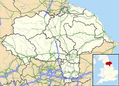
 Cononley
Cononley shown within North YorkshirePopulation 1,080 (2001 Census) OS grid reference SD988469 District Craven Shire county North Yorkshire Region Yorkshire and the Humber Country England Sovereign state United Kingdom Post town KEIGHLEY Postcode district BD20 Dialling code 01535 Police North Yorkshire Fire North Yorkshire Ambulance Yorkshire EU Parliament Yorkshire and the Humber UK Parliament Skipton and Ripon List of places: UK • England • Yorkshire Cononley is a village and civil parish in the Craven district of North Yorkshire, England. In the Aire Valley 3 miles south of Skipton and with an estimated population of 1,080 (2001 est.). It is situated near the A629 creating easy access to Skipton, Keighley and other nearby settlements. Also joined to the Leeds-Carlisle railway, the village has commuter access to Leeds and Bradford.
The village is served by Cononley railway station.
History and information
The settlement dates back to medieval times when much of the cultivated land formed part of the estate of Bolton Priory.
 Disused lead mine at Cononley in 1996
It is clear that most of the dwellings in Cononley date back to mostly the 17th century; the oldest surviving building (Milton House) dates from 1635,however it is rumoured that The Old Hall part of Cononley Hall which was thought to have been a Jacobite safe house in the 18th Century(escape tunnel in the fire place) could be much older and has a stone in the loft dated 1436!!, whilst the other half mostly date back to the first half of the 19th century which was when the village was a centre for hand loom weaving and lead mining.
By 1851, the population of Cononley had grown to 1,272. In the late 19th century most of the citizens of Cononley were employed in one of the two textile mills in the village. Back then Cononley was physically in the West Riding of Yorkshire whereas now it is in North Yorkshire.
Today, with a population of 1,080 (2001 census), farming is still significant as well as there being still a few local businesses. The number of people employed in industry within the village has radically declined over the last 25 years.
Housing development in the 20th century was very limited due to the lack of economic growth. Even so, the village is a quite popular place to live with its predominant stone buildings.
As well as part of the working community in the village commuting to Skipton and Keighley, a large number also travel large distances which is made possible by the frequent electric trains to Leeds and Bradford.
The village has a joint Anglican-Methodist church, a primary school, two pubs and a post office.
See also
External links
Categories:- Villages in North Yorkshire
- Civil parishes in North Yorkshire
- Craven (district)


Wikimedia Foundation. 2010.