- Cernay, Haut-Rhin
-
Cernay


 CernayLocation within Alsace region
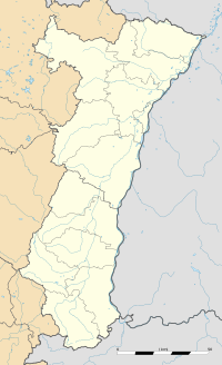 Cernay
Administration Country France Region Alsace Department Haut-Rhin Arrondissement Thann Canton Cernay Intercommunality Cernay et environs Mayor Michel Sordi
(2008–2014)Statistics Elevation 277–358 m (909–1,175 ft)
(avg. 295 m/968 ft)Land area1 18.04 km2 (6.97 sq mi) Population2 10,995 (2006) - Density 609 /km2 (1,580 /sq mi) INSEE/Postal code 68063/ 68700 1 French Land Register data, which excludes lakes, ponds, glaciers > 1 km² (0.386 sq mi or 247 acres) and river estuaries. 2 Population without double counting: residents of multiple communes (e.g., students and military personnel) only counted once. Coordinates: 47°48′26″N 7°10′36″E / 47.8072222222°N 7.17666666667°E
Cernay (in German Sennheim) is a commune in the Haut-Rhin department in Alsace in north-eastern France.
It is situated on the river Thur, 17 km northwest of Mulhouse.
Contents
Second World War
The Schutzstaffel had an "ideology school" for their soldiers, where "race theory" was part of the curriculum.[1]
External links
See also
References
- ^ Verdens Gang, 2010-11-11,Frivillig til tjeneste i helvete (An interview of former soldier Bjørn Lindstad),pages 44,45: "Du gikk på SS-ideologiskole i Sennheim og beskriver detaljert i boken om raselære og jødehets. Ble du ideologisk påvirket? — Sikkert, det ville vært rart ellers. Senere erfarte vi at jøder ikke var slik propagandaen fremstilte dem."
Categories:- Communes of Haut-Rhin
- Haut-Rhin geography stubs


Wikimedia Foundation. 2010.