- Blanca Peak
-
Blanca Peak Sisnaajiní (Navajo) 
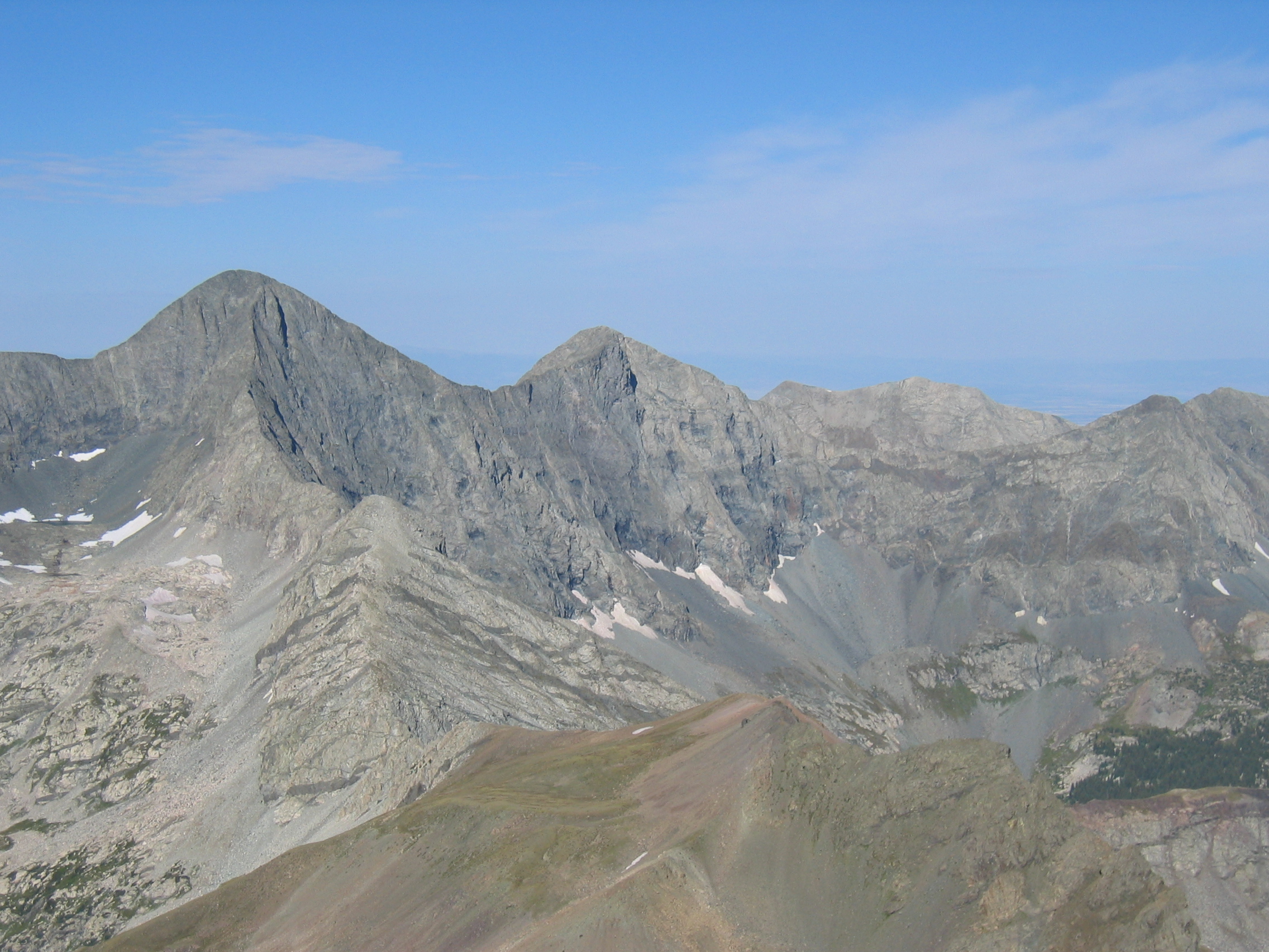
View of Blanca Peak (left of center) from Mt. LindseyElevation 14,345 ft (4,372 m) NGVD 29[1] Prominence 5,325 ft (1,623 m) [2] Listing Ultra
Colorado FourteenerLocation Colorado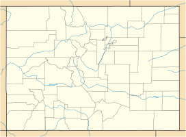
 Blanca Peak
Location Alamosa, Costilla, Huerfano counties, Colorado, USA Range Sangre de Cristo Range Coordinates 37°34′38″N 105°29′09″W / 37.57722°N 105.48583°WCoordinates: 37°34′38″N 105°29′09″W / 37.57722°N 105.48583°W[3] Topo map USGS Blanca Peak Climbing First ascent August 14, 1874 by the Wheeler Survey (first recorded) Easiest route Northwest Face/North Ridge: Scramble (Class 2/easy Class 3) Blanca Peak is the highest peak of the Sierra Blanca Massif at the southern tip of the Sangre de Cristo Mountains in the U.S. State of Colorado. It is the fourth highest peak of the Rocky Mountains, and the eighth highest peak in the contiguous United States.
Contents
Geography
It is located at the southern end of the Sangre de Cristo Range, a subrange of the larger Sangre de Cristo Mountains, and is the highest peak in both ranges. It marks the common boundary of Huerfano, Costilla and Alamosa counties, approximately 20 miles (32 km) ENE of the town of Alamosa. Approximately 15 miles (24 km) to the north-northwest is Great Sand Dunes National Park and Preserve.
Blanca Peak is notable not only for its absolute height, but also for its great local relief and dominant position at the end of the range, rising high above the San Luis Valley to the west. For example, it rises 6,600 ft (2011 m) over the edge of the San Luis Valley in only 6 mi (9.65 km).[4] Blanca is also the third most topographically prominent peak in Colorado; it is separated from the higher peaks in the Sawatch Range by relatively low Medano Pass (9,982 ft/3,043 m).
Blanca Peak heads up three major creeks. Holbrook Creek is on the west, flowing from a basin including Crater Lake, Blue Lakes, and Como Lake. An extremely challenging four wheel drive road accesses Como Lake (11,750 ft/3,580 m), and provides the most common access to Blanca Peak. Most vehicles stop at an elevation of between 8,000 ft and 10,000 ft (2,440 m-3,050 m) on this road. The Como Lake Road is a designated Alamosa County Road and runs to the edge of the Sangre de Cristo Wilderness just short of Blue Lakes. The Como Lake Road is rated as the most challenging 4WD road in Colorado. The Huerfano River flows from the north side of Blanca Peak. A road, starting out as a two wheel drive road, then becoming a four wheel drive road (less challenging than the Como Lake Road), provides access to the technical climbing on the North Face of Blanca Peak. Blanca Creek drains Blanca Basin under the south slopes of the peak, and Little Ute Creek descends from the Winchell Lakes on the southeast side. However these are not used to access the peak due to private property.
Three other fourteeners are nearby: Mount Lindsey to the east, Ellingwood Point to the north and Little Bear Peak to the southwest. Ellingwood Point is connected to Blanca by a short, high ridge, and is often climbed in conjunction with Blanca. Little Bear also has a high connecting ridge to Blanca, but it is a technical traverse, only recommended for highly experienced parties.[5]
Geology
The granite that makes up the Blanca massif is pre-Cambrian in age, dated at approximately 1.8 billion years old. The major part of the Wet Mountains to the east and the Front Range to the northeast are also pre-Cambrian, also about 1.8 billion years old. In contrast, the Sangre de Cristo Range to the north and the Culebra Range to the south are Permian rock between 250 and 300 million years old.
History
Blanca Peak is known to the Navajo people as the Sacred Mountain of the East: Sisnaajiní[6] (or Tsisnaasjiní[7]), the Dawn or White Shell Mountain. The mountain is considered to be the eastern boundary of the Dinetah, the traditional Navajo homeland. It is associated with the color white, and is said to be covered in daylight and dawn and fastened to the ground with lightning. It is gendered male.[6]
Summitpost notes that "the first recorded ascent of Blanca by the Wheeler Survey was recorded on August 14, 1874, but to their surprise they found evidence of a stone structure possibly built by Ute Indians or wandering Spaniards."[8]
Gallery
-

Leaf gold from the old Blanca Peak Mining Company claims
-

The north wall of Blanca Peak from the Lily Lake Trail
-

Ellingwood Point to the left, Blanca Peak to the right, from just above the Blue Lakes
-

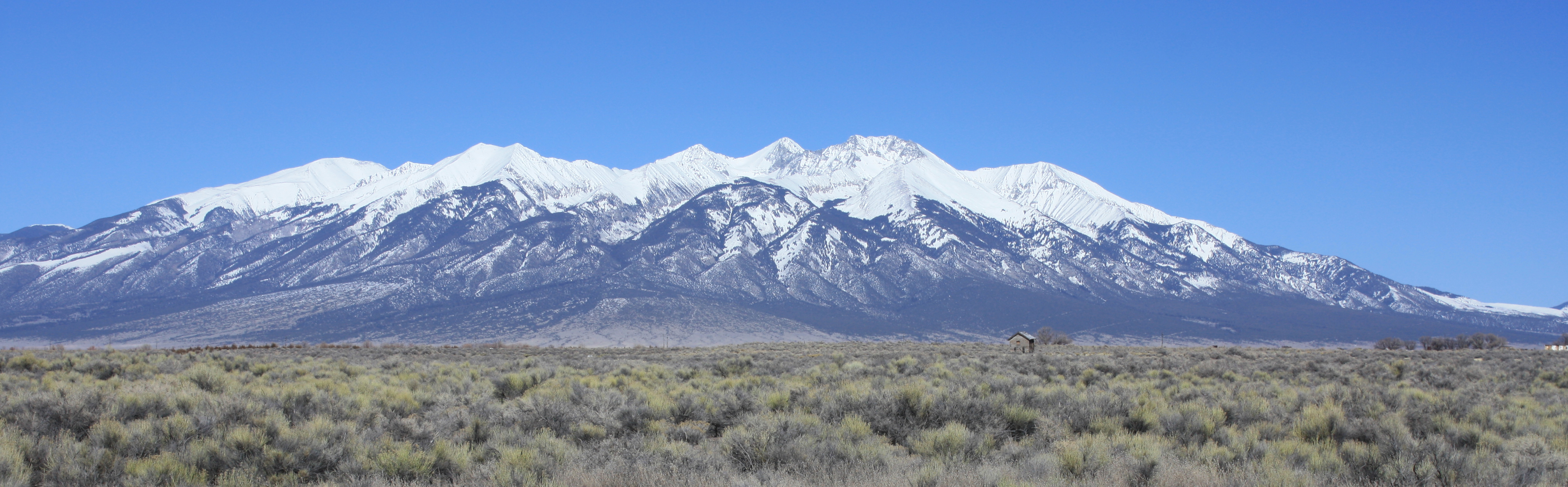
Panorama of the Sierra Blanca Massif viewed from milepost 240 along U.S. 160, seven miles east of Alamosa. Blanca Peak (14,345 ft /4,372 m) is the third peak from the right. (original photo at Flickr has annotations naming the individual peaks.)
See also
References
- ^ "Blanca Peak, Colorado". Peakbagger.com. http://www.peakbagger.com/peak.aspx?pid=5921. Retrieved 2011-02-23.
- ^ Colorado peaks on peaklist.org
- ^ "Blanca Peak". Geographic Names Information System, U.S. Geological Survey. http://geonames.usgs.gov/pls/gnispublic/f?p=gnispq:3:::NO::P3_FID:192735. Retrieved 2011-02-23.
- ^ Blanca Peak on TopoQuest
- ^ Louis W. Dawson II, Dawson's Guide to Colorado's Fourteeners, Volume 2, Blue Clover Press, 1996, ISBN 0-9628867-2-6
- ^ a b Robert S. McPherson, Sacred Land, Sacred View: Navajo perceptions of the Four Corners Region, Brigham Young University, ISBN 1-56085-008-6.
- ^ Lapahie.com
- ^ "Blanca Peak on Summitpost". SummitPost.org. http://www.summitpost.org/page/150450. Retrieved 2011-05-07.
External links
Categories:- Geography of Alamosa County, Colorado
- Geography of Costilla County, Colorado
- Geography of Huerfano County, Colorado
- Fourteeners of Colorado
- Religious places of the indigenous peoples of North America
- Sacred mountains
-


Wikimedia Foundation. 2010.