- Congonhas
-
- There is another settlement called Congonhas in Minas Gerais state, south of Belo Horizonte (see Congonhas do Norte), and yet another in Santa Catarina state (see Congonhas, Santa Catarina).
- For the airport, see Congonhas/São Paulo Airport.
Sanctuary of Bom Jesus do Congonhas * UNESCO World Heritage Site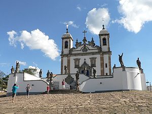
Country Brazil Type Cultural Criteria i, iv Reference 334 Region ** Latin America and the Caribbean Coordinates 20°29′59″S 43°51′28″W / 20.49972°S 43.85778°WCoordinates: 20°29′59″S 43°51′28″W / 20.49972°S 43.85778°W Inscription history Inscription 1985 (9th Session) * Name as inscribed on World Heritage List
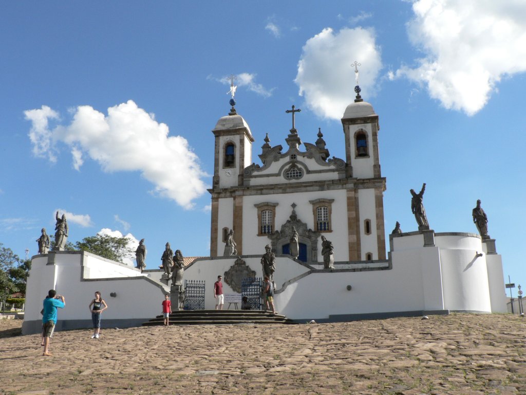
** Region as classified by UNESCOCongonhas (Congonhas do Campo) is a historical Brazilian city located in the state of Minas Gerais. It is situated 90 kilometres (56 mi) south from Belo Horizonte, the capital of state of Minas Gerais, by the highway BR-040. The city has a population of 50,000.
The city is notable for its basilica - the Santuário do Bom Jesus do Matosinhos - and associated sculptures which was commissioned by Portuguese adventurer, Feliciano Mendes in the 18th century. It was created by Aleijadinho, one of the best artists in the baroque style in the world. The soapstone sculptures of old testament prophets around the terrace are considered amongst his finest work.
In 1985 UNESCO granted the Sanctuary the title of a World Heritage Site.
See also
- List of municipalities in Minas Gerais
External links
 Media related to Congonhas do Campo at Wikimedia Commons
World Heritage Sites in Brazil North 
Northeast Brazilian Atlantic Islands: Fernando de Noronha and Atol das Rocas Reserves · Discovery Coast Atlantic Forest Reserves1 · Historic Centre of São Luís · Historic Centre of Salvador da Bahia · Historic Centre of the Town of Olinda · Serra da Capivara National Park
Central-West Brasília · Cerrado Protected Areas: Chapada dos Veadeiros and Emas National Park · Historic Centre of the Town of Goiás · Pantanal Conservation Area
Southeast Atlantic Forest South-East Reserves1 · Discovery Coast Atlantic Forest Reserves1 · Historic Centre of the Town of Diamantina · Historic Town of Ouro Preto · Sanctuary of Bom Jesus do Congonhas
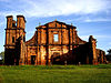
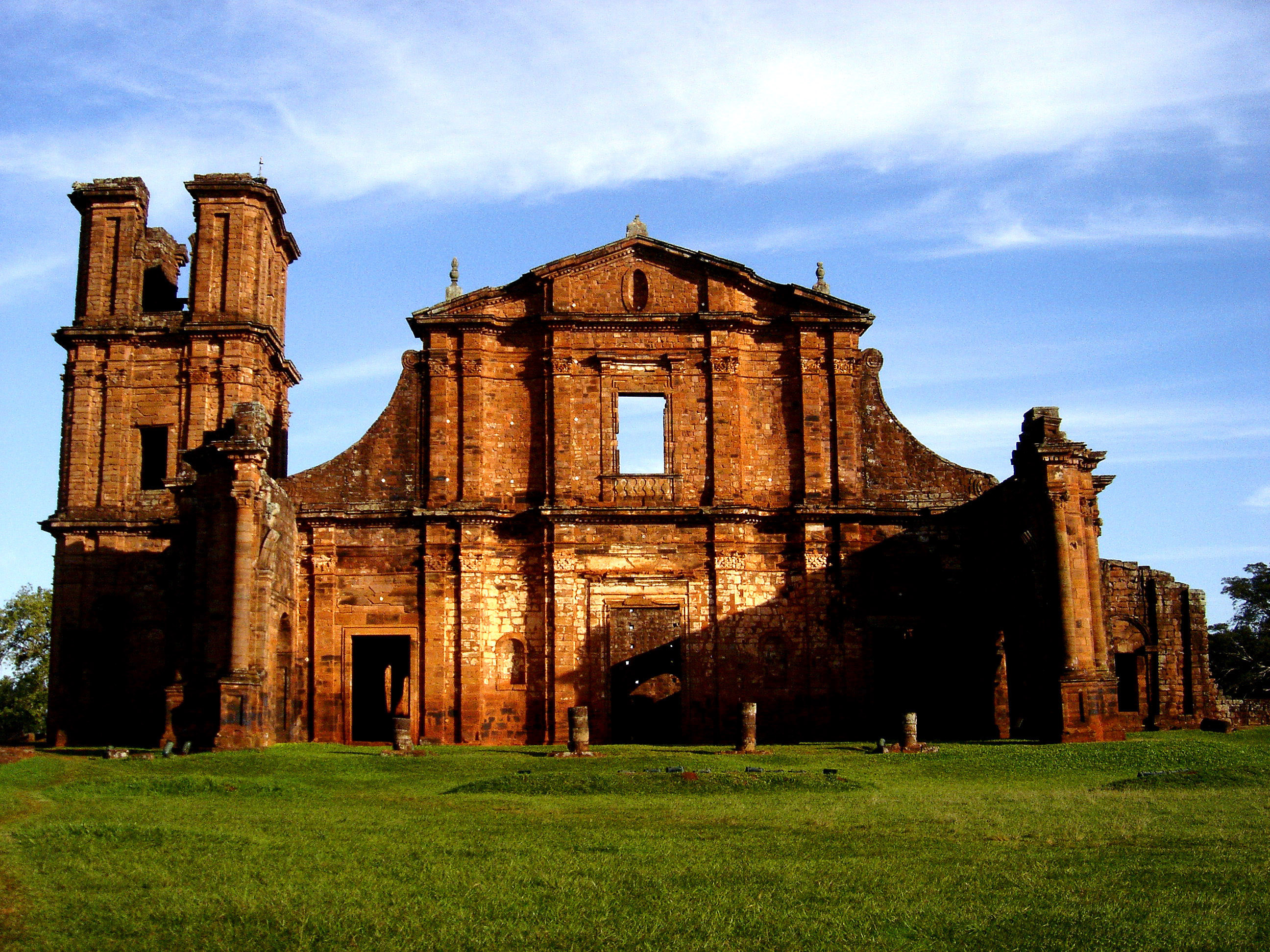
South Atlantic Forest South-East Reserves1 · Iguaçu National Park · Jesuit Missions of the Guaranis2: Ruins of São Miguel das Missões
1 Shared with other region/s · 2 Shared with Argentina Categories:- Populated places in Minas Gerais
- World Heritage Sites in Brazil

Wikimedia Foundation. 2010.