- Harrison, Ohio
Infobox Settlement
official_name = Harrison, Ohio
settlement_type =City
nickname =
motto =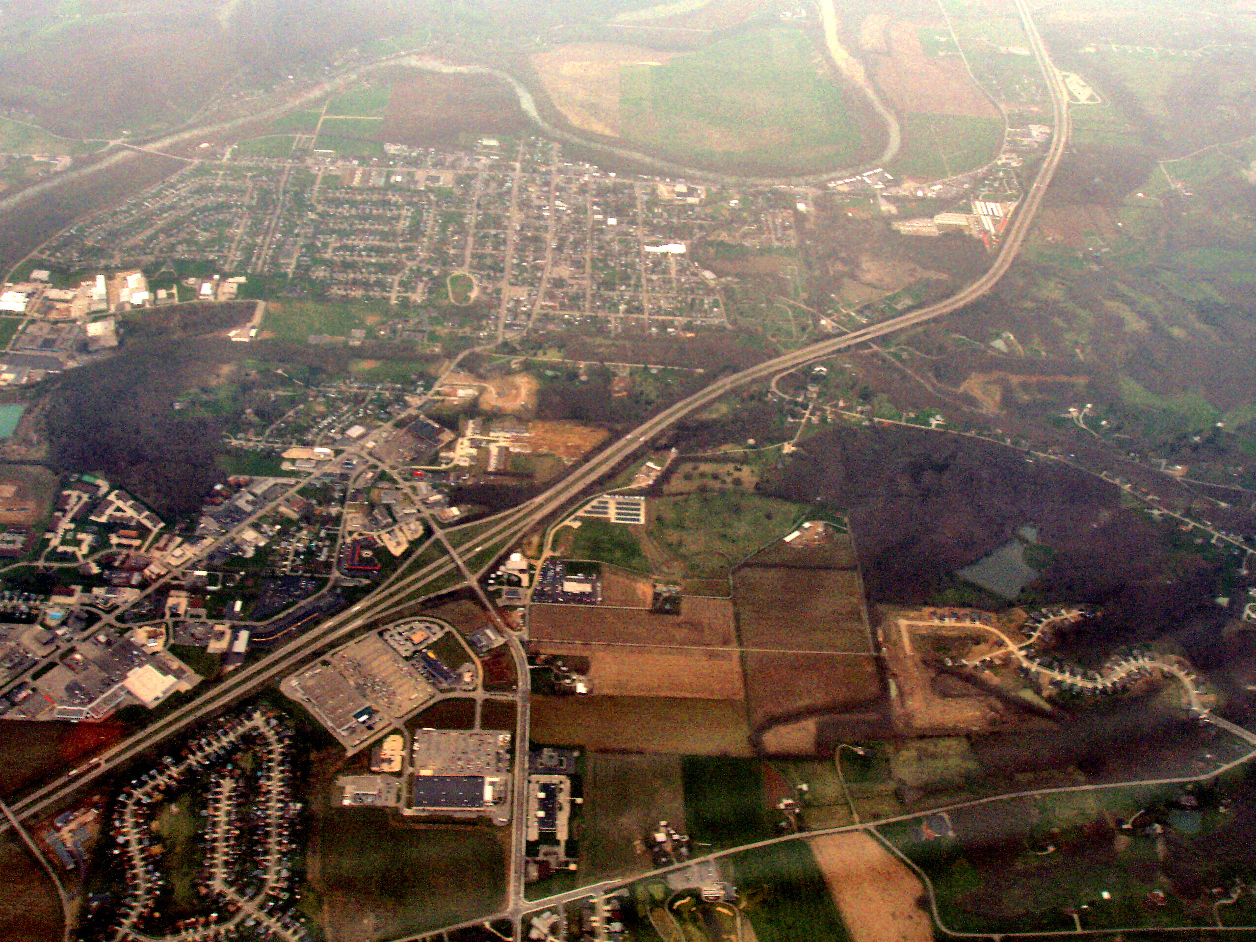
image_caption = Harrison, OH from the east.West Harrison, IN is the northern most portion. The state line runs almost horizontally near the top of the picture, along State Street and just below the river.
imagesize = 250px
image_
mapsize = 250px
map_caption = Location of Harrison, Ohio
mapsize1 =
map_caption1 =subdivision_type = Country
subdivision_name =United States
subdivision_type1 = State
subdivision_name1 =Ohio
subdivision_type2 = County
subdivision_name2 = Hamiltongovernment_footnotes =
government_type =
leader_title =
leader_name =
leader_title1 =
leader_name1 =
established_title =
established_date =unit_pref = Imperial
area_footnotes =area_magnitude =
area_total_km2 = 9.7
area_land_km2 = 9.6
area_water_km2 = 0.1
area_total_sq_mi = 3.7
area_land_sq_mi = 3.7
area_water_sq_mi = 0.0population_as_of = 2000
population_footnotes =
population_total = 7487
population_density_km2 = 781.7
population_density_sq_mi = 2024.5timezone = Eastern (EST)
utc_offset = -5
timezone_DST = EDT
utc_offset_DST = -4
elevation_footnotes = GR|3
elevation_m = 159
elevation_ft = 522
latd = 39 |latm = 15 |lats = 29 |latNS = N
longd = 84 |longm = 48 |longs = 16 |longEW = Wpostal_code_type =
ZIP code
postal_code = 45030
area_code = 513
blank_name = FIPS code
blank_info = 39-33838GR|2
blank1_name = GNIS feature ID
blank1_info = 1041362GR|3
website =
footnotes =Harrison is a city in Hamilton County,
Ohio ,United States . The population was 7,487 at the 2000 census.History
Harrison was named after the 9th US President,
William Henry Harrison . It was incorporated in 1850, and became a city in 1981.It was the home of Ohio Governor
Othneil Looker .The city was devastated on
June 2 ,1990 by an F4tornado , but was quickly rebuilt.Local Government
Harrison's mayor is Joel McGuire, an attorney and former Army Ranger. On November 6, 2007, McGuire (Independent) defeated incumbent mayor Daniel Gieringer (Democrat) by a vote of 58.7% to 41.3%. McGuire is a native of Harrison, Ohio and a former member of the city council.
It has a council made up of 7 members (Deborah Acra, Tony Burkart, Judy Kercheval, Matt Hiatt, William Neyer, Jim Robertson and Randy Shank) who are elected to 4 year terms.
Its police department is an accredited department with 21 sworn officers and 4 civilian personnel. It is headed by Col. Charles Linsey, Chief of Police.
The Fire Department is headed by Chief Rob Hursong. The Harrison Fire Department is a combination department with thirty-three employees, sixteen of which are full-time and seventeen part-time. The Harrison Fire Department coverage areas consist of 44 square miles in Ohio and Indiana resulting in 2100 Fire and EMS details annually.
Geography
Harrison is located at coor dms|39|15|29|N|84|48|16|W|city (39.257931, -84.804535)GR|1.
According to the
United States Census Bureau , the city has a total area of 3.7square mile s (9.7km² ), of which, 3.7 square miles (9.6 km²) of it is land and 0.04 square miles (0.1 km²) of it (0.80%) is water.Demographics
As of the
census GR|2 of 2000, there were 7,487 people, 2,717 households, and 2,005 families residing in the city. Thepopulation density was 2,024.5 people per square mile (781.3/km²). There were 2,847 housing units at an average density of 769.8/sq mi (297.1/km²). The racial makeup of the city was 98.18% White, 0.17% African American, 0.09% Native American, 0.39% Asian, 0.01% Pacific Islander, 0.20% from other races, and 0.95% from two or more races. Hispanic or Latino of any race were 0.52% of the population.There were 2,717 households out of which 41.4% had children under the age of 18 living with them, 57.6% were married couples living together, 11.7% had a female householder with no husband present, and 26.2% were non-families. 22.3% of all households were made up of individuals and 8.6% had someone living alone who was 65 years of age or older. The average household size was 2.75 and the average family size was 3.26.
In the city the population was spread out with 29.9% under the age of 18, 9.9% from 18 to 24, 31.4% from 25 to 44, 19.4% from 45 to 64, and 9.3% who were 65 years of age or older. The median age was 32 years. For every 100 females there were 93.7 males. For every 100 females age 18 and over, there were 91.3 males.
The median income for a household in the city was $46,107, and the median income for a family was $54,028. Males had a median income of $37,455 versus $27,418 for females. The
per capita income for the city was $17,966. About 4.3% of families and 6.8% of the population were below thepoverty line , including 5.6% of those under age 18 and 5.0% of those age 65 or over.chools
Harrison is part of the
Southwest Local School District [http://www.southwestschools.org/] , which encompasses Harrison Township, Crosby Township, and Whitewater Township in Hamilton County as well as a small section of Morgan Township in southwest Butler County. The school district has 8 schools - Harrison Elementary, Whitewater Elementary, Crosby Elementary, Elizabethtown Elementary, Hooven Elementary, Miamitown Elementary, William Henry Harrison Jr. School and William Henry Harrison Sr. High School. It is the largest in land mass in the Ohio. As of the most recent rankings all 8 schools were ranked Excellent by the State of Ohio. [http://www.ode.state.oh.us/reportcardfiles/2005-2006/DIST/047381.pdf] .ee also
*
Whitewater Canal References
External links
* [http://www.harrisonoh.org/ Harrison official website]
Wikimedia Foundation. 2010.