- Austintown, Ohio
Infobox Settlement
official_name = Austintown, Ohio
settlement_type = CDP
nickname =
motto =
imagesize =
image_caption =
image_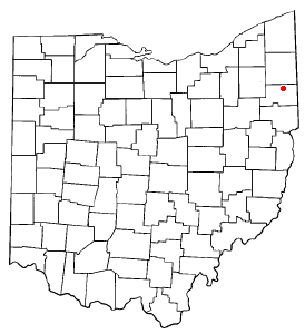
mapsize = 250px
map_caption = Location of Austintown, Ohio
mapsize1 =
map_caption1 =subdivision_type = Country
subdivision_name =United States
subdivision_type1 = State
subdivision_name1 =Ohio
subdivision_type2 = County
subdivision_name2 = Mahoninggovernment_footnotes =
government_type =
leader_title =
leader_name =
leader_title1 =
leader_name1 =
established_title =
established_date =unit_pref = Imperial
area_footnotes =area_magnitude =
area_total_km2 = 30.2
area_land_km2 = 30.2
area_water_km2 = 0.0
area_total_sq_mi = 11.7
area_land_sq_mi = 11.7
area_water_sq_mi = 0.0population_as_of = 2000
population_footnotes =
population_total = 31627
population_density_km2 = 1046.1
population_density_sq_mi = 2709.3timezone = Eastern (EST)
utc_offset = -5
timezone_DST = EDT
utc_offset_DST = -4
elevation_footnotes = GR|3
elevation_m = 344
elevation_ft = 1129
latd = 41 |latm = 5 |lats = 30 |latNS = N
longd = 80 |longm = 44 |longs = 17 |longEW = Wpostal_code_type =
ZIP code
postal_code = 44515
area_code = 330
blank_name = FIPS code
blank_info = 39-03184GR|2
blank1_name = GNIS feature ID
blank1_info = 1064362GR|3
website =
footnotes =Austintown is a
census-designated place (CDP) and Youngstown suburb, in Mahoning County,Ohio ,United States . The population was 31,627 at the 2000 census. The high school serving the area is Austintown-Fitch High School.Geography
Austintown is located at coor dms|41|5|30|N|80|44|17|W|city (41.091743, -80.738103)GR|1.
According to the
United States Census Bureau , the CDP has a total area of 11.7square mile s (30.2km² ), all of it land.Demographics
As of the
census GR|2 of 2000, there were 31,627 people, 13,419 households, and 8,762 families residing in the CDP. Thepopulation density was 2,709.3 people per square mile (1,046.4/km²). There were 14,179 housing units at an average density of 1,214.6/sq mi (469.1/km²). The racial makeup of the CDP was 92.51% White, 5.09% African American, 0.14% Native American, 0.59% Asian, 0.03% Pacific Islander, 0.43% from other races, and 1.21% from two or more races. Hispanic or Latino of any race were 1.83% of the population.There were 13,419 households out of which 25.8% had children under the age of 18 living with them, 49.6% were married couples living together, 12.1% had a female householder with no husband present, and 34.7% were non-families. 30.2% of all households were made up of individuals and 11.4% had someone living alone who was 65 years of age or older. The average household size was 2.32 and the average family size was 2.90.
In the CDP the population was spread out with 20.9% under the age of 18, 9.0% from 18 to 24, 27.3% from 25 to 44, 25.5% from 45 to 64, and 17.2% who were 65 years of age or older. The median age was 40 years. For every 100 females there were 90.8 males. For every 100 females age 18 and over, there were 87.7 males.
The median income for a household in the CDP was $38,216, and the median income for a family was $47,507. Males had a median income of $36,797 versus $23,733 for females. The
per capita income for the CDP was $19,087. About 6.2% of families and 8.8% of the population were below thepoverty line , including 14.4% of those under age 18 and 6.9% of those age 65 or over.Government and politics
Austintown is governed by a
non-partisan board of trustees elected by the people for a four year term. The township trustees are David Ditzler, Lisa Oles, and Warren "Bo" Pritchard. Michael Kurish serves as the township clerk and Michael Dockry as administrator.References
External links
* [http://www.austintowntwp.com/ Official website]
* [http://www.austintown.k12.oh.us/ Austintown Local Schools]
Wikimedia Foundation. 2010.