- Céreste
-
Céreste


 Céreste
Administration Country France Region Provence-Alpes-Côte d'Azur Department Alpes-de-Haute-Provence Arrondissement Forcalquier Canton Reillanne Intercommunality Haute Provence Mayor Gérard Baumel
(2008–2014)Statistics Elevation 323–971 m (1,060–3,186 ft)
(avg. 370 m/1,210 ft)Land area1 32.54 km2 (12.56 sq mi) Population2 1,208 (2008) - Density 37 /km2 (96 /sq mi) INSEE/Postal code 04045/ 04280 1 French Land Register data, which excludes lakes, ponds, glaciers > 1 km² (0.386 sq mi or 247 acres) and river estuaries. 2 Population without double counting: residents of multiple communes (e.g., students and military personnel) only counted once. Coordinates: 43°51′24″N 5°35′16″E / 43.8566666667°N 5.58777777778°E
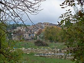
Céreste is a commune in the Alpes-de-Haute-Provence department in southeastern France.
Contents
Geography
The river Calavon forms the commune's northern and northwestern borders.
History
A Gallo-Roman period settlement was established in the quarter of today's Saint-Sauveur priory, possibly as a crossing control point for the river.[1] Surviving relics of the Roman period include a potters' oven, an ancient tomb and Sarcophagi at Saint-Sauveur.
The Priory of Carluc was founded in the eleventh century. Another priory, that of Saint-Sauveur, belonged during the twelfth and thirteenth century to the Abbey of Saint Andrew at Villeneuve-lès-Avignon. The fiefdom was held initially by the Forcalquiers, and later by the Brancas family.
By the start of the eighteenth century, the Estieu brothers were running a pottery oven.[2]
During the revolution the commune had its own Patriotic Society, a variation on the Jacobin Club theme, created in this case soon after 1792.[3]
Population
Historical population of Céreste 1765 1793 1800 1806 1821 1831 1836 1841 1846 1851 1003 1051 972 1061 1082 1147 1183 1141 1153 1138 1856 1861 1866 1872 1876 1881 1886 1891 1896 1901 1198 1272 1306 1250 1152 1173 1124 1052 1045 926 1906 1911 1921 1926 1931 1936 1946 1954 1962 1968 884 820 770 773 708 630 630 558 632 757 1975 1982 1990 1999 2008 832 862 950 1036 1208 See also
References
- ^ Raymond Collier, Haute-Provence, pp. 18 and 24-25. See also Gallia XXV, 1967, 2, p. 386.
- ^ Collier, p. 511.
- ^ Patrice Alphand, "Les Sociétés populaires", La Révolution dans les Basses-Alpes, Annales de Haute-Provence, bulletin de la société scientifique et littéraire des Alpes-de-Haute-Provence, no. 307, 1989, pp. 296-298
Categories:- Communes of Alpes-de-Haute-Provence
- Alpes-de-Haute-Provence geography stubs


Wikimedia Foundation. 2010.