- Aqraba
-
Aqraba Other transcription(s) – Arabic عقربة – Also spelled 'Aqraba (official)
Akraba (unofficial)Location of Aqraba within the Palestinian territories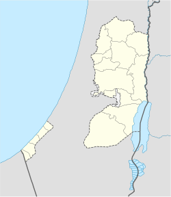
 Aqraba
Coordinates: 32°07′35.17″N 35°20′36.82″E / 32.1264361°N 35.3435611°ECoordinates: 32°07′35.17″N 35°20′36.82″E / 32.1264361°N 35.3435611°E Governorate Nablus Government – Type Municipality – Head of Municipality Jawdat 'Abd al-Hadi Area – Jurisdiction 34,659 dunams (34.7 km2 / 13.4 sq mi) Population (2007) – Jurisdiction 8,180 Aqraba (Arabic: عقربة) is a Palestinian town in the Nablus Governorate, located eighteen kilometers southeast of Nablus in the northern West Bank. According to the Palestinian Central Bureau of Statistics (PCBS), Aqraba had a population of approximately 8,180 inhabitants in 2007.[1]
Nearby hamlets surrounding Aqraba for natural extensions of the town; they are the khirbets of al-Arama, al-Kroom, Abu al-Reisa, al-Rujman, Firas al-Din and Tel al-Khashaba. The total population of these hamlets is estimated to be 500. The prominent families of Aqraba are Bani Jaber, al-Mayadima, Bani Jame', Bani Fadel and al-Deili.[2]
Contents
History and archeology
Aqraba is mentioned several times in the Bible as Akrabbim being at the southern boundary of the "Promised Land". Its Hebrew translation is "scorpions".[3]
In the town is a mosque built of ancient stones with Greek inscriptions and contained a cross. According to local tradition and a number of British scholars believe the mosque was originally a Byzantine-era church. To the north of the village there is a fort called Qal'at al-Hosn consisting of a block of buildings put on the hill. The masonry is drafted with a rustic boss. A cistern exists within the enclosure which still holds water. A birkeh ("pool") stands in the middle of Aqraba near the hillside nearby are some kokhim tombs.[3]
Alladin is from Aqraba.
Economy
It consists of about 34,700 dunams, of which 1,783 is built-up area. Around 62% of the remaining land is covered with olive and almond groves, 8% with other fruits and vegetables and the remaining 30% for grazing purposes.[4]
Aqraba's unemployment rate is above 50% primarily due to the violence since the beginning of the Second Intifada. Because the Palestinian labor force is unable to work in Israeli localities, the town's workers currently hold public and private jobs. Some also depend on agriculture and industrial workshops as main sources of income.[4]
Government
Aqraba is located in Area B, giving the Palestinian National Authority control over its administration and civil affairs. The town is governed by a municipal council, consisting of eleven members including the mayor. In the 2005 Palestinian municipal elections, the Fatah-backed Future Palestine list won the majority of the seats (six) while the Hamas-backed al-Islamiya list won five seats. Jawdat 'Abd al-Hadi was elected mayor.[5]
References
- ^ 2007 PCBS Census. Palestinian Central Bureau of Statistics. p.110.
- ^ Aqraba Village: General Information Land Research Center. 2008-10-20.
- ^ a b Acraba, the last village adjacent to the desert Studium Biblicum Franciscanum - Jerusalem. 2000-12-19.
- ^ a b A new Expansion in the colony of Itamar on the Lands of the Palestinian Town of Aqraba: General Information about Aqraba The Land Research Center via POICA. ARIJ and LRC 2007-10-21
- ^ Local Elections (Round Three)- Successful lists by local authority and No. of votes obtained Central Elections Commission - Palestine. p.4.
External links
Cities 

Municipalities Aqraba · Asira al-Shamaliya · Awarta · Beita · Beit Furik · Huwara · Jamma'in · Qabalan · Sebastia · TellVillages Ammuriya · al-Aqrabaniya · Asira al-Qibliya · Azmut · al-Badhan · Balata al-Balad · Beit Dajan · Beit Hasan · Beit Iba · Beit Imrin · Beit Wazan · Bizziriya · Burin · Burqa · Deir al-Hatab · Deir Sharaf · Duma · Einabus · Ein Shibli · Furush Beit Dajan · Ijnisinya · Jalud · Jurish · Kafr Qallil · al-Lubban ash-Sharqiya · Madama · Majdal Bani Fadil · an-Naqura · an-Naseriya · Odala · Osarin · Qaryut · Qusin · Qusra · Rujeib · Salim · Sarra · as-Sawiya · Talfit · Talluza · Urif · Yanun · Yasid · Yatma · Zawata · Zeita Jamma'inRefugee camps Categories:- Nablus Governorate
- Towns in the West Bank


Wikimedia Foundation. 2010.