- Franklin Furnace, Ohio
Infobox Settlement
official_name = Franklin Furnace, Ohio
settlement_type = CDP
nickname =
motto =
imagesize =
image_caption =
image_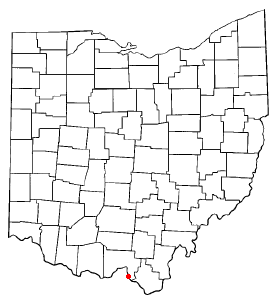
mapsize = 250px
map_caption = Location of Franklin Furnace, Ohio
mapsize1 =
map_caption1 =subdivision_type = Country
subdivision_name =United States
subdivision_type1 = State
subdivision_name1 =Ohio
subdivision_type2 = County
subdivision_name2 = Sciotogovernment_footnotes =
government_type =
leader_title =
leader_name =
leader_title1 =
leader_name1 =
established_title =
established_date =unit_pref = Imperial
area_footnotes =area_magnitude =
area_total_km2 = 7.1
area_land_km2 = 6.2
area_water_km2 = 0.9
area_total_sq_mi = 2.7
area_land_sq_mi = 2.4
area_water_sq_mi = 0.4population_as_of = 2000
population_footnotes =
population_total = 1537
population_density_km2 = 249.0
population_density_sq_mi = 644.8timezone = Eastern (EST)
utc_offset = -5
timezone_DST = EDT
utc_offset_DST = -4
elevation_footnotes = GR|3
elevation_m = 175
elevation_ft = 574
latd = 38 |latm = 37 |lats = 24 |latNS = N
longd = 82 |longm = 50 |longs = 53 |longEW = Wpostal_code_type =
ZIP code
postal_code = 45629
area_code = 740
blank_name = FIPS code
blank_info = 39-28532GR|2
blank1_name = GNIS feature ID
blank1_info = 1075237GR|3
website =
footnotes =Franklin Furnace is a
census-designated place (CDP) in Scioto County,Ohio ,United States , along theOhio River . The population was 1,537 at the 2000 census. Franklin Furnace was the name of an early iron ore furnace built in eastern Scioto County in 1826 The community that grew in that area is named after the furnace.cite news|title=Portsmouth Area Resource Guide, 2007-2008|publisher="The Community Common"|page=7|date=2007-07-29|accessdate=2007-07-29]Geography
Franklin Furnace is located at coor dms|38|37|24|N|82|50|53|W|city (38.623342, -82.847997)GR|1.
According to the
United States Census Bureau , the CDP has a total area of 2.7square mile s (7.1km² ), of which, 2.4 square miles (6.2 km²) of it is land and 0.4 square miles (0.9 km²) of it (13.14%) is water.Demographics
As of the
census GR|2 of 2000, there were 1,537 people, 519 households, and 389 families residing in the CDP. Thepopulation density was 644.8 people per square mile (249.3/km²). There were 588 housing units at an average density of 246.7/sq mi (95.4/km²). The racial makeup of the CDP was 91.09% White, 7.22% African American, 0.78% Native American, 0.07% Asian, 0.07% from other races, and 0.78% from two or more races. Hispanic or Latino of any race were 0.46% of the population.There were 519 households out of which 30.8% had children under the age of 18 living with them, 57.4% were married couples living together, 13.3% had a female householder with no husband present, and 24.9% were non-families. 21.4% of all households were made up of individuals and 8.7% had someone living alone who was 65 years of age or older. The average household size was 2.44 and the average family size was 2.80.
In the CDP the population was spread out with 31.9% under the age of 18, 11.3% from 18 to 24, 21.3% from 25 to 44, 23.3% from 45 to 64, and 12.1% who were 65 years of age or older. The median age was 31 years. For every 100 females there were 129.1 males. For every 100 females age 18 and over, there were 99.2 males.
The median income for a household in the CDP was $27,279, and the median income for a family was $30,156. Males had a median income of $27,216 versus $22,292 for females. The
per capita income for the CDP was $12,998. About 13.2% of families and 12.5% of the population were below thepoverty line , including 13.8% of those under age 18 and 7.3% of those age 65 or over.ee also
*
List of cities and towns along the Ohio River References
External links
Wikimedia Foundation. 2010.