- Munroe Falls, Ohio
-
Munroe Falls, Ohio — City — Munroe Falls City Hall

SealLocation in Summit County Location in Ohio
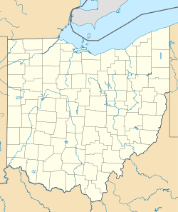
 Munroe Falls, Ohio
Coordinates: 41°8′40″N 81°26′23″W / 41.14444°N 81.43972°WCoordinates: 41°8′40″N 81°26′23″W / 41.14444°N 81.43972°W Country  United States
State  Ohio
OhioCounty Summit Founded 1838 Government – Mayor Frank Larson Area – Total 7.3 km2 (2.8 sq mi) – Land 7.1 km2 (2.7 sq mi) – Water 0.2 km2 (0.1 sq mi) Elevation 314 m (1,030 ft) Population (2000) – Total 5,314 – Density 748.8/km2 (1,939.8/sq mi) Time zone EST (UTC-5) – Summer (DST) EDT (UTC-4) ZIP code 44262 Area code(s) 330, 234 FIPS code 39-53312[1] GNIS feature ID 1065085[2] Website www.munroefalls.com Munroe Falls is a city located in the east-central portion of Summit County, Ohio, United States, between Stow and Tallmadge. It is a suburb of Akron and is part of the Akron Metropolitan Statistical Area. The population was 5,314 at the 2000 census.
Contents
History
Like much of the Connecticut Western Reserve, the area that makes up present-day Munroe Falls was previously inhabited by various tribes of American Indians.[3] When the Western Reserve began being surveyed in 1796, what is now Munroe Falls was mostly in the southern part of the survey township Town 3, Range 10 (later to be Stow Township), then a part of Washington County before being placed in the new Jefferson County the following year. In 1800, it was made part of Trumbull County, which followed the boundaries of the Western Reserve, and in 1808, the area was made part of Portage County.[4] The first settlers in present-day Munroe Falls, a group of around 40 people including Francis Kelsey and William Stow, came in 1809.[5] Kelsey built a sawmill on the south side of the Cuyahoga River and a gristmill was built on the north side.[6] The initial name of the new village was Kelsey's Mills (also Kelsey Mills). In 1817 a wooden dam was built to provide power for both mills and the name of the village was changed to Florence.[7] Around 1836, William and Edmund Munroe (also spelled Monroe) from Boston arrived and purchased the two mills and approximately 250 acres (101 ha) of land around them to lay out a new village, which they named Munroe Falls.[6] The village was incorporated October 26, 1838.[8] The Munroes had great plans for the village to become a center of commerce and an important city, but these plans never worked out. After about 10 years, which included the economic instability of the Panic of 1837,[5] the Munroes defaulted to many of the creditors and the properties they owned were taken over by other individuals.[6]
The Pennsylvania and Ohio Canal opened in 1840 and passed through Munroe Falls. It closed around 1870[9] Also in 1840, Munroe Falls was made part of the new Summit County.[10] In 1866, the old gristmill was purchased by the Cleveland Paper Company and refitted for paper manufacturing. The building burned down approximately 1–2 years later and the present factory - today owned by Sonoco Products - was built on the same site.[6] In 1884 railroad tracks were laid in the former canal bed as part of a single line owned by the Pittsburgh and Western Railroad.[11] These tracks were doubled in 1900 following the purchase of the railroad by Baltimore and Ohio Railroad.
In the early 2000s, the Ohio Environmental Protection Agency (EPA) and Summit County determined that the oxygen levels were too low in the Cuyahoga River, due mostly to the stagnant pool behind the Munroe Falls dam.[12] The solution was to lower the dam, which dated to 1903.[7] Eventually, the entire dam was removed after workers discovered a natural ledge underneath the existing dam. This project, begun in August 2005 and completed in October 2006, was part of a larger project along much of the river in the city that included cleanup and restoration.[13]
Geography
Munroe Falls is located in eastern Summit County adjacent to the cities of Stow to the north, Tallmadge to the south, and Cuyahoga Falls to the west with the village of Silver Lake on the northwest. It was formed from parts of the now-defunct Stow and Tallmadge townships.
According to the United States Census Bureau, the city has a total area of 2.8 square miles (7.3 km²), of which, 2.7 square miles (7.1 km²) of it is land and 0.1 square miles (0.2 km²) of it (3.18%) is water.
Demographics
As of the census[1] of 2000, there were 5,314 people, 1,955 households, and 1,524 families residing in the city. The population density was 1,939.8 people per square mile (748.8/km²). There were 2,035 housing units at an average density of 742.9 per square mile (286.8/km²). The racial makeup of the city was 97.10% White, 0.92% African American, 0.02% Native American, 1.19% Asian, 0.06% Pacific Islander, 0.09% from other races, and 0.62% from two or more races. Hispanic or Latino of any race were 0.70% of the population.
There were 1,955 households out of which 35.0% had children under the age of 18 living with them, 68.7% were married couples living together, 6.7% had a female householder with no husband present, and 22.0% were non-families. 18.8% of all households were made up of individuals and 6.3% had someone living alone who was 65 years of age or older. The average household size was 2.66 and the average family size was 3.04.
In the city the population was spread out with 24.6% under the age of 18, 6.4% from 18 to 24, 25.6% from 25 to 44, 29.8% from 45 to 64, and 13.6% who were 65 years of age or older. The median age was 41 years. For every 100 females there were 94.4 males. For every 100 females age 18 and over, there were 91.8 males.
The median income for a household in the city was $61,169, and the median income for a family was $69,918. Males had a median income of $51,277 versus $31,563 for females. The per capita income for the city was $27,317. About 0.3% of families and 1.5% of the population were below the poverty line, including 0.8% of those under age 18 and 0.8% of those age 65 or over.
Education
Main article: Stow-Munroe Falls City School DistrictMunroe Falls is primarily served by the Stow-Munroe Falls City School District.[14] Serving more than 5,700 students, the district operates six elementary schools (Echo Hills, Fishcreek, Highland, Indian Trail, Riverview and Woodland), Lakeview Intermediate School, Kimpton Middle School and Stow-Munroe Falls High School. Riverview Elementary and Kimpton Middle School are located in Munroe Falls, while the remainder of the district's facilities are located in Stow.[15] A small portion of Munroe Falls is part of the neighboring Tallmadge school district.[14]
Notable natives and residents
- John Magaro - actor.[16]
- Richard Myers - independent/experimental filmmaker.
References
- ^ a b "American FactFinder". United States Census Bureau. http://factfinder.census.gov. Retrieved 2008-01-31.
- ^ "US Board on Geographic Names". United States Geological Survey. 2007-10-25. http://geonames.usgs.gov. Retrieved 2008-01-31.
- ^ Perrin, William Henry, ed (1881). History of Summit County (1972 ed.). Chicago, Illinois (1881); Indianapolis, Indiana (1972): Baskin & Balley (1881); Unigraphic (1972). pp. 207–225.
- ^ "Ohio County Formation Maps". n2genealogy.com. Genealogy Inc.. 2008. http://www.n2genealogy.com/maps/oh-maps.html. Retrieved 28 September 2009.
- ^ a b "Early History Munroe Falls". SMFPL.org. Stow-Munroe Falls Public Library. http://www.smfpl.org/node/78. Retrieved 12 October 2009. Adapted from Fifty Years and Over Of Akron and Summit County by Samuel A. Lane (1892)
- ^ a b c d Perrin, pp 516-518
- ^ a b "History". Munroe Falls Dam: Changing a Dam, Restoring a River. County of Summit. 2008. http://www.co.summit.oh.us/executive/mfd/mfdhistory.htm. Retrieved 27 September 2009. "In 1809, an estimated 40 people traveled from Connecticut and settled next to a river called the Cuyahoga. The settlers called their new village Kelsey's Mills. ... The first report of a dam in Munroe Falls was 1817, the same year that the name of the village was changed to Florence."
- ^ "Sights to See in Monroe Falls". SummitHistory.org. Summit County Historical Society. 2007. http://www.summithistory.org/Community/museum_munfalls.html. Retrieved 28 September 2009.
- ^ Adkins, Wendy J. (1997). "Penn & Ohio". Archived from the original on 2009-10-26. http://www.webcitation.org/query?url=http://www.geocities.com/heartland/prairie/6687/pennohio.htm&date=2009-10-25+23:48:48. Retrieved 28 September 2009.
- ^ Perrin, p. 229
- ^ "Timeline". Stow.Oh.Us. City of Stow. 2008. http://www.stow.oh.us/community/history/historyTimeline.shtml. Retrieved 28 September 2009.
- ^ "Problem and Solution". Munroe Falls Dam: Changing a Dam, Restoring a River. County of Summit. 2008. http://www.co.summit.oh.us/executive/mfd/mfdproblemsolution.htm. Retrieved 28 September 2009.
- ^ "Removing the Munroe Falls Dam". Munroe Falls Dam: Changing a Dam, Restoring a River. County of Summit. 2008. http://www.co.summit.oh.us/executive/mfd/mfdRemoveDam.htm. Retrieved 28 September 2009.
- ^ a b Exner, Rich (January 13, 2009). "Northeast Ohio property tax rates, and where the money goes". Cleveland.com (Cleveland Live, Inc). http://www.cleveland.com/datacentral/index.ssf/2009/01/northeast_ohio_property_tax_ra.html. Retrieved August 6, 2010.
- ^ "Stow-Munroe Falls City School District". SMFSchools.org. Stow-Munroe Falls City School District. 2010. http://www.smfschools.org/. Retrieved August 6, 2010.
- ^ Heldenfels, Rich (October 8, 2010). "Slasher film star chases after dream: Stow grad John Magaro carves out acting career, stars in Wes Craven flick". Akron Beacon Journal (Beacon Journal Publishing Co.).
External links
- City of Munroe Falls
- Stow-Munroe Falls Chamber of Commerce
- Munroe Falls Historical Society
- SummitMemory.org: Images from the Munroe Falls Historical Society
Municipalities and communities of Summit County, Ohio Cities 
Villages Boston Heights | Clinton | Lakemore | Mogadore‡ | Northfield | Peninsula | Reminderville | Richfield | Silver Lake
Townships Bath | Boston | Copley | Coventry | Northfield Center | Richfield | Sagamore Hills | Springfield | Twinsburg
CDPs Unincorporated
communitiesFootnotes ‡This populated place also has portions in an adjacent county or counties
Categories:- Cities in Ohio
- Populated places in Summit County, Ohio
- Akron metropolitan area
- Populated places established in 1809


Wikimedia Foundation. 2010.