- Stow, Ohio
Infobox Settlement
official_name = Stow, Ohio
settlement_type =City
nickname =
motto =
website = http://www.stow.oh.us
established_title = Founded
established_date = 1804 [ http://www.smfpl.org/Timelinepage.htm Local History - Stow Timeline. Retrieved13 November 2006 . ]
established_title2 =
established_date2 =
established_title3 =
established_date3 =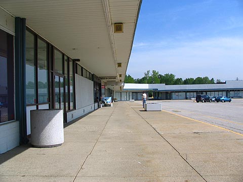
image_caption =Stow-Kent Shopping Center ,May 28 2006
imagesize = 250px
image_

mapsize = 250px
map_caption = Location inOhio 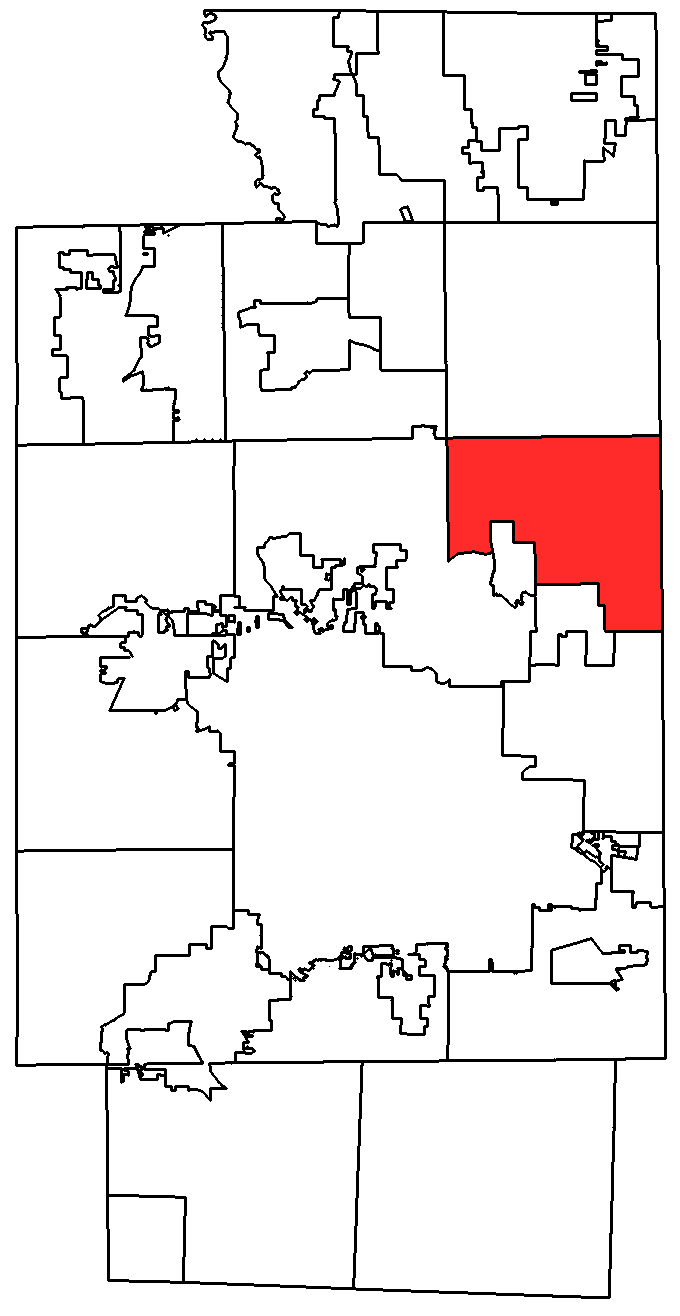
mapsize1 = 250x200px
map_caption1 = Location within Summit County,Ohio
subdivision_type = Country
subdivision_type1 = State
subdivision_type2 = County
subdivision_name =United States
subdivision_name1 =Ohio
subdivision_name2 = Summit
government_type =
leader_title =Mayor
leader_name = Karen Fritschel [ [http://www.stow.oh.us/government/mayor.shtml City of Stow - Mayor ] ]
area_magnitude = 1 E8
area_total_km2 = 44.9
area_land_km2 = 44.3
area_water_km2 = 0.6
population_as_of = 2007 http://www.census.gov/popest/cities/tables/SUB-EST2007-04-39.csv]
population_total = 34051
population_metro =
population_density_km2 = 768.6
timezone = EST
utc_offset = -5
timezone_DST = EDT
utc_offset_DST = -4
latd = 41 |latm = 10 |lats = 36 |latNS = N
longd = 81 |longm = 26 |longs = 10 |longEW = W
area_total_sq_mi = 17.3
area_land_sq_mi = 17.1
area_water_sq_mi = 0.2
elevation_m = 333
elevation_ft = 1093
postal_code_type =ZIP code
postal_code = 44224
area_code = 330
blank_name = FIPS code
blank_info = 39-74944GR|2
blank1_name = GNIS feature ID
blank1_info = 1065392GR|3
footnotes =Stow is a city in Summit County,
Ohio ,United States . The population was 32,139 at the 2000 census, and 34,051 as of 2007. It is asuburb of Akron and is part of the Akron Metropolitan Statistical Area. Stow is located adjacent to several other suburban communities in Summit and Portage Counties. It is bordered on the south by the cities of Tallmadge and Munroe Falls and the village of Silver Lake, on the east by the city of Kent and Franklin Township, on the north by the city of Hudson, and on the west by the city of Cuyahoga Falls.History
John Graham came to Stow in 1809 and bought his farm on what is now West Graham Road. His sons, Maxwell and William, became very well known horticulturists and the owners of large fruit farms.Of the thirteen original states, only Connecticut held anything back, reserving a strip of land lying south of Lake Erie. As the new state's government was short of money, part was given in lieu of bonuses to Revolutionary soldiers. Connecticut sold the rest of the Reserve to the
Connecticut Land Company , made up of speculators organized for that purpose.Joshua Stow of Middletown,Connecticut , secured for his share the land that is now the City of Stow.All of this land was surveyed under the terms of the
Northwest Ordinance : divided into counties, the counties into townships, the townships into sections. Stow Township was first a part of Trumbull, then of Portage, and finally of Summit County. In the original draft it was known as Town 3, Range 10.William Wetmore's involvement
Joshua Stow came often to his township and spent a good deal of his money in developing it, but never actually took residence. Stow's agent on the land, William Wetmore, also from Middletown, came to Stow in July, 1804, bringing his wife, three sons, and one daughter. Besides them in this first colony were:
* Capt. Gregory Powers and his wife and large family;
* Thomas Rice, his wife and daughter;
* Titus Wetmore, and a younger brother not yet named;
* John Campbell; and
* Josiah Starr, 18 or 19 years oldAll of these people resided in Stow the rest of their lives. They bought land in various parts of the town and cleared it and so contributed to its early settlement. William Wetmore died in 1827, but some of his descendants are still living in the town.
William Wetmore was the first justice of the peace in Stow. He and his sons laid out the first village in the township, on the southwest corner of the town bordering on the Cuyahoga River. They built a dam in the river and started several factories. When the township of Cuyahoga Falls was laid out it took this corner of Stow, so that now the Wetmore village is part of the City of Cuyahoga Falls.
Walker settlement
Judge Wetmore's colonists, however, were not the first settlers in Stow Township. This happened in an odd way. Hudson Township, to the north, was settled a little before Stow. One of its earliest settlers was Robert Walker. Walker, who had come from Virginia, brought his family with him. His land was in the southeast corner of Hudson Township. One of his sons, William Walker, started in 1802 to build a house in the woods south of his father's. But in 1804 Wetmore hired Joseph Darrow to cut up the town into sections and to lay out roads. It was found that William Walker's house was built in lot 89 in Stow, so Walker bought the lot and continued to live there.
Township organization and government
Portage County was taken from Trumbull in 1804 and Stow became a township in the new county. A township government was organized in 1808, even though there were barely enough men living in town to fill the offices. The first election occurred on January 5, 1811, at the home of Stephen Butler near the center of Stow. (Today Butler's home is the site of the city administration buildings, at Graham and Darrow Roads.)
The following officers were chosen:
* Trustees: Titus Wetmore, Josiah Starr, and Christopher Starr.
* Overseers of the poor: George Darrow and Thomas Rice.
* Fence viewers (inspectors): Thomas Van Hyning and Constant Rogers.
* Constables: Charles Powers and Thomas Gaylord.
* Treasurer: Titus Wetmore.On the same day and in the same place a special election was held for two justices of the peace. The two selected were Joseph Darrow and Ezra Wyatt. William Wetmore, Stephen Butler and Samuel Cheney became Justices in later elections. These elections were not held on regular dates, as they are today.
Notable figures
Brief mention of some of these men should be made because they served their town in other ways besides holding office. Stephen Butler, a
Presbyterian , came to Stow in 1806 and at once started his church. A meeting house was built at what is now the west end of the Stow Cemetery. This house was used for worship until 1876, first by the Presbyterians, until that congregation disbanded, and then by aDisciples of Christ congregation.Ezra Wyatt built Stow Tavern about 1810. This was one of the best known stage coach houses of entertainment. It stood at the crossing of the stage lines from Cleveland to Pittsburgh and from Wooster to Warren.
Joseph Darrow is perhaps the best known of that family who have lived on the Street since 1804.
Josiah Starr came with William Wetmore in 1804. He was Howard Call's great-grandfather and lived on the Call Farm the rest of his life. The Call Farm may be the land in Stow longest held continuously by a single family. The farm, however was sold to a real estate developer at the beginning of the 21st century, and the development built is named Call's Farm. The Call family still owns their home and a plot of land on the original farm.
Thomas Gaylord was a member of one of the best-known pioneer families in Stow. Johnathon Gaylord came here in 1809 with a party of 40 of his relations. His son-in-law, William Stow, and his wife Peggy were in the group. Both families have always been well known here. William Stow was a distant cousin of Joshua, also from Middletown, Connecticut.
ettler life
Stow Township's rolling hills, thick forests, the Cuyahoga River and many lakes made it "one of the very best townships of Summit County." The settlers earnestly set about chopping down trees for their cabins and to clear land for farming. They also had to deal with many kinds of wild animals. Some of these were hunted for meat, such as deer, rabbits and pigeons. Some animals were hunted in order to make the area safer: those included bears and wolves.
Settlers immediately made acquaintance with the resident Indians. About 500 of them lived on the shores of the Silver Springs laes, now a city park located off of both Young Rd. and Stow Rd.. Most of the natives were friendly, and would visit the settlers' cabins. They even invited settlers' children to visit their wigwam villages. Most of the Indians moved west during the War of 1812, and they were all gone by the 1860s.
School and Road Districts were early made. The school districts were often changed, but schools were constantly maintained and teachers hired up to the time of their consolidation.
Stow Township for many, many years was a farming community. Most of the farmers kept some milk cows. Their wives made butter and once in a while cheese. When the cheese factories were built, dairying became a major industry. Some of the farmers milked a lot of cows. The milk had to be taken to the factory twice a day and the sanitary conditions were non-existent. Factories only ran in warm weather, so the cows were bred to freshen in the spring. The cheese factories furnished a market for the milk for a long time, but when they quit there was quite an interval when Stow dairymen didn't know what to do with their milk. In 1915, the Stow Elgin Butter and Ice Cream Co. was organized. It provided a market for milk for some time.
Sheep and hogs have been kept on Stow's farms, but the raising of sheep was profitable only during the
American Civil War as all of the Union soldiers' uniforms were made of wool.By the end of the 1800s, Stow's population was about 900 people. Several hundred more lived in Cuyahoga Falls and Munroe Falls. These communities were divided off from the original square township.
Geography & Climate
Stow is located at coor dms|41|10|36|N|81|26|10|W|city (41.176623, -81.436231)GR|1.
According to the
United States Census Bureau , the city has a total area of 17.3square mile s (44.Fs9km² ), of which, 17.1 square miles (44.3 km²) of it is land and 0.2 square miles (0.6 km²) of it (1.33%) is water.Stow is a suburb of the city of
Akron, Ohio and has a very similar climate. Weather varies during each season.Demographics
As of the
census GR|2 of 2000, there were 32,139 people, 12,317 households, and 8,745 families residing in the city. Thepopulation density was 1,878.1 people per square mile (725.2/km²). There were 12,852 housing units at an average density of 751.0/sq mi (290.0/km²). The racial makeup of the city was 95.20% White, 1.54% African American, 0.11% Native American, 1.91% Asian, 0.01% Pacific Islander, 0.30% from other races, and 0.93% from two or more races. Hispanic or Latino of any race were 0.91% of the population.There were 12,317 households out of which 35.3% had children under the age of 18 living with them, 59.8% were married couples living together, 8.4% had a female householder with no husband present, and 29.0% were non-families. 23.7% of all households were made up of individuals and 8.0% had someone living alone who was 65 years of age or older. The average household size was 2.57 and the average family size was 3.08.
In the city the population was spread out with 26.0% under the age of 18, 7.4% from 18 to 24, 31.1% from 25 to 44, 23.5% from 45 to 64, and 12.0% who were 65 years of age or older. The median age was 37 years. For every 100 females there were 93.8 males. For every 100 females age 18 and over, there were 89.8 males.
The median income for a household in the city was $57,525, and the median income for a family was $67,822. Males had a median income of $47,472 versus $30,820 for females. The
per capita income for the city was $25,509. About 2.9% of families and 4.0% of the population were below thepoverty line , including 4.0% of those under age 18 and 5.9% of those age 65 or over.ports & Recreation
Stow has several community parks including Adell Durbin Park, Meadow Lake Park, Silver Springs Park, and Oregon Trail Park. Stow also owns Fox Den Golf Course. [ [http://www.stow.oh.us/Departments/ParksRecreation/parks+recreation-main.shtml City of Stow - Parks and Recreation Home ] ] Stow Parks and Recreation allows children and teenagers to participate in sports such as baseball and basketball.
Education
Stow-Munroe Falls High School is located in Stow.Stow shares a school system with Munroe Falls,
Ohio : seven elementary schools as of 2007, one intermediate, one middle and one high school. Their mascot is the bulldog and their colors are maroon and gold. Their main sports rival is Cuyahoga Falls and they have joined the newNortheast Ohio Conference composed of 18 schools.Stow is also home to the 2006 Division I Boys Soccer State Championship team.Stow high school had one of high school basketball's greatest players in Ryan Rundle. He once made an outstanding 11 3-pointers in a single game. He now rules the courts at the Kent State Rec center.
Media
Newspaper
:
Stow Sentry [ [http://www.stowsentry.com/ Stowsentry.com - Breaking News, World & Local News, Sports & Multimedia ] ]Television
:Stow has its own television station (The Stow Channel) that is associated with
Time Warner . The station plays music from the 1960's-1990's and shows monthly announcements and city information. It gives information such as information for city hall, opening places, school functions, maintenance work, and local events. It also shows city hall meetings.Transportation
Airport
:
Kent State University Airport is located at 4020 Kent Road (Ohio State Route 59).Highways
:Three Ohio state highways run through Stow. These include
Ohio State Route 8 (a limited access highway),Ohio State Route 59 (Kent Road), andOhio State Route 91 (Darrow Road).Public Transportation
:Akron / Summit County
METRO RTA and Portage CountyPortage Area Regional Transportation Authority have bus lines that stop in Stow.Notable Natives and Residents
*
Haley Bennett - (also known as Haley Keeling) costar in Romantic Comedy "Music and Lyrics"
*Treniere Clement - USA Track and Field 1500 meter champion.
*Larry Csonka -Pro Football Hall of Fame r
* Ben Curtis - Professional Golf Association (PGA) Tour player. Winner of the 2003 Open Championship (British Open).
*Neel Kashkari , Assistant Secretary for International Economics and Development
*David Kerr - National Champion Collegiate Debater [http://en.wikipedia.org/wiki/International_public_debate_association#E-Mail]
*Erick Purkhiser (Lux Interior) - lead singer, the Cramps
*Mike Vrabel Ohio State Football Alumni and New England Patriots NFL
*The Cathedrals - Christian Quartet
*Steve French - Sports Director, WNIR 100.1FM Host of SportsTalk on local cable channels 35 and 29. (The Cat)
*Matt Kaulig - Business Owner, Owner of LeafFilter North, Inc. (Gutter Protection)
*Dave Jamerson - Former first-round draft pick of the Houston Rockets out of Ohio University. His #33 was retired in January 2007 at Ohio University.
*Mark Gangloff - 2008 olympics gold medalistReferences
External links
* [http://www.stow.oh.us City of Stow web site]
* [http://www.smfpl.org/ Stow-Munroe Falls Public Library]
* [http://www.stow.summit.k12.oh.us/index.html Stow-Munroe Falls City Schools]
* [http://www.smfcc.com/ Stow-Munroe Falls Chamber of Commerce]
Wikimedia Foundation. 2010.