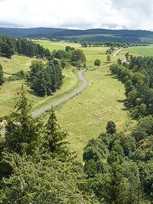
Margeride

Margeride

Margeride (In Occitan Marjarida) is a mountainous region of France, situated in the Massif Central, inside the départements of Cantal, Haute-Loire and Lozère.

Contents

Location

In Cantal, its western boundary is the Truyère, and its eastern boundary, in Haute-Loire, by the gorges of the river Allier. To the south, in Lozère, It is the Lot which delimits the region.

Geology

The lithology of area is manly granitoids and gneiss.[1] The highest peaks are the Signal de Randon at 1,551 metres and the Mont Mouchet at 1,465 metres.

Other details

In the 18th century the Margeride was the terrorised by the Beast of Gévaudan.

The area was a stronghold of the French Resistance in the Second World War. It was from here that the Resistance worked to delay German reinforcements travelling north after the D-Day landings.

Today the area contains a museum of ecology, and a park with a herd of rare European Bison.

External links


Wikimedia Foundation. 2010.

Игры ⚽ Поможем решить контрольную работу

Look at other dictionaries:

  • Margeride — Carte de localisation de la Margeride. Géographie Altitude 1 551 m, Truc de Fortunio Massif Massif central …   Wikipédia en Français

  • Margeride — bei Ruynes en Margeride, Département Cantal Die Margeride ist eine Landschaft im französischen Zentralmassiv. Geographie Die Margeride erstreckt sich über die Départements Cantal, Haute Loire und Lozère und die Regionen Auvergne …   Deutsch Wikipedia

  • Margeride — Le nom est très rare. Il peut s agir d un nom de personne, équivalent de Marguerite (voir ce nom). Mais comme plusieurs mentions anciennes le situent dans le Cantal, on pensera aussi à celui qui est originaire de la région montagneuse de la… …   Noms de famille

  • Margeride — (spr. marsch rīd ), Gebirgskette des franz. Zentralplateaus, s. Cevennen …   Meyers Großes Konversations-Lexikon

  • Monts de la Margeride — Margeride Margeride Carte de localisation de la Margeride. Géographie Altitude 1 551 m, Truc de For …   Wikipédia en Français

  • Ruynes-en-Margeride — 45° 00′ 10″ N 3° 13′ 27″ E / 45.0028, 3.2242 …   Wikipédia en Français

  • Ruynes-en-margeride — Pays …   Wikipédia en Français

  • Gare de Ruynes-en-Margeride — Ruynes en Margeride Vue de l ancien bâtiment voyageurs de Ruynes en Margeride en 2011. Localisation Pays France Commune …   Wikipédia en Français

  • Canton de Ruynes-en-Margeride — Administration Pays France Région Auvergne Département Cantal Arrondissement Arrondissement de Saint Flour …   Wikipédia en Français

  • Paulhac-en-margeride — Pour les articles homonymes, voir Paulhac. Paulhac en Margeride …   Wikipédia en Français

Share the article and excerpts

Direct link
Do a right-click on the link above
and select “Copy Link”