- Hugo, Oklahoma
-
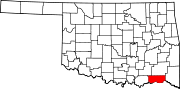
Hugo, Oklahoma — City — Location of Hugo, Oklahoma
Coordinates: 34°0′34″N 95°30′53″W / 34.00944°N 95.51472°WCoordinates: 34°0′34″N 95°30′53″W / 34.00944°N 95.51472°W Country United States State Oklahoma County Choctaw Area - Total 5.5 sq mi (14.4 km2) - Land 5.5 sq mi (14.4 km2) - Water 0.0 sq mi (0.0 km2) Elevation 545 ft (166 m) Population (2000) - Total 5,395 - Density 980.9/sq mi (374.7/km2) Time zone Central (CST) (UTC-6) - Summer (DST) CDT (UTC-5) ZIP code 74743 Area code(s) 580 FIPS code 40-36300[1] GNIS feature ID 1094002[2] Hugo is a city in the southeastern part of the U.S. state of Oklahoma, bordering Texas. Hugo is the county seat for Choctaw County and has a population of 5,395 as of 2009 estimates. The city serves as winter quarters for some circus performers. It is adjacent to the oldest school west of the Mississippi: Goodland Academy, begun in 1848.
The town is located in a cultural area of the state known as Little Dixie, as it was settled by Native American tribes, African Americans and European Americans from the Southeast United States. It is near the tourist area of Kiamichi Country.
The city was split in two by the construction of the railroad through town. Historically, to the south of the tracks is an African-American neighborhood, where the Booker T. Washington High school is located; north of the tracks is a European-American area, where the former General Robert E. Lee High is located (today it is called Hugo High School).
Contents
History
This was part of the Indian Territory to which the United States government relocated Native American tribes from east of the Mississippi River in the 1830s under its Indian Removal policy. Among the nations relocated here were the Choctaw, for whom the county is named. They were one of what were called the "Five Civilized Tribes" of the southeastern United States, as they had adopted numerous elements of European-American culture. When they relocated, they brought with them the numerous African-American slaves whom they held. As the Choctaw allied with the Confederate South during the American Civil War, the United States government insisted on a new peace treaty with them after its end. A condition was the Choctaws' emancipation of their slaves and granting to the freedmen of rights of full citizenship in the Choctaw nation, as the US was granting citizenship to former slaves of the South.
In the early 20th century, a number of Jewish immigrants, fleeing the chaos and intensifying anti-Semitism of the waning years of the Czarist Russian Empire, settled in Hugo. They generally became merchants, shopkeepers and peddlers. One was Abe Romick, who later moved to Alaska and was appointed as the state's first Secretary of Commerce. By the early 1950s, nearly all the Jewish Americans had left Hugo to settle in larger cities such as Dallas and Fort Worth, where there were more opportunities. By the 1970s, no ethnic Jews lived in Hugo. Present-day townspeople are generally not aware of this part of the city's history.
In late 1993, the town suffered several violent incidents. Before Christmas, a shootout occurred in a Wal-Mart parking lot. Within one week in December, two fires occurred; the first was at the Booker T. Washington gymnasium on December 26. On December 28 a fire erupted in the central business district of Hugo, consuming five buildings and burning for four hours. The Belmont Hotel, which the area historical society was renovating, was destroyed. Area authorities suspected that the fires were arson.[3]
Geography
Hugo is located at 34°0′34″N 95°30′53″W / 34.00944°N 95.51472°W (34.009308, -95.514601)[4].
According to the United States Census Bureau, the city has a total area of 5.6 square miles (15 km2), of which, 5.5 square miles (14 km2) of it is land and 0.18% is water.
Climate
Climate data for Hugo, Oklahoma Month Jan Feb Mar Apr May Jun Jul Aug Sep Oct Nov Dec Year Record high °F (°C) 81
(27)86
(30)92
(33)94
(34)98
(37)105
(41)110
(43)110
(43)108
(42)100
(38)88
(31)84
(29)110
(43)Average high °F (°C) 53.1
(11.7)58.3
(14.6)67.6
(19.8)76
(24)82.2
(27.9)89.2
(31.8)94.1
(34.5)94.5
(34.7)87.4
(30.8)77.7
(25.4)65.8
(18.8)55.8
(13.2)75.1 Average low °F (°C) 30.6
(−0.8)34.9
(1.6)43.3
(6.3)52.2
(11.2)59.7
(15.4)67.1
(19.5)70.3
(21.3)69.2
(20.7)63
(17)51.8
(11.0)42.7
(5.9)33.7
(0.9)51.5 Record low °F (°C) 0
(−18)−6
(−21)7
(−14)26
(−3)36
(2)50
(10)54
(12)53
(12)38
(3)22
(−6)13
(−11)−4
(−20)−6
(−21)Precipitation inches (mm) 2.2
(56)3.3
(84)4.2
(107)4.2
(107)6
(152)4.8
(122)2.8
(71)2.7
(69)4.5
(114)4.2
(107)4
(102)3.3
(84)46.1
(1,171)Snowfall inches (cm) 1.3
(3.3)1.2
(3)0.4
(1)0
(0)0
(0)0
(0)0
(0)0
(0)0
(0)0
(0)0.1
(0.3)0.7
(1.8)3.4
(8.6)Avg. rainy days 6 6 8 8 8 7 5 5 6 6 6 7 83 Source no. 1: weather.com Source no. 2: Weatherbase.com [5] Demographics
As of the census[1] of 2000, there were 5,536 people, 2,309 households, and 1,415 families residing in the city. The population density was 999.0 people per square mile (385.8/km²). There were 2,798 housing units at an average density of 504.9 per square mile (195.0/km²). The racial makeup of the city was 49.28% White, 30.6% African American, 14.1% Native American, 0.3% Asian, 0.02% Pacific Islander, 0.4% from other races, and 5.3% from two or more races. Hispanic or Latino of any race were 1.61% of the population.
There were 2,309 households out of which 29.4% had children under the age of 18 living with them, 37.4% were married couples living together, 20.7% had a female householder with no husband present, and 38.7% were non-families. 35.3% of all households were made up of individuals and 19.7% had someone living alone who was 65 years of age or older. The average household size was 2.30 and the average family size was 2.98.
In the city the population was spread out with 26.6% under the age of 18, 8.7% from 18 to 24, 23.6% from 25 to 44, 20.8% from 45 to 64, and 20.3% who were 65 years of age or older. The median age was 38 years. For every 100 females there were 79.9 males. For every 100 females age 18 and over, there were 73.0 males.
The median income for a household in the city was $19,321, and the median income for a family was $26,523. Males had a median income of $26,473 versus $17,348 for females. The per capita income for the city was $11,676. About 25.5% of families and 29.4% of the population were below the poverty line, including 43.5% of those under age 18 and 22.1% of those age 65 or over.
References
- ^ a b "American FactFinder". United States Census Bureau. http://factfinder.census.gov. Retrieved 2008-01-31.
- ^ "US Board on Geographic Names". United States Geological Survey. 2007-10-25. http://geonames.usgs.gov. Retrieved 2008-01-31.
- ^ Cobb, Kim. "Another blow to little town in Oklahoma", Houston Chronicle. Thursday December 30, 1993. A20. Retrieved on January 13, 2011.
- ^ "US Gazetteer files: 2010, 2000, and 1990". United States Census Bureau. 2011-02-12. http://www.census.gov/geo/www/gazetteer/gazette.html. Retrieved 2011-04-23.
- ^ "Historical Weather for Hugo, Oklahoma, United States". http://www.weatherbase.com/weather/weatherall.php3?s=483443&refer=.
External links
- Hugo information and video on TravelOK.com Official travel and tourism website for the State of Oklahoma
- Choctaw County Public Library (Hugo, OK)
- "Hugo", Encyclopedia of Oklahoma History and Culture
Municipalities and communities of Choctaw County, Oklahoma County seat: HugoCity Hugo
Towns Boswell | Fort Towson | Sawyer | Soper
Unincorporated
communitiesCounty seats in Oklahoma Ada • Altus • Alva • Anadarko • Antlers • Arapaho • Ardmore • Arnett • Atoka • Bartlesville • Beaver • Boise City • Buffalo • Chandler • Chelsea • Cherokee • Cheyenne • Chickasha • Claremore • Coalgate • Duncan • Durant • El Reno • Enid • Eufaula • Fairview • Frederick • Guthrie • Guymon • Hobart • Holdenville • Hollis • Hugo • Idabel • Jay • Kingfisher • Lawton • Madill • Mangum • Marietta • McAlester • Medford • Miami • Muskogee • New Cordell • Newkirk • Nowata • Okemah • Oklahoma City • Okmulgee • Pauls Valley • Pawhuska • Pawnee • Perry • Poteau • Pryor • Purcell • Sallisaw • Sapulpa • Sayre • Shawnee • Stigler • Stillwater • Stilwell • Sulphur • Tahlequah • Taloga • Tishomingo • Tulsa • Vinita • Wagoner • Walters • Watonga • Waurika • Wewoka • Wilberton •
WoodwardFort Towson Doaksville Site · Fort Towson · Spencer Academy · Willie W. Wilson House

Hugo Everidge Cabin and Cemetery · Hugo Armory · Hugo Frisco Railroad Depot · Hugo Historic District · Hugo Public Library · Rose Hill Plantation · Speer School
Spencerville Spencerville School Campus
Swink Chief's House
Categories:- Populated places in Choctaw County, Oklahoma
- Cities in Oklahoma
- County seats in Oklahoma


Wikimedia Foundation. 2010.